Of the roughly 37 million miles of rivers crisscrossing Earth, scientists receive regular, reliable data from gauges on only about 3,000 stretches — a coverage gap so severe that most of the planet’s freshwater moves essentially unobserved. Now, a new generation of satellites is being designed specifically to close that gap, offering the first realistic prospect of monitoring every significant river on Earth from orbit.
A Planet Flying Blind on Its Own Water
The consequences of that blind spot are not abstract. Flood warnings go unissued because no instrument recorded the upstream surge. Droughts go undetected until crops fail and water reserves collapse. The sediment and nutrient loads flowing into the world’s oceans shift in ways science cannot yet fully track, with ripple effects reaching fisheries, coastal ecosystems, and global carbon budgets. For a civilization whose agriculture, drinking water, and economic stability depend on freshwater, flying blind on river behavior is not a minor inconvenience — it is a structural vulnerability.
The question scientists are now asking is not whether orbital monitoring of rivers is theoretically possible. The physics, they say, has already been demonstrated. The question is whether governments, space agencies, and international institutions will make the choices needed to turn a maturing scientific capability into a functioning global public-service system.
The Gauge Problem: Why 3,000 Stations Are Not Nearly Enough
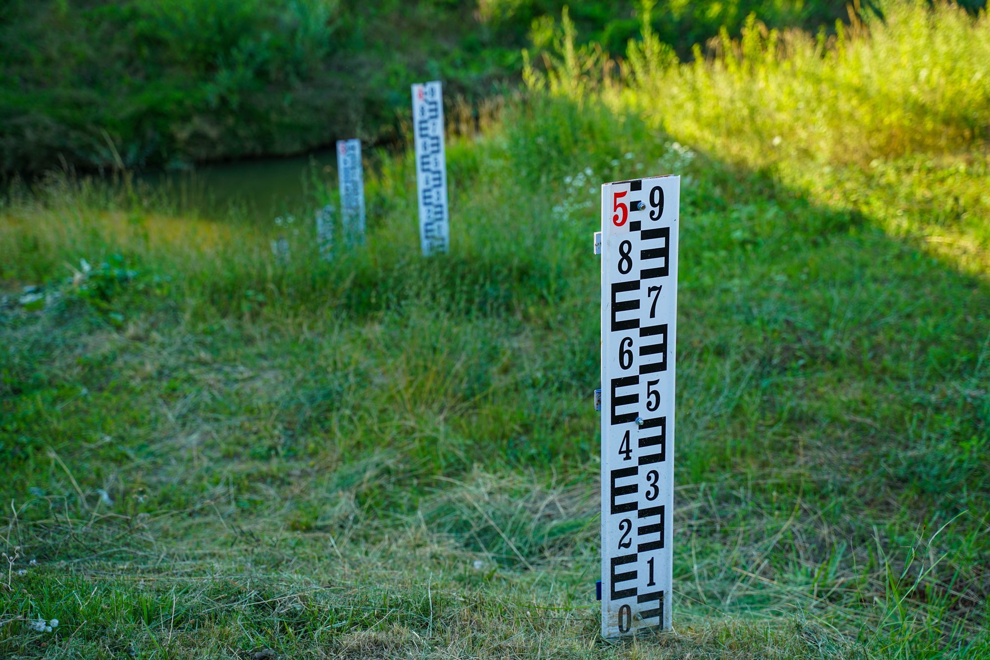
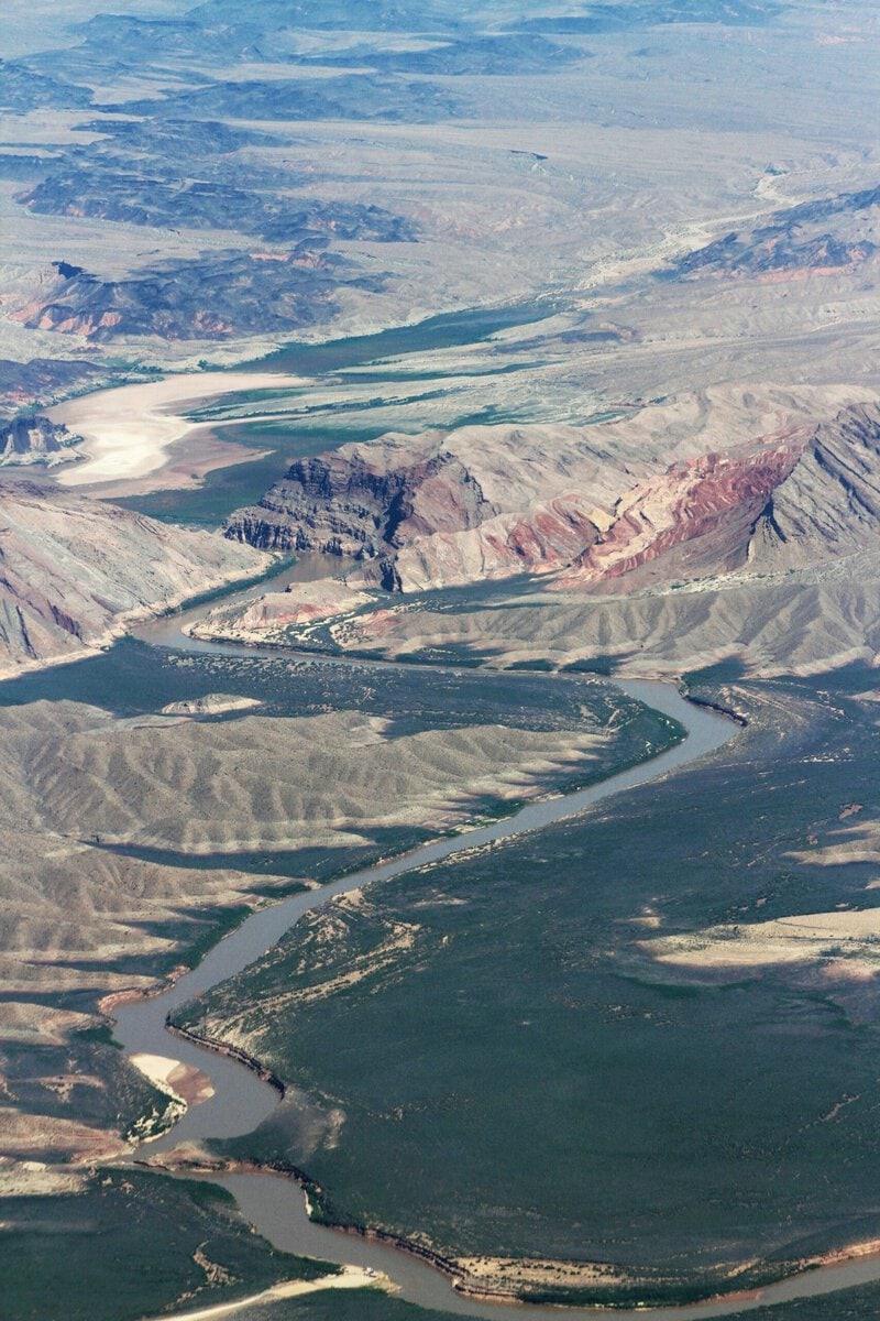
A river gauge is a ground-based instrument — typically a pressure sensor or float well — that measures water height, known as “stage,” at a single fixed point. Hydrologists then convert those stage readings into flow volume through a mathematical relationship called a rating curve. The system works well where it exists. The problem is how little of the world it covers.
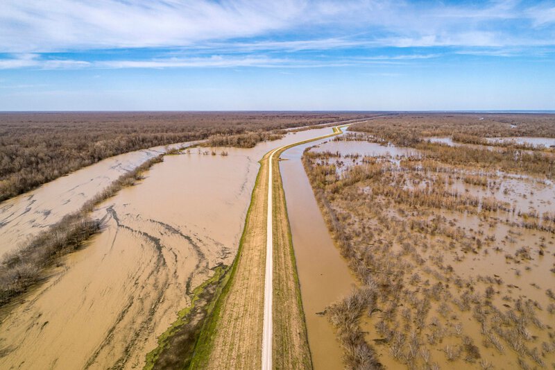
With only roughly 3,000 active gauge stations delivering consistent data worldwide, entire continents have watersheds the size of Western Europe producing almost no reliable streamflow records. Sub-Saharan Africa, central Asia, and the interior of the Amazon basin are among the most severely underserved regions — precisely the places where climate change is expected to alter river regimes most dramatically, and where populations are often most dependent on rivers for survival.
The coverage that does exist is also shrinking. The World Meteorological Organization has documented a decades-long decline in gauge networks across lower-income countries, where maintenance budgets have been cut and political instability disrupts the data-sharing agreements that international hydrology depends on. The result is a compounding knowledge deficit: scientists cannot accurately model how climate change is altering river regimes if the baseline data needed to validate those models simply does not exist.
How Satellites Read a River: The Physics of Remote Sensing
Space-based hydrology — the use of orbital instruments to study Earth’s water cycle — relies on several distinct measurement techniques, each capturing a different property of a river system. Radar altimetry bounces microwave pulses off the water surface and times their return to calculate precise water-surface elevation. Synthetic aperture radar, or SAR, can map river width and inundation extent through clouds and at night. Multispectral imaging detects color changes that signal shifts in sediment load, algal growth, or pollutants.
One critical limitation shapes every application of satellite river monitoring: river flow, or discharge, cannot yet be measured directly from orbit. It must be inferred by combining surface-height data with hydraulic models — mathematical representations of how water moves through a channel. That inference step introduces uncertainty that scientists are actively working to reduce, and it means that satellite river monitoring currently produces estimates, not direct measurements. That distinction matters enormously when the data is being used to issue flood warnings, adjudicate water-rights disputes, or hold governments accountable for transboundary water use.
Advances in machine-learning-assisted hydraulic modeling are beginning to narrow that uncertainty gap, but researchers are candid that the algorithms remain a work in progress — particularly in ungauged basins where models have never been calibrated against real-world observations.
SWOT: The Mission Designed to Change Everything
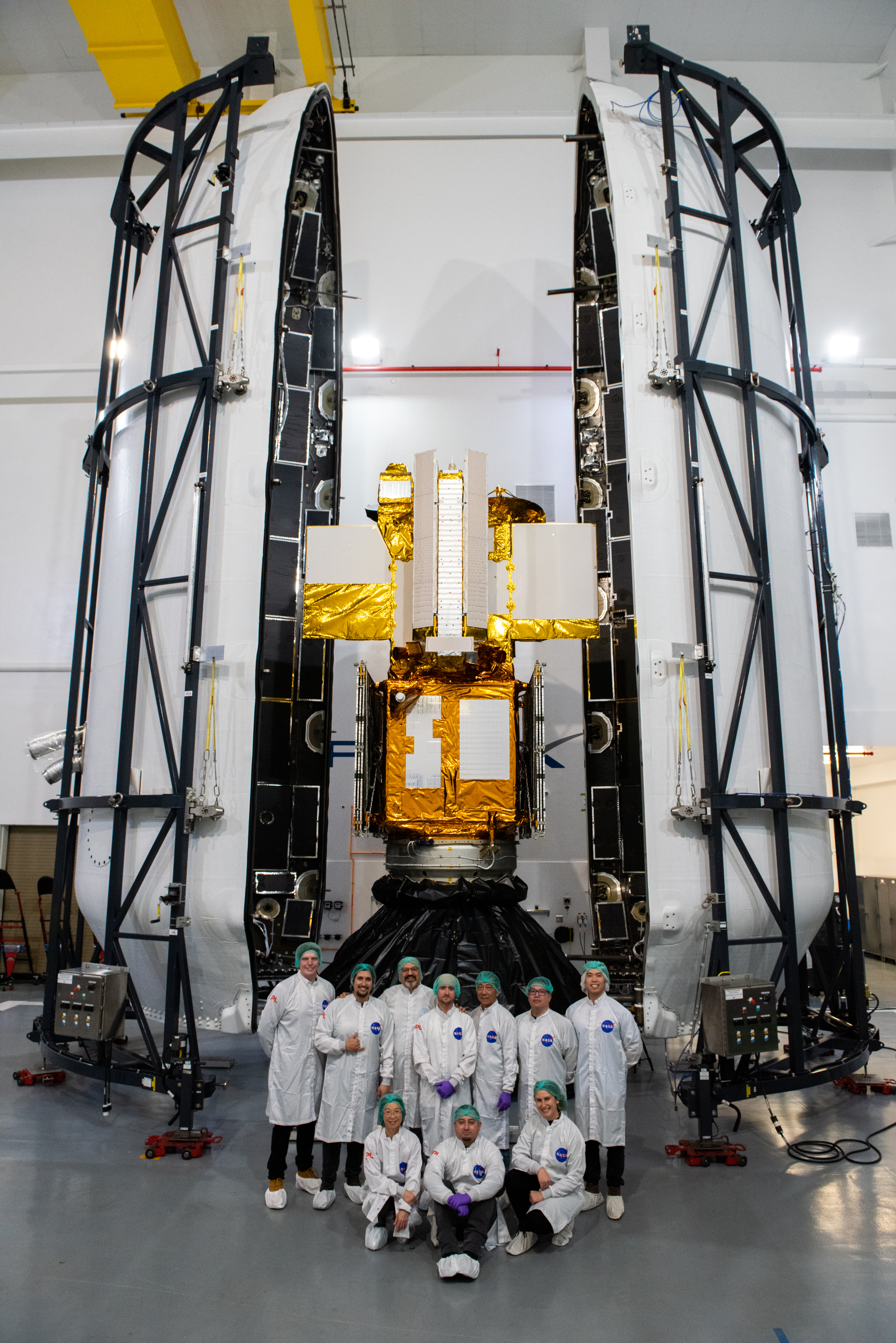
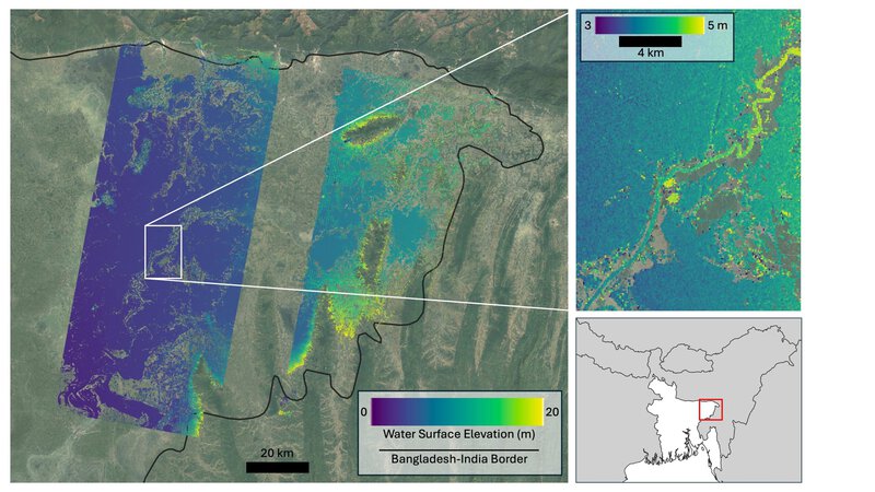
In December 2022, NASA and the French space agency CNES launched the Surface Water and Ocean Topography satellite, universally known as SWOT. Its primary science mission is to map the precise height of rivers, reservoirs, lakes, and ocean surface features at a spatial resolution and global coverage unprecedented in the history of hydrology. NASA described the mission as offering an unprecedented view of Earth’s surface water — language that, in this case, is technically justified.
Unlike traditional radar altimeters that sample a narrow ground track directly below the spacecraft, SWOT uses a technique called Ka-band radar interferometry to image a 120-kilometer-wide swath. That approach allows it to measure water-surface elevation across the full width of a river rather than just at a single centerline point — a critical advantage for estimating discharge. SWOT is designed to observe nearly every body of water on Earth wider than 100 meters at least once every 21 days, producing a dataset that scientists say could substitute for thousands of the missing ground gauges in data-sparse regions.
The mission represents a genuine milestone in space-based hydrology. Researchers are candid, however, that validating SWOT’s river-height measurements against ground truth in complex terrain — braided channels, heavily vegetated floodplains, ice-covered reaches — remains an active and not fully resolved scientific challenge. The satellite is capable; the algorithms that translate its measurements into hydrologically useful numbers are still being refined.
What Satellite River Monitoring Can Already Do
Researchers from NASA and Virginia Tech used satellite data to measure the height and speed of potentially hazardous flood waves traveling down rivers across the United States — demonstrating that orbital observations can track a moving hydraulic event in near-real time. That capability has direct implications for emergency management, particularly along river stretches where no ground gauges exist to provide advance warning.
Separately, researchers have used satellite data to monitor how rivers transport sediments and nutrients to the world’s oceans — work that is revealing large-scale shifts in coastal ecosystems that ground-based networks were too sparse to detect. Those sediment fluxes govern delta stability, coral reef health, and the productivity of some of the world’s most important fisheries.
The same remote-sensing technology is also being applied to water quality surveillance, using spectral signatures to flag turbidity spikes, algal blooms, and thermal anomalies that may indicate pollution events or ecosystem stress. Each of these applications sits at a different stage of maturity. Flood-wave tracking from space is an emerging but demonstrated capability. Ocean-sediment flux monitoring is an established research application. Routine operational water-quality surveillance from orbit remains largely a near-future goal rather than a deployed operational system.
The Hard Problems: Resolution, Politics, and the Inference Gap

Even with SWOT and complementary missions operating, rivers narrower than roughly 100 meters — which includes the majority of the world’s stream network by count, though not by total discharge volume — remain below the resolution threshold of current orbital sensors. That preserves a significant blind spot in global freshwater surveillance, particularly for the headwater streams and small tributaries that collectively govern the hydrology of much larger river systems downstream.
The political dimension is equally real. International river basins account for roughly 60 percent of global freshwater flow, according to United Nations estimates, and they cross borders where data sharing is often deeply contentious. Satellite data — collected without requiring host-country cooperation — may offer a partial workaround, but the legal and diplomatic questions surrounding its use in transboundary water disputes remain genuinely unresolved. Whether a downstream nation can legitimately use orbital measurements of an upstream neighbor’s river diversions as evidence in international negotiations is a question that hydrology and international law have not yet answered together.
Translating satellite observations into the discharge estimates that water managers actually need also requires coupling remote-sensing data with hydrodynamic models that carry their own uncertainties. A fully operational global river monitoring system, capable of delivering actionable data at the speed and reliability that emergency managers require, does not yet exist.
What Success Would Look Like — and Why Freshwater Security Depends on It
A mature global river monitoring network — combining satellite remote sensing with strategically placed ground gauges and AI-assisted hydraulic modeling — could, in principle, provide early flood warnings to populations currently living beyond the reach of any alert system, a group the United Nations estimates in the hundreds of millions. For communities in data-sparse regions of Africa, South Asia, and Latin America, that capability could mean the difference between timely evacuation and catastrophe.
For the longer-term challenge of climate adaptation, continuous orbital records of river height, extent, and water quality would give scientists the observational foundation needed to detect how river regimes are shifting decade by decade. That baseline data is currently missing across most of the Global South — the very regions where hydrological change is expected to be most severe and where adaptive capacity is most limited.
The sediment and nutrient data generated by space-based river monitoring also has direct relevance to ocean science, fisheries management, and global carbon accounting, meaning the value of the investment extends well beyond hydrology alone. Whether that vision is realized will depend less on the physics of the satellites — which scientists say are now demonstrably capable — than on the institutional choices of governments and space agencies about how to fund, operate, and openly share what could become one of the most consequential environmental datasets ever assembled.
The rivers are moving. The question is whether humanity will finally be watching.