
A single rift on Mars stretches more than 4,000 kilometers (2,500 miles) across the planet’s surface — roughly the width of the continental United States — and plunges as deep as 10 kilometers into the Martian crust. Valles Marineris, which NASA calls “the Grand Canyon of Mars,” is not merely a large canyon; it is the largest canyon in the solar system by every meaningful measure. The story of how it formed reveals a planet whose geology operates on a scale that Earth’s own geology simply cannot match — and raises questions about water, habitability, and the fate of rocky worlds that scientists are still working to answer.
By the Numbers: Just How Big Is Valles Marineris?
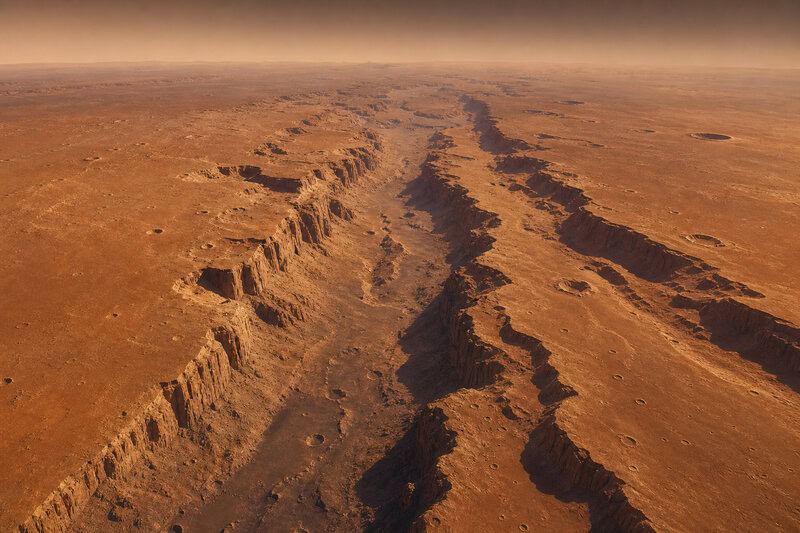
The raw dimensions of Valles Marineris are difficult to absorb without a reference point. The system runs more than 4,000 km (2,500 miles) in length, spans up to 200 km (120 miles) in width at its broadest points, and reaches depths NASA cites at up to 7 km (roughly 23,000 feet) in certain sections. The European Space Agency, using different topographic reference datums, extends that depth figure to up to 10 km in the canyon’s deepest troughs. Both figures are scientifically valid; they reflect distinct sections of the canyon system measured against different baselines, not a disagreement about the underlying geology.
For comparison, Earth’s Grand Canyon runs approximately 460 miles (750 km) in length and reaches a maximum depth of roughly 1.6 km (about 1 mile). That makes Valles Marineris approximately ten times longer and five times deeper depending on which section and which datum is used. If the Martian canyon were placed on Earth, it would stretch from New York City to Los Angeles and extend hundreds of kilometers further into the Pacific Ocean.
The “Grand Canyon of Mars” label, while useful shorthand, understates the feature’s complexity. Planetary scientists describe Valles Marineris as a canyon system — a networked set of interconnected troughs, chasms, and basins rather than a single continuous gorge. The system includes distinct named sections such as Ius Chasma, Coprates Chasma, and Melas Chasma, each with its own geological character, wall structure, and floor deposits.
Discovery and Naming: How Mariner 9 Rewrote Martian Science
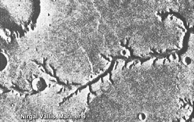
Before November 1971, many planetary scientists expected Mars to resemble the Moon — geologically inert, its surface shaped almost entirely by ancient impacts. NASA’s Mariner 9 spacecraft, upon entering Mars orbit that month as the first spacecraft to orbit another planet, immediately overturned that assumption. Its cameras resolved a vast rift system of branching chasms, layered cliff walls, and enormous landslide debris fields that bore no resemblance to anything seen on the lunar surface. The canyon’s name honors the mission: “Valles Marineris” is Latin for “Mariner Valleys,” a designation formalized by the International Astronomical Union.
The early imagery alone suggested that multiple geological forces — not a single event — had shaped the system. Subsequent orbiters refined that picture considerably. NASA’s Mars Global Surveyor and Mars Reconnaissance Orbiter, along with ESA’s Mars Express, produced progressively detailed topographic maps that now form the basis for modern depth and width measurements. Each mission has added resolution without fundamentally overturning the structural understanding that Mariner 9 first established.
The Leading Formation Theory: Tectonic Rifting and the Tharsis Bulge
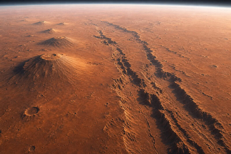
The dominant scientific consensus holds that Valles Marineris originated as a tectonic rift — a zone where the Martian crust was pulled apart under enormous stress. The source of that stress sits directly to the canyon’s west: the Tharsis Plateau, the solar system’s largest volcanic province.
Tharsis is a dome of volcanic rock roughly 5,000 km across. Its sheer mass warped the Martian crust beneath and around it, generating stresses sufficient to fracture the crust and initiate the canyon’s formation billions of years ago. The rift that resulted became the structural skeleton of what we now call Valles Marineris.
Crucially, Mars does not have the moving tectonic plates that Earth does. Earth’s crust is divided into a mosaic of plates that shift, collide, and recycle material back into the mantle — a process that distributes and ultimately relieves geological stress. Mars, by contrast, has a single rigid lithospheric shell. Stress generated by the Tharsis volcanic load built up in the same location for billions of years without being redistributed or relieved. The result was a rift of a scale that Earth’s plate-tectonic system would have prevented or erased long before it reached such proportions.
This origin distinguishes Valles Marineris fundamentally from Earth’s Grand Canyon. The Colorado River carved Earth’s canyon top-down, incising through sedimentary rock over roughly 5 to 6 million years. Mars’s canyon was largely torn open from within — a wound in a planet’s crust rather than a valley sculpted by flowing water.
Water, Ice, and Catastrophic Collapse: Other Forces That Shaped the System
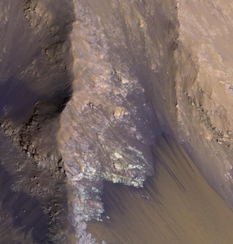
Tectonic rifting explains how Valles Marineris opened, but it does not account for everything visible on the canyon walls and floor today. Layered sediment deposits and branching outflow channels observed by NASA’s Mars Reconnaissance Orbiter indicate that liquid water played a significant role in widening and deepening sections of the system during Mars’s wetter early history. Water flowing into and through the rift would have eroded cliff faces, transported sediment, and contributed to the canyon’s present dimensions.
Researchers have documented landslide scars along the canyon walls that rank among the largest known mass-wasting events anywhere in the solar system. These catastrophic wall collapses — triggered by the steep, tectonically fractured cliffs — repeatedly reshaped the canyon floor over geological time, and the debris fields they left behind remain visible in orbital imagery today.
A 2021 study published in Geophysical Research Letters, using data from ESA’s Mars Express MARSIS subsurface radar sounder, reported signals consistent with subsurface water ice or hydrated minerals beneath parts of Valles Marineris. If confirmed, that finding would suggest water-related processes extended further into Martian history than many models predicted. Scientists have been careful to note, however, that this interpretation remains under active investigation and that alternative explanations — including certain volcanic mineral signatures — have not been fully ruled out.
Wind erosion, known in planetary science as aeolian processes, has also shaped the canyon’s current appearance. Over billions of years, Martian winds have sculpted wall surfaces and redistributed fine-grained sediment across the canyon floor. Mars orbiters continue to document active wind-driven changes in the system today, making Valles Marineris a rare example of an ancient feature that is still being actively modified.
What the Canyon Tells Us About Martian Geology — and Planetary Science More Broadly
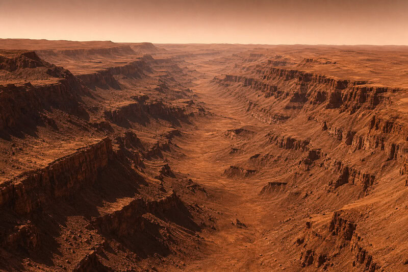
The comparison between Valles Marineris and the Grand Canyon is scientifically instructive precisely because the two features formed through such different mechanisms. Mars’s lower surface gravity — approximately 38% of Earth’s — combined with its thinner atmosphere, absence of rainfall, and single-plate structure, allows geological structures to grow far larger before erosion or tectonic recycling destroys them. The Martian canyon walls, unweathered by rain or biological processes, preserve a record of the planet’s internal history in a way that Earth’s more dynamic surface cannot.
Planetary scientists use Valles Marineris as a natural laboratory for understanding how rocky planets evolve when plate tectonics never fully develop. The questions raised by its formation bear directly on the study of exoplanets — rocky worlds orbiting other stars where the presence or absence of plate tectonics may determine whether a planet retains liquid water and, potentially, conditions hospitable to life.
Key open questions about Valles Marineris include how much water flowed through the system, for how long, and whether the canyon’s subsurface could have supported habitable conditions during Mars’s wetter past. ESA’s ExoMars Trace Gas Orbiter is currently mapping mineral signatures within the canyon that could help distinguish water-deposited sediments from volcanic ash layers — evidence that would clarify the relative contributions of water and tectonics to the canyon’s final form.
NASA’s long-term human exploration planning identifies Valles Marineris as a scientifically high-priority destination for future crewed missions, in part because its deep walls expose billions of years of Martian stratigraphy in a single cross-section — a geological archive of extraordinary richness. Recent orbital imaging continues to reveal new structural details within the system, but the canyon floor itself remains entirely unvisited at ground level. The solar system’s largest canyon, for all that half a century of orbital observation has uncovered, still holds answers that only a rover — or a geologist standing on the rim — will ever fully retrieve.