
In December 2025, a lava fountain at Kīlauea’s summit erupted with enough force to destroy a USGS webcam outright — a visceral reminder that no instrument, however rugged, is a match for a volcano that has been erupting almost continuously since January 1983. That single event compressed four decades of geological persistence into one stark image: molten rock winning a round against the technology humans use to watch it. If you want to see what is happening right now, the live feeds are free, require no login, and are running around the clock. Below is everything you need to find them, understand them, and put what you are watching in context.
Where to Watch the Kīlauea Live Cam Right Now
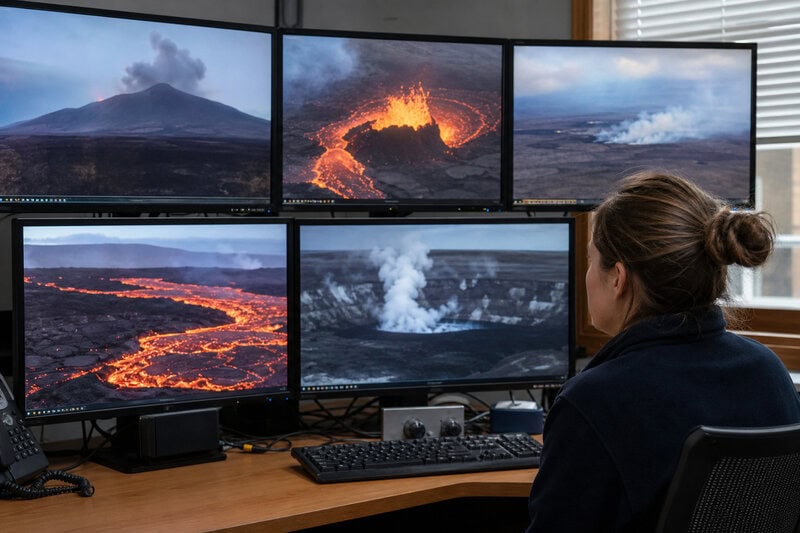
Several reliable, no-cost streams are available simultaneously, each offering a different angle and level of detail.
The authoritative starting point is the USGS Kīlauea webcam page, maintained directly by the Hawaiian Volcano Observatory (HVO). It hosts multiple labeled feeds — including views designated V1cam, V2cam, and V3cam — each trained on a different angle of the west Halemaʻumaʻu crater. The page also displays a timestamp and camera status, so you can immediately tell whether a feed is live, paused for maintenance, or offline after an eruptive event like the December 2025 webcam destruction.
Several of those same feeds run continuously on the USGS YouTube live streams channel, making the Hawaii volcano live stream one of the most-watched geology broadcasts on the internet. The YouTube interface adds a live chat, a running viewer count, and an automatic archive of recent hours — useful if you missed a fountaining episode and want to scrub back through the recording.
The National Park Service operates its own complementary feed: the Hawaiʻi Volcanoes National Park webcam page hosts the S2cam, a fixed camera mounted on the south rim of Halemaʻumaʻu crater and pointed west. Where the USGS PTZ cameras zoom in tight on active vents, the NPS shot supplies the spatial context — you can see the crater walls, the surrounding caldera floor, and the sky conditions that affect how well the glow reads on camera.
Third-party aggregators round out the options. EarthSky’s dedicated Kīlauea eruption page pairs an embedded live feed with plain-language eruption updates, making it a strong single-tab option for readers who want scientific context alongside the video. HDOnTap’s Kīlauea stream re-broadcasts the USGS feed in a clean player without ads, convenient if the official page is experiencing high-traffic slowdowns during an active eruption event.
How the Webcam Network Actually Works
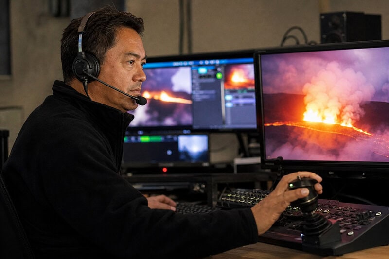
The cameras are more sophisticated than fixed security equipment. HVO operates manually controlled PTZ — pan-tilt-zoom — cameras that scientists can reposition remotely within seconds to track a fast-moving lava fountain or a newly opened fissure. When eruptive style shifts, an operator can swing the camera, tighten the focal length, and capture imagery that feeds directly into hazard assessments. The December 2025 event that destroyed one of these cameras illustrates the system’s value in reverse: the loss of a single unit immediately altered what scientists could see, underscoring how much continuous visual coverage contributes to situational awareness on the ground.
Replacement cameras carry improved sensors with wider dynamic range, built to capture both the dim glow of a slowly circulating lava lake and the blinding brightness of a high-energy fountain jet without washing out either extreme. Data pathways have also become more redundant over successive hardware generations, so a single point of failure — whether a lava spatter strike or a communications outage — is less likely to blank the entire network.
Viewers watching the Hawaii volcano live stream are seeing the same real-time imagery HVO scientists use to issue eruption alerts, making citizen observation a genuine, if informal, extension of the professional monitoring network.
Eruption History: Four Decades of Nearly Unbroken Fire
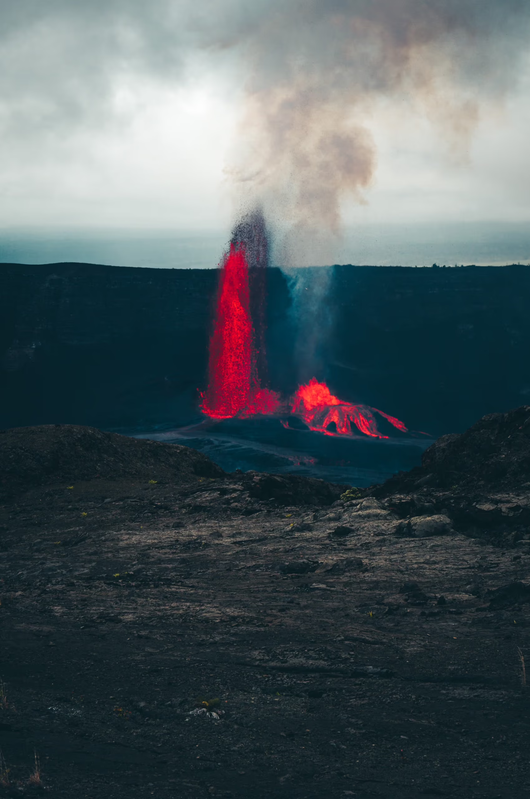
Understanding what the cameras are watching requires knowing how long the show has been running. Kīlauea’s current eruptive cycle began on January 3, 1983, when the East Rift Zone opened and initiated the Puʻuʻōʻō eruption. According to USGS records, that single eruptive episode lasted 35 years before ending in 2018 — one of the longest-duration rift zone eruptions ever documented anywhere on Earth.
The word “continuous” demands careful reading. Kīlauea’s eruption history is not a single, steady lava river but a sequence of distinct phases that have shifted location, intensity, and character repeatedly over four-plus decades. The 2018 lower East Rift Zone eruption was catastrophic by any measure: it destroyed more than 700 homes and added roughly 875 acres of new land to Hawaiʻi’s coastline, according to USGS documentation. That event demonstrated that “continuous” eruption is emphatically not synonymous with “stable” eruption.
After 2018, activity migrated to the summit. Eruptive episodes at Halemaʻumaʻu crater began in December 2020 and have continued in episodic but frequent bursts through 2025, with HVO issuing periodic eruption advisories documenting multiple distinct phases within that span. This unbroken record makes Kīlauea’s eruption history arguably the best-documented volcanic sequence in scientific literature.
The Geology: Why Kīlauea Never Really Stops
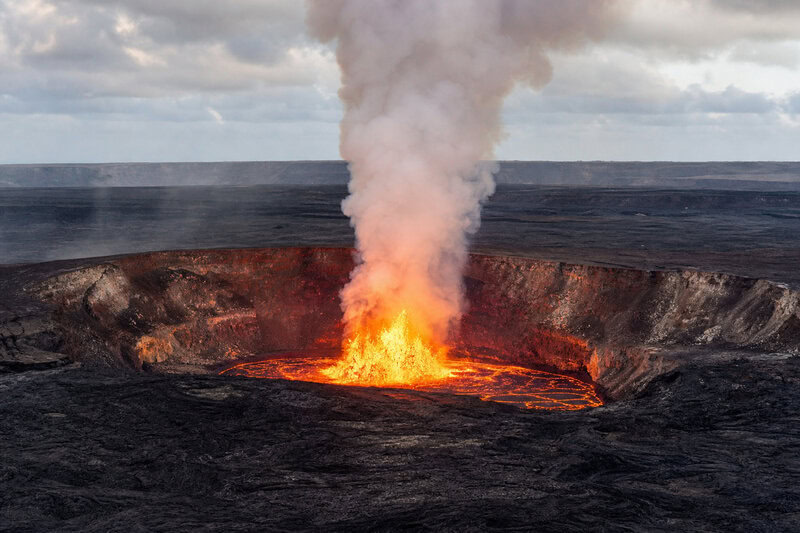
The geological reason for Kīlauea’s persistence lies beneath the island, not at its surface. Kīlauea sits above the Hawaiian hotspot, a mantle plume — a column of anomalously hot rock rising from deep within Earth’s mantle — that has been driving volcanism across the Pacific Plate for tens of millions of years, according to USGS research. As the plate moves northwest over this relatively stationary heat source, it creates the chain of islands and seamounts that stretches from the Big Island toward the Aleutians.
Unlike volcanoes at tectonic plate boundaries, where eruptions are driven by water-induced melting or crustal collision, hotspot volcanism delivers a nearly constant supply of low-viscosity basaltic magma directly beneath the island. This is why pauses in Kīlauea’s activity are measured in months rather than the centuries or millennia between eruptions at many boundary volcanoes. The pipeline from depth is effectively always open.
The chemistry of that magma matters too. Hawaiian basalt has a low silica content, which gives it a relatively fluid consistency and allows dissolved gases to escape more easily rather than accumulating to explosive pressures. This reduces — though does not eliminate — the risk of catastrophic, ash-generating blasts associated with silica-rich stratovolcanoes like Mount St. Helens. The 2018 summit collapse, which produced significant ashfall and ballistic projectiles, is a reminder that even basaltic systems can behave explosively under the right conditions.
HVO’s monitoring infrastructure tracks the internal dynamics of this plumbing system in near-real time. Tiltmeters measure ground deformation — inflation signals that magma is accumulating in the shallow reservoir beneath the summit, deflation that it is draining toward a rift or erupting at the surface. GPS sensors provide three-dimensional ground movement data. Seismographs record the micro-earthquakes that accompany magma migration through rock. Scientists correlate these deformation patterns with eruption onset, a predictive relationship that remains an active and productive area of volcanological research.
What “Most Active Volcano” Actually Means — and Why the Label Is Contested
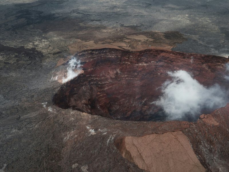
USGS describes Kīlauea as one of the most active volcanoes on Earth, a characterization based on eruption frequency, duration, and lava output volume. But volcanologists note that “most active” lacks a single universal definition across the scientific literature. By erupted volume per century, Mauna Loa on the same island is a serious competitor. By number of discrete eruptive episodes, some submarine volcanoes may outpace both — though their activity is far harder to measure comprehensively. Comparative rankings of this kind are useful shorthand, not settled taxonomy.
What is scientifically unambiguous is a more meaningful distinction: Kīlauea’s combination of accessibility, instrumentation density, and eruption continuity makes it the single most intensively studied subaerial volcano on Earth, according to HVO publications. A researcher can drive to the eruption site, deploy sensors within hours, and collect data across eruption cycles that on other volcanoes would take centuries to accumulate. Techniques developed to interpret Kīlauea’s tiltmeter signals, sulfur dioxide flux measurements, and lava effusion rates have been exported to monitoring programs on volcanoes from Iceland to Indonesia.
What the Cameras Are Showing in 2025
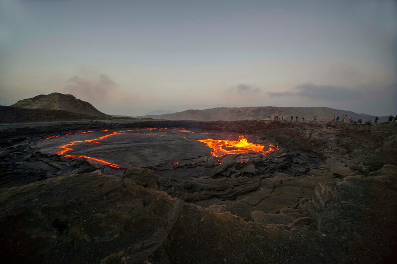
Through 2025, eruptive activity at Kīlauea has been centered at Halemaʻumaʻu within Hawaiʻi Volcanoes National Park. HVO has issued periodic updates as lava lake levels rise and fall in patterns scientists correlate with magma supply fluctuations from depth. For extended stretches, activity has consisted of relatively effusive lava lake behavior — slow, steady lava output accompanied by moderate gas emissions.
The December 2025 lava fountain event that destroyed a webcam represents a higher-energy eruptive style. Lava fountains form when dissolved gases — primarily water vapor, carbon dioxide, and sulfur dioxide — exsolve rapidly from rising magma, essentially the same physics as a shaken carbonated beverage, though at temperatures exceeding 1,000 degrees Celsius. When fountains reach sufficient height and velocity, they project molten spatter far beyond the crater rim, as the destroyed camera attests.
Sulfur dioxide emission rates, measured in tonnes per day by HVO instrumentation, serve as a reliable proxy for magma flux. Spikes in SO₂ output consistently precede or accompany visible eruptive intensification, a relationship the 2025 episodes have continued to validate. Elevated SO₂ also produces volcanic smog — vog — that affects air quality across the island and informs public health advisories issued by state agencies. When you watch the live cam and notice a hazy, yellowish cast to the air above the crater, you are seeing vog in real time.
HVO scientists are investigating whether the frequency of discrete eruptive episodes at Kīlauea’s summit may be shifting compared with earlier phases of this eruptive cycle, and whether any observed change represents a meaningful trend or natural variability within a dynamic system. That distinction matters for long-term hazard assessment across the island.
Why Watching the Live Cam Matters Beyond the Spectacle
The USGS live webcam network is not merely spectacle. It functions as the public-facing layer of a hazard-monitoring system that informs evacuation decisions, air-quality advisories, and park access policies for tens of thousands of residents and visitors. When a new fissure opens or a lava lake overflows its margins, the cameras provide the first visual confirmation that ground-sensor data has predicted — closing the loop between instrument readings and observable reality.
Every hour of archived webcam footage also contributes to a visual geological record. Researchers use time-lapse imagery to measure lava effusion rates, map the spatial extent of new flows, and reconstruct eruption chronologies with a precision that field surveys alone cannot match. These archives are increasingly integrated with satellite remote-sensing data to build models of how eruptions evolve over days and weeks.
The global audience for the Kīlauea live cam carries an additional, less tangible value: it normalizes real-time scientific transparency. Government monitoring agencies demonstrating that raw instrumental data can be shared openly with the public — without sacrificing rigor or creating undue alarm — provides a model for communicating about natural hazards in an era of widespread scientific skepticism. Earth’s most persistently restless volcano is also, by a wide margin, its most visible, and the science produced by watching it closely benefits every community living in the shadow of an active volcano anywhere on the planet.