Somewhere beneath the northwest Pacific Ocean, roughly 1,000 miles east of Japan, lies a single volcanic structure so vast that its base covers an area comparable to the state of New Mexico — yet it went unrecognized as one unified volcano until 2013. That discovery quietly reshuffled the geological record books, and the full implications are still being worked out by volcanologists today.
Two Contenders, One Complicated Question
Ask which volcano is the biggest in the world and you will get at least two defensible answers, depending on what you mean by “biggest.” Mauna Loa in Hawaiʻi holds the title by mass and volume — no active volcano on Earth comes close on those measures. A submerged giant called Tamu Massif, sitting roughly 6,500 feet beneath the northwest Pacific, holds the title by sheer geographic footprint, stretching approximately 400 miles across the seafloor. Neither answer is wrong. They address different questions, and understanding both reveals far more about Earth’s volcanic diversity than any single superlative can.
Mauna Loa: The Largest Active Volcano by Mass and Volume
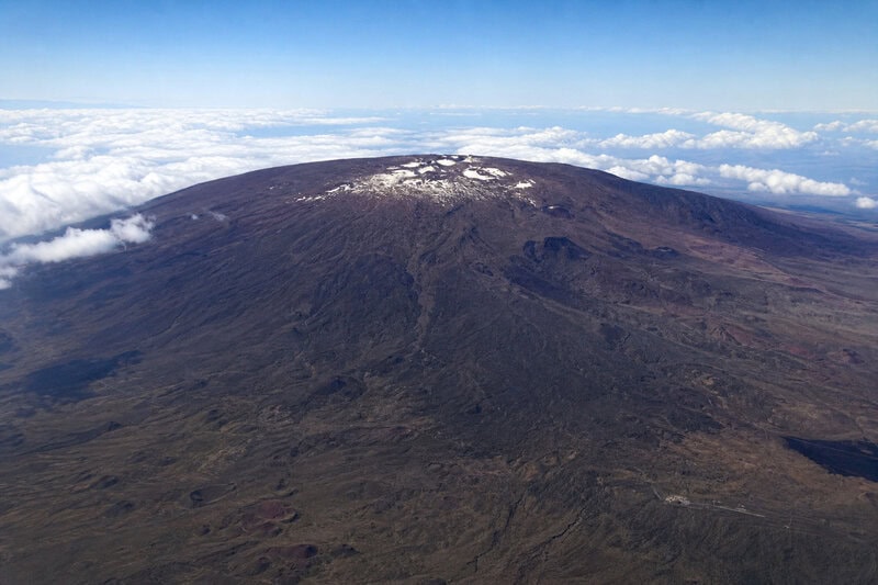
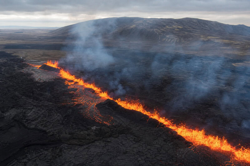
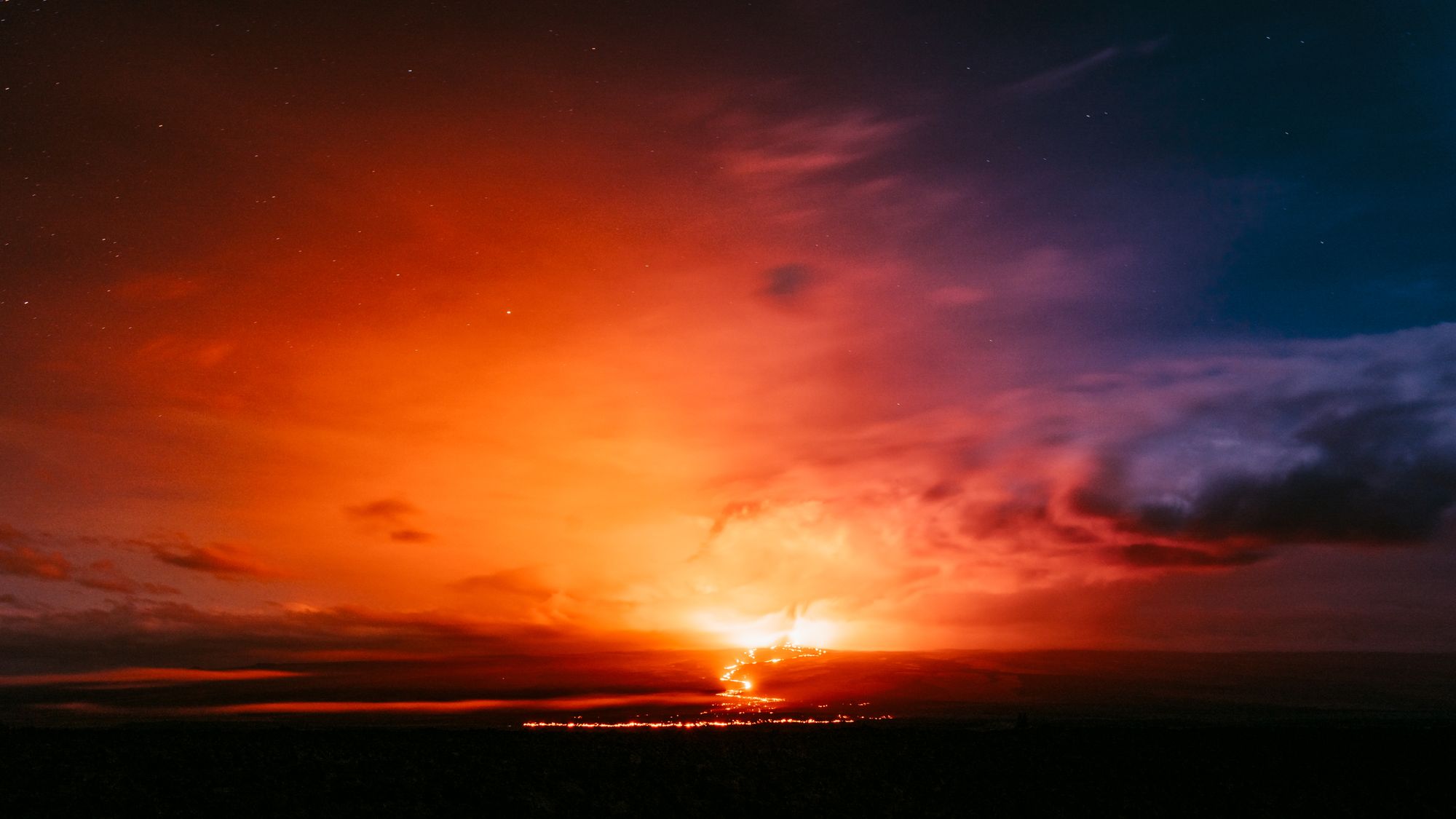
Mauna Loa is an extraordinary structure by any measure. It rises more than 4 kilometers above sea level, extends far deeper below the ocean surface, and remains a vigorously active system — it last erupted in November 2022. According to the U.S. Geological Survey, Mauna Loa is Earth’s largest active volcano by both mass and volume, with an estimated volume of approximately 75,000 cubic kilometers of rock. Those two measures — how much material a volcano contains and how much it weighs — are the metrics scientists most commonly use when comparing active volcanic systems, and on both counts Mauna Loa has no rival among living volcanoes.
It is also among the most thoroughly studied volcanoes on Earth. The Hawaiian Volcano Observatory has monitored it continuously for more than a century, and Native Hawaiian communities have lived alongside it for centuries longer, developing a cultural relationship with the mountain that predates any scientific classification. Mauna Loa is visible, accessible, active, and deeply understood. Those qualities alone make it the reference point against which every other large volcano tends to be measured.
What “Biggest” Actually Means — and Why the Metric Matters
The confusion surrounding the biggest volcano in the world stems from an imprecision in the question itself. Scientists use at least three distinct measurements, and each can produce a different winner.
- Volume refers to the total amount of rock material making up the volcanic edifice — how many cubic kilometers of lava and solidified magma have accumulated over the structure’s lifetime.
- Mass accounts for the density of that material, giving a measure of how much the volcano actually weighs — relevant when comparing structures built from different rock compositions.
- Areal footprint describes the surface area covered by the volcano’s base — essentially, how wide it is when viewed from directly above.
Any claim that one volcano is simply “the largest” without specifying the metric is, at minimum, incomplete. Readers and headline writers who drop that qualifier are usually the source of the most persistent confusion on the subject.
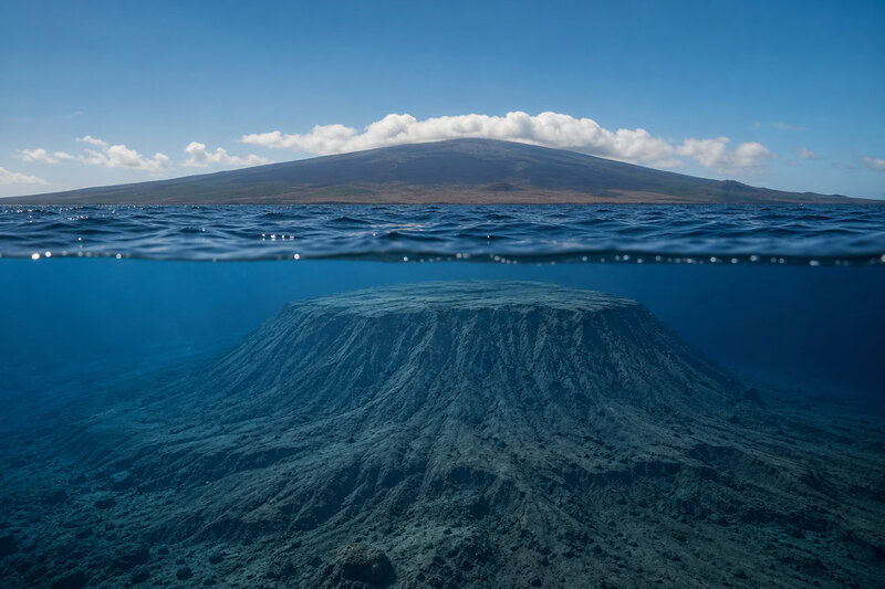
Tamu Massif: The Largest Volcanic Structure by Footprint
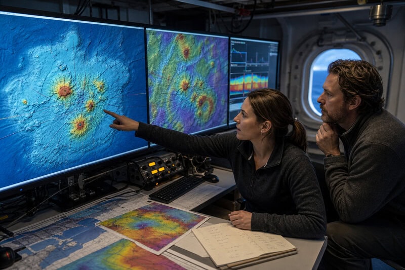
Tamu Massif is the dominant feature of Shatsky Rise, an oceanic plateau in the northwest Pacific. The name “Tamu” is an acronym derived from Texas A&M University, where foundational research on the structure was conducted. For most of the twentieth century, geologists knew the plateau existed but interpreted it as a collection of overlapping volcanic features rather than one unified edifice. A landmark 2013 study led by William Sager and colleagues, published in Nature Geoscience, changed that interpretation. Using seismic data and rock-sample analysis, Sager’s team demonstrated that lava flows radiate outward from a single central summit — the defining characteristic of a shield volcano — and argued that Tamu Massif should be classified as one coherent structure rather than many.
On that classification, its dimensions are staggering. Its base covers an area comparable to the British Isles. Its slopes are so gentle — roughly one degree of incline — that a traveler crossing its surface would perceive it as nearly flat. The immense width is not the product of dramatic vertical buildup but of repeated floods of low-viscosity lava that spread laterally across the seafloor over millions of years. For context within the solar system: Tamu Massif is approximately 25 percent smaller than Olympus Mons on Mars, the largest confirmed volcano in the solar system — a comparison that communicates something important about the scale involved.
How a Volcano This Large Forms
Oceanic plateau volcanoes like Tamu Massif are thought to originate from mantle plumes — columns of abnormally hot rock rising from deep within Earth’s mantle that, upon reaching the base of the oceanic crust, release enormous volumes of lava over geologically brief intervals. Tamu Massif’s main eruptive episode is estimated to have occurred roughly 145 million years ago, during the Early Cretaceous period. These are not individual eruptions in any familiar sense but sustained episodes of volcanism capable of reshaping entire ocean basins.
After that eruptive phase concluded, the oceanic crust beneath Tamu Massif continued to cool, contract, and subside — a standard consequence of plate tectonics — carrying the structure progressively deeper beneath the sea surface over tens of millions of years. Today it rests thousands of feet underwater, visible only through sonar mapping and accessible only to research expeditions equipped with deep-water drilling equipment. The JOIDES Resolution, the scientific ocean-drilling vessel operated under the International Ocean Discovery Program, has collected sediment and basalt cores from Shatsky Rise that continue to inform models of how the plateau was originally constructed.
The contrast with Mauna Loa is sharp. Mauna Loa erupts in recorded human history, rises dramatically above sea level, and can be observed directly. Tamu Massif is geologically dormant, entirely submerged, and requires sophisticated remote-sensing technology to study at all. That invisibility is precisely why its true character took until 2013 to be recognized.
The Ongoing Debate: Is Tamu Massif Really One Volcano?
The 2013 classification was compelling, but it was not the final word. Subsequent researchers examined magnetic anomalies and lava-flow direction data and raised alternative interpretations, suggesting that the internal structure may involve multiple overlapping eruptive centers rather than a single coherent shield. If that alternative interpretation proves correct, the “single volcano” classification would need revision, and the comparison with Mauna Loa would become substantially more complicated — not because the physical dimensions would change, but because a volcanic complex is a meaningfully different thing from a single volcanic edifice.
Sager and colleagues have continued refining the hypothesis, and the scientific conversation remains open. The measured consensus as of the mid-2020s is this: Tamu Massif represents an exceptionally large and coherent volcanic feature, even if the precise boundaries of its internal architecture are still being investigated. Any authoritative account of the largest volcano on Earth must acknowledge that uncertainty honestly rather than paper over it with a confident superlative.
Side by Side: Mauna Loa and Tamu Massif Compared
Placing the two structures in direct comparison clarifies what each record actually means.
- Mauna Loa: Active; last erupted November 2022. Estimated volume approximately 75,000 cubic kilometers. Rises roughly 9 kilometers from seafloor to summit. Continuously monitored. Largest active volcano on Earth by mass and volume.
- Tamu Massif: Dormant for an estimated 145 million years. Base approximately 400 miles across. Entirely submerged, roughly 6,500 feet beneath the Pacific surface. Largest individual volcanic structure mapped on Earth by areal footprint, pending final confirmation of its single-volcano classification.
The most precise summary is also the least satisfying for a headline: Mauna Loa is the largest volcano by mass and volume; Tamu Massif is the largest by geographic extent, though its precise classification continues to be refined. Both statements are accurate. They answer different versions of the same question.
Why Hidden Giants Matter Beyond the Record Books
The scientific importance of Tamu Massif extends well beyond settling a trivia dispute. It belongs to a category geologists call large igneous provinces, or LIPs — regions where massive, rapid outpourings of lava reshaped large sections of the planet’s surface. Research has linked certain LIP events to significant shifts in ocean chemistry, sea-level change, and, in some documented cases, mass extinction events in Earth’s deep past. Understanding how and why these episodes occurred is central to reconstructing the planet’s environmental history.
Mapping Tamu Massif and structures like it also helps geophysicists build more accurate models of mantle dynamics — specifically, the mechanisms by which heat escapes from Earth’s interior over geological timescales. Those models have relevance not only to Earth science but to understanding volcanic and tectonic processes on rocky planets throughout the solar system.
On a more practical level, studying dormant submarine volcanoes improves scientists’ ability to distinguish genuinely extinct structures from those that retain the potential, under changed tectonic conditions, to reactivate. Knowing where the world’s largest volcanic structures are located is a prerequisite for assessing whatever long-term hazards, if any, they might eventually pose.
As sonar technology improves and ocean-drilling programs expand their reach into underexplored sections of the seafloor, researchers expect to identify and reclassify additional submarine volcanic features. The record for Earth’s largest volcano — however that superlative is precisely defined — may not be finished being written. Tamu Massif demonstrated in 2013 that the ocean floor still holds surprises of continental proportions. There is little scientific reason to think it was the last one.