
At 3:11 p.m. on May 22, 1960, roughly 1,000 kilometers of the Chilean coastline lurched as much as 40 feet in a matter of minutes — releasing more energy than all other earthquakes combined in the entire 20th century, according to the U.S. Geological Survey. What followed was not just a regional catastrophe but a global one: a tsunami that traveled at the speed of a commercial jet and killed people nearly 10,000 miles from where the ground first broke.
The Largest Earthquake Ever Recorded
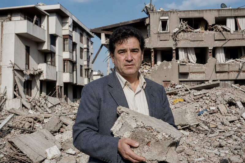
The 1960 Valdivia earthquake — also called the Great Chilean earthquake — registered magnitude 9.5 on the moment magnitude scale, the highest number ever reliably recorded in the instrumental era of seismology. The shaking killed an estimated 1,655 people in Chile within minutes, but the disaster was far from over: a tsunami was already radiating outward across the Pacific before the ground had stopped moving.
Understanding why this earthquake was so extraordinarily powerful, and why its effects reached Hawaii, Japan, and the Philippines, reveals the fundamental mechanics of the planet’s most violent geological process.
What ‘Magnitude 9.5’ Actually Means
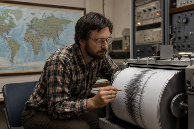
The moment magnitude scale (Mw) is frequently confused with the older Richter scale, but the two are fundamentally different tools. The Richter scale was designed for moderate earthquakes recorded at specific distances from a seismograph; Mw, by contrast, measures the total energy released by calculating the area of the fault that ruptured, how far it slipped, and the rigidity of the surrounding rock. This formula was standardized by seismologists Hiroo Kanamori and Thomas Hanks in a landmark 1979 paper published in the Journal of Geophysical Research, and it remains the scientific standard today.
The scale is logarithmic, which means each whole-number step represents roughly 32 times more energy released. A magnitude 9.5 therefore releases approximately 180 times more energy than a magnitude 9.0 — a difference that is enormous in practical terms, not merely numerical. The gap becomes even more striking when compared against the verified ranking of the largest earthquakes ever recorded.
According to the USGS list of the 10 largest earthquakes ever recorded (updated 2025), the second-largest was the 1964 Good Friday earthquake in Prince William Sound, Alaska, at magnitude 9.2, and the third-largest was the 2004 Indian Ocean earthquake off the coast of Sumatra at magnitude 9.1. Even those catastrophic events — each responsible for enormous death tolls — were substantially dwarfed by Valdivia in terms of raw energy release.
One important qualifier deserves acknowledgment: the USGS notes that no seismograph network capable of reliably recording a 9.5 existed before the mid-20th century. The title “largest earthquake ever recorded” therefore carries the implicit caveat “in the instrumental era.” Prehistoric megathrust events of comparable or greater magnitude may have occurred and left no written record — only geological traces that researchers continue to study.
The Geology Behind the Monster: Subduction Zones Explained
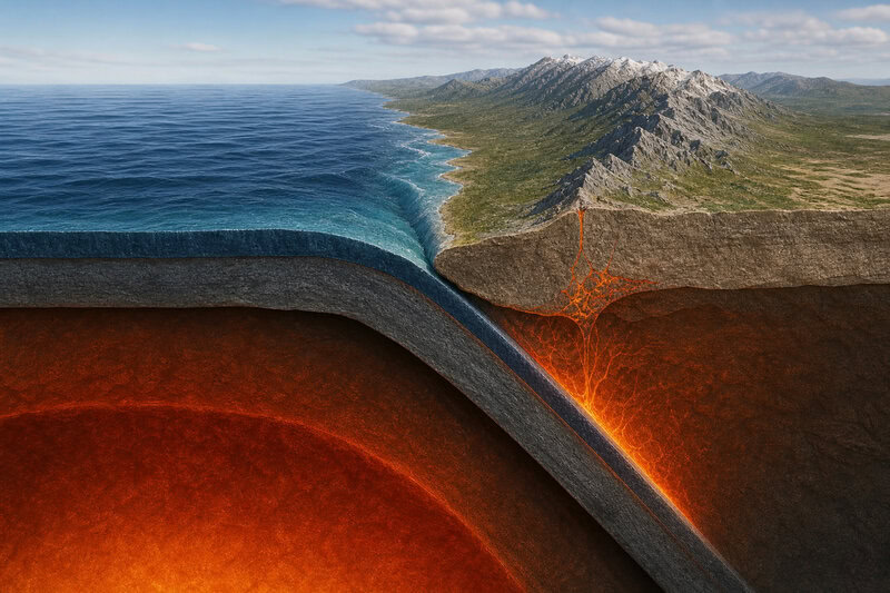
The Valdivia earthquake did not happen by chance. It was the predictable, if terrifying, consequence of where two of Earth’s tectonic plates meet. The earthquake occurred at a convergent plate boundary — specifically a subduction zone — where the Pacific Plate dives beneath the South American Plate at a rate of roughly 7 to 8 centimeters per year, according to USGS plate-motion models.
The process that produces megathrust earthquakes begins with friction. As one plate slides under another, the boundary between them “locks” — the two plates grip each other rather than slipping smoothly. Stress accumulates over decades or centuries. When the accumulated stress finally exceeds frictional resistance, the fault violently unlocks in what seismologists call a megathrust earthquake — the most energetic category of seismic event that Earth produces.
In 1960, the fault segment that ruptured stretched approximately 1,000 kilometers along the Chilean coast, with some sections of the seafloor displacing by as much as 20 meters horizontally, as documented in a foundational analysis by seismologist Hiroo Kanamori published in the Journal of Geophysical Research in 1977. That displacement — roughly the length of six city buses end to end — happened in a geological instant.
Chile’s position within this system explains why it is so disproportionately represented in the historical record of extreme earthquakes. The subduction zone forms part of the Pacific “Ring of Fire,” one of the most seismically active boundaries on Earth, and it is why Chile has hosted four of the ten largest earthquakes ever recorded, per USGS historical catalogs. A broader look at the highest-magnitude earthquakes ever documented confirms that subduction zones dominate the list almost exclusively.
What Happened on May 22, 1960
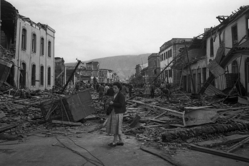
The mainshock did not arrive without warning, though the warning was ambiguous. A magnitude 7.5 earthquake had struck southern Chile the morning of May 21, prompting some residents to evacuate buildings — a decision that likely saved lives when the 9.5 mainshock arrived the following afternoon. That foreshock was itself a significant earthquake by any ordinary standard; the event that followed made it seem trivial.
When the mainshock struck at 3:11 p.m. local time, centered approximately 100 miles off the coast of Biobío, Chile, its effects were felt across an area larger than Western Europe. Intense shaking lasted between 10 and 11 minutes in some locations, according to USGS event records — an almost incomprehensible duration for anyone who has experienced even a brief tremor.
The regional destruction was severe. The USGS estimates the earthquake destroyed or heavily damaged approximately 58,000 houses in southern Chile. The cities of Valdivia, Puerto Montt, and Concepción sustained severe structural damage. Within 47 hours, a volcanic eruption at Cordón Caulle began — a phenomenon that researchers have linked to seismic stress redistribution along the fault system, though the precise mechanism remains an area of active scientific inquiry.
Distinguishing direct seismic casualties from the overall toll matters for accuracy. Roughly 1,655 confirmed deaths in Chile are attributed to the earthquake shaking itself, but the combined death toll from shaking, triggered landslides, and the subsequent tsunami reached an estimated 4,000 to 6,000 people across multiple countries — a range the USGS presents as uncertain due to incomplete record-keeping in 1960.
The Tsunami: How Devastation Crossed 10,000 Miles of Ocean
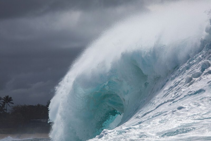
When the seafloor violently displaced during the rupture, it shoved an enormous column of seawater upward, generating a series of waves — technically a tsunami, from the Japanese 津波 (harbor wave) — that radiated outward across the Pacific at speeds exceeding 500 miles per hour, comparable to a cruising commercial jetliner, per NOAA’s National Centers for Environmental Information.
The physics of tsunamis explain why they are so deceptive and so deadly at a distance. In the open ocean, tsunami waves may be only one to two feet high and nearly imperceptible to ships. But as the waves approach shallow coastal shelves, the water column is compressed and the waves amplify dramatically — a process called shoaling. Waves that posed no hazard in deep water can become walls of water tens of feet high by the time they reach shore, which is why distant coastlines can receive lethal wave heights long after the originating event.
Approximately 15 hours after the Chilean mainshock, waves up to 35 feet high struck Hilo, Hawaii — roughly 6,600 miles away — killing 61 people and destroying 537 homes, according to records from NOAA’s Pacific Tsunami Warning Center. Authorities had issued warnings and many residents initially evacuated. But after smaller precursor waves arrived and receded without dramatic effect, some people returned to the waterfront — a dangerous behavioral pattern now studied under the term “tsunami normalization” — and were killed when the larger waves arrived.
The reach of the tsunami extended even further. Approximately 22 hours after the earthquake — nearly 10,000 miles from the epicenter — waves between 10 and 18 feet high struck the Japanese coast, killing 142 people and destroying more than 1,600 homes, per records from the Japan Meteorological Agency. The Philippines also reported deaths and significant damage. Among the five strongest earthquakes ever recorded, the 1960 event stands apart as generating one of the most geographically extensive tsunamis in history — a single geological rupture that produced casualties on opposite sides of the world’s largest ocean.
How 1960 Reshaped Earthquake and Tsunami Science
The Valdivia earthquake exposed a painful gap between the scale of the event and the scientific tools available to study it. Existing seismographs were saturated and unable to accurately capture the full magnitude of the shaking — a technical failure that directly motivated the U.S. Coast and Geodetic Survey to establish the World-Wide Standardized Seismograph Network (WWSSN) in 1961. That global array of instruments, according to USGS institutional history, remains a foundational component of earthquake monitoring today.
The 1960 event also played a significant role in the broader scientific revolution of plate tectonics. The earthquake provided some of the earliest large-scale empirical evidence for the megathrust mechanism at subduction zones, helping solidify plate tectonics — then still a contested hypothesis — as the consensus framework for understanding Earth’s dynamic crust, as discussed in historical reviews published by the Seismological Society of America.
Tsunami warning infrastructure also advanced substantially in the earthquake’s wake. The Pacific Tsunami Warning Center, established in Honolulu in 1949, was expanded and formalized after 1960. When the 2004 Sumatra earthquake struck without an equivalent warning system covering the Indian Ocean — killing an estimated 227,000 people — it prompted the creation of the Indian Ocean Tsunami Warning System. Each record-breaking event has, in a measurable way, improved global preparedness for the next one.
What remains scientifically contested is the recurrence interval for a comparable megathrust rupture along the Chilean subduction zone. Estimates range from 100 to more than 300 years. A 2017 study in the journal Earth and Planetary Science Letters found paleoseismic evidence suggesting the 1960 rupture zone had not produced a comparable event for at least several centuries prior, but the authors cautioned that the geologic record is incomplete and that recurrence intervals should not be treated as reliable clocks.
What the 1960 Earthquake Tells Us About Living on a Dynamic Planet
The 1960 Valdivia earthquake was not an anomaly. It was a predictable consequence of plate tectonics — the same process that builds mountain ranges, opens ocean basins, and recycles the crust of the Earth over millions of years. The USGS estimates that subduction zones like the one beneath Chile will continue to produce megathrust earthquakes on geological timescales that dwarf any human planning horizon.
The three largest earthquakes ever recorded — Chile 1960 at magnitude 9.5, Alaska 1964 at magnitude 9.2, and Sumatra 2004 at magnitude 9.1 — all occurred at subduction zones bordering the Pacific or adjacent ocean basins. The Ring of Fire is not a metaphor; it is the planet’s primary source of extreme seismic and volcanic hazard, and it will remain so for as long as plate tectonics operates.
Modern early-warning systems, improved building codes in seismically active nations, and real-time tsunami modeling now give coastal populations minutes to hours of advance notice that simply did not exist in 1960. But scientists at the USGS and NOAA consistently emphasize that no technology eliminates the underlying hazard — it only extends the time available to respond. The difference between those extra minutes and no warning at all is, in the most direct sense, a matter of lives.
More than six decades after a fault beneath the South Pacific moved twenty meters in a matter of minutes, the 1960 Valdivia earthquake remains the definitive benchmark against which every subsequent seismic event is measured — a reminder that the ground beneath our feet is never entirely still, and that the forces shaping this planet operate on a scale that dwarfs anything in human experience.