
On the eve of Halloween 2026, NASA released a satellite image that spread across the internet faster than most space agency communications manage in a year: a grinning skull staring out from the frozen surface of Antarctica, its hollow eye socket fixed on a place called Devil Island. The image is completely real, entirely unaltered, and stranger in its implications than the eerie face it shows.
A Skull Carved by Ice, Captured from Orbit
The skull belongs to Vega Island, a remote landmass near the Antarctic Peninsula photographed from orbit on October 10, 2026. NASA Earth Observatory published the image on October 30, 2026, titling the piece “Vega Island Frozen in Fright” — a rare flash of editorial personality from an agency that typically speaks in data and technical precision. The timing, one day before Halloween, was entirely deliberate.
From above, Vega Island’s terrain arranges itself into an unmistakable side-profile skull. A dark, hollow rocky formation serves as the eye socket — exposed bedrock where ice has retreated or never settled. A sweeping glacier curves below it in a shape that maps almost perfectly onto a jawline. The resulting face appears to turn and gaze directly toward Devil Island, a coincidence of geography that NASA leaned into for full effect. Nothing about the image was staged or digitally manipulated. This is raw satellite data showing what nature and millennia of geological process produced on a real Antarctic island.
The Operational Land Imager 2 aboard Landsat 9 captured the photograph, one of a fleet of Earth-observing satellites that NASA and the United States Geological Survey operate jointly to produce continuous, comparable records of the planet’s surface. That technical context matters: these are not artistic photographs taken for visual effect. They are scientific instruments that happened, in this case, to document something that looks disturbingly like a face.
The Science Behind the Skull: Pareidolia
The skull is a textbook example of pareidolia — the brain’s hardwired tendency to find faces and familiar patterns in random shapes. This is not a flaw in human perception; it is a survival trait refined over thousands of years, when quickly recognizing a face or predator in a cluttered environment could mean the difference between life and death. The brain runs this pattern-recognition process automatically, which is why the skull on Vega Island registers as a face before the conscious mind has time to analyze the geology producing it.
NASA satellite images turn out to be a surprisingly rich hunting ground for pareidolia. Vast, alien landscapes photographed at unusual angles and high resolutions produce shapes that the human brain instantly tries to read — faces on Mars, animals in cloud formations, hearts in crater fields. The Vega Island skull joins that tradition. Knowing the phenomenon is pareidolia does not make the image less striking. If anything, it makes it more interesting, because the skull says as much about human perception as it does about Antarctic geology.
Two Images, One Unsettling Comparison
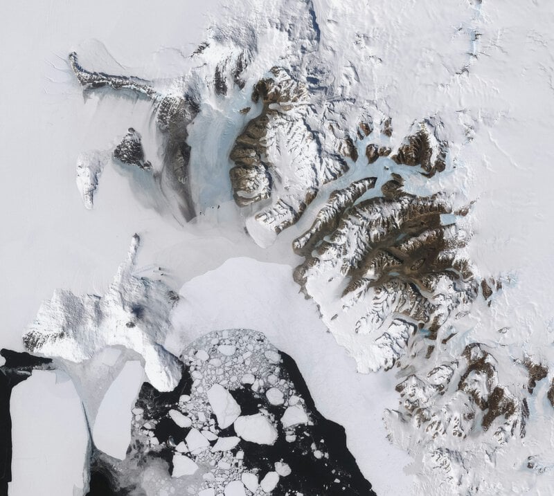
NASA did not simply publish a spooky photograph and move on. The agency paired the October 2026 image with an earlier satellite view of the same island captured in March 2025, and the comparison carries a weight the Halloween framing barely contains. The October 2026 view reveals more bare ice exposed across Vega Island’s surface compared to the March 2025 image, a change NASA attributed to an unusually warm winter in the Antarctic Peninsula region.
The juxtaposition is worth sitting with. March in Antarctica is late summer — the point in the seasonal cycle when ice coverage is at its annual low. October is early spring, when ice should still be relatively extensive. The fact that the October 2026 image shows more exposed bare ground than the March 2025 image suggests conditions that run against the expected seasonal pattern, not with it. The skull, in other words, is not a Halloween novelty with a tidy punchline. It is a visual record of a landscape quietly — and measurably — changing between one year and the next.
Why the Antarctic Peninsula Is Ground Zero for Climate Change
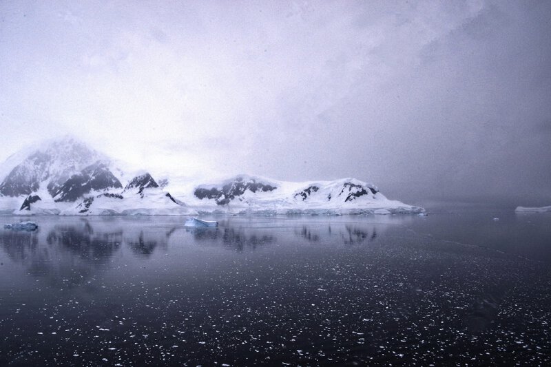
Vega Island sits within one of the most climate-sensitive regions on Earth. The Antarctic Peninsula has warmed at roughly three times the global average rate over the past several decades, making it a closely watched indicator of broader environmental shifts. Seasonal ice patterns in the region are changing in ways that alter the visual character of the landscape from year to year, and the difference visible between the 2025 and 2026 satellite images is consistent with documented trends of reduced sea ice coverage and accelerated surface melt.
For scientists, images like this serve a function that goes beyond communication strategy. They act as low-cost, high-impact visual evidence of environmental shifts that are otherwise difficult to convey to audiences without specialist backgrounds. A side-by-side comparison of two satellite images — one with more ice, one with less — communicates a trend that pages of technical data struggle to make visceral.
- The Antarctic Peninsula is among Earth’s fastest-warming regions, having warmed at approximately three times the global average rate over recent decades.
- Seasonal ice patterns on islands like Vega are shifting visibly from year to year, not just across longer timescales.
- The increased bare ice exposure visible between March 2025 and October 2026 is consistent with documented regional melt trends.
- Satellite imagery provides an accessible, repeatable, and scientifically rigorous record of these changes over time.
NASA’s Long Tradition of Finding Faces in Remote Places

The Vega Island image joins a lineage of “face” images that NASA and affiliated agencies have published over the decades — from the famous Face on Mars photographed by Viking 1 in 1976 to heart-shaped craters and smiley-face galaxy clusters. These images are not accidents of curation. They serve a genuine communications purpose, making remote and abstract science immediately engaging to audiences with no background in earth observation or planetary geology.
“Frozen in Fright” demonstrates that NASA understands something important about public attention: a well-timed piece of visual storytelling can carry climate data further than a technical report. The skull-shaped island and the ice loss story attached to it reached audiences who would not ordinarily seek out Antarctic research, which is precisely the point. The image spread widely online, attaching public attention to Antarctic science at a moment when that attention has practical value. It also provided educators with an entry point into climate discussions for younger audiences who might otherwise find the subject abstract or remote.
The Face Is the Hook. The Data Is What Matters.
Strip away the Halloween framing and what remains is a satellite record of an Antarctic island showing measurable changes in ice coverage between 2025 and 2026, set against a backdrop of documented regional warming. Pareidolia brought people to the image. The underlying data is what should keep them thinking about it.
NASA’s choice to publish on October 30 was calculated, and it worked, because the skull is nearly impossible to forget. The rocky eye socket and glacier jaw of Vega Island will stay in the memory long after the seasonal news cycle moves on — which is, arguably, the most useful thing a satellite image of a remote Antarctic island has ever managed to do. The ice made a face. Scientists are watching closely to see what happens to it next.