
When NASA’s Curiosity rover crested a ridge and looked down into a Martian valley earlier this year, its cameras captured something no mission had ever documented at this scale: a vast plain tiled from edge to edge with geometric, honeycomb-shaped fractures, stretching toward distant hills like a shattered mosaic frozen in rust-colored rock. Scientists working with the rover have since described this as the largest field of polygon-shaped rock fractures ever observed on Mars — and they believe it may be one of the most detailed physical records yet found of how long liquid water once shaped the planet.
What Are Honeycomb Cracks? Understanding Polygon Terrain
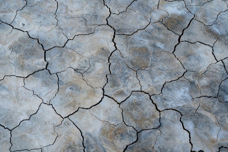
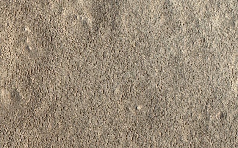
The scientific term for this kind of landscape is polygon terrain — a surface pattern in which rock or sediment fractures into repeating multi-sided shapes, most commonly triangles, pentagons, and hexagons, under the influence of cyclical physical stress. That stress can come from temperature swings, moisture change, or both, causing the ground to expand and contract repeatedly until it splits along predictable geometric lines. The honeycomb analogy holds up well: just as a beehive’s wax cells form efficient, space-filling hexagons under uniform pressure from every direction, rock or sediment under similarly uniform stress tends to crack in regular, repeating patterns rather than chaotic ones.
That regularity is precisely what makes these fractures scientifically meaningful. Random damage — from a meteorite impact, a volcanic event, or simple erosion — does not produce continent-spanning networks of evenly spaced, geometrically consistent cracks. A systematic, repeated environmental force is required, which is why planetary scientists treat polygon terrain as an environmental archive rather than mere surface damage. On Earth, the closest analogs are found in permafrost regions such as Siberia and northern Canada, where freeze-thaw cycles split the ground into polygon networks that can persist for thousands of years. That analogy is useful but imperfect: Mars today is colder, drier, and geologically far older than any active permafrost field on Earth, which means the Martian version encodes a different and more ancient history.
The Discovery: Curiosity Enters the Largest Fracture Field on Mars
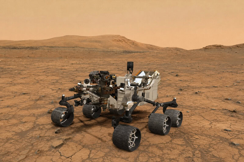
Curiosity is currently traversing the lower slopes of Mount Sharp — formally known as Aeolis Mons — inside Gale Crater, a site that prior NASA research has confirmed once held a lake billions of years ago. That established geological context means every new water-related signature found here carries additional scientific weight. What the rover’s cameras revealed in this latest phase of the mission was a sweeping valley floor covered in polygon-shaped fractures, each individual shape outlined by slightly raised or recessed ridges, creating a texture that reads — even from rover height — as unmistakably structured. NASA’s Curiosity science team has characterized this fracture field as the largest honeycomb-patterned formation ever observed on Mars, dwarfing previously catalogued polygon terrains identified from orbit or by earlier surface missions.
A panoramic image released by the mission shows the scale of the find viscerally: geometric fractures extend from the foreground to the horizon in every direction, the valley floor transformed into something that looks less like a natural landscape and more like a tiled floor designed by an obsessive geometer. Ground-level imagery confirms that the pattern is not an optical artifact of distance — the individual polygons are visible, textured, and structurally consistent at the scale of the rover itself. Detailed scientific analysis of the fractures is ongoing as of the rover’s current mission phase, meaning the full picture of what formed them is still being assembled.
How Cracks Become Clocks: Reading Ancient Water in Rock
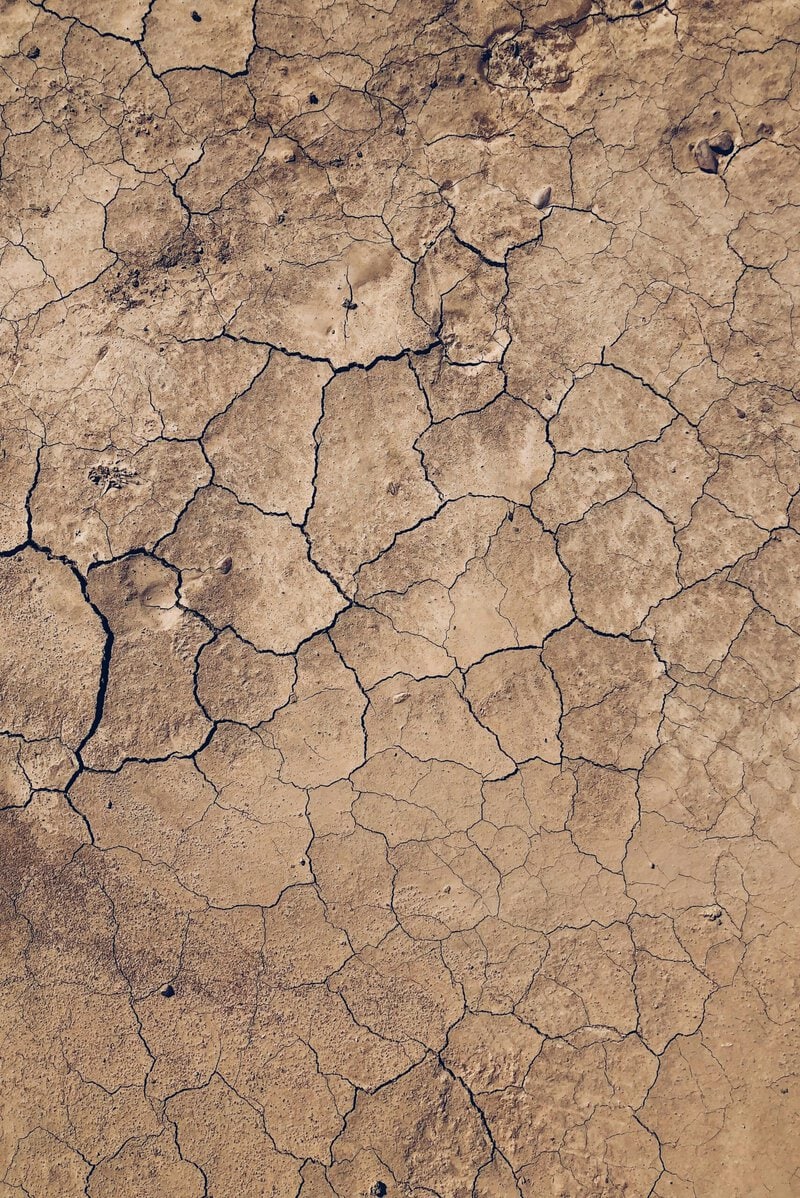
The core mechanism scientists are investigating centers on a well-understood geological process: when wet sediment dries out repeatedly — through seasonal flooding and evaporation, or through a climate that gradually loses its water supply — it shrinks and fractures in polygon patterns. The geometry of those cracks, their depth, their spacing, and crucially what minerals have filled them over time, collectively encode how many wet-dry cycles occurred and over what timescale. In other words, the honeycomb cracks on Mars may function as a kind of frozen diary, recording the rhythm of water’s presence and absence across geological time.
The key scientific question these fractures may help answer is not simply whether water was present on ancient Mars — that is already established — but how long it persisted and whether conditions were stable enough, for long enough, to be relevant to the question of habitability. A planet briefly flooded by a catastrophic event is a very different environment from one that hosted stable, cycling wet-dry seasons over millions of years. Polygon terrain formed by repeated wet-dry cycling would argue for the latter, with direct implications for whether Mars’s climate was ever stable enough to support microbial life.
The mineral dimension of the fractures is particularly important. If the cracks are filled with salts or sulfates — minerals that precipitate out of solution when water evaporates — then chemical analysis by Curiosity’s onboard instruments could confirm a wet-dry cycling origin and help constrain when that water was present. This is the direct link between Mars polygon terrain and ancient water evidence: the crack geometry suggests cycling, and the mineral fill could confirm it and date it.
Scientists are careful to note that competing hypotheses remain on the table. Wet-dry cycling is one explanation; freeze-thaw permafrost cycles driven by ice rather than liquid water are another; and purely thermal contraction in a dry environment — the kind that produces polygon terrain in Antarctic dry valleys without any liquid water involvement — cannot yet be ruled out. The record-breaking scale of this fracture field makes resolving that question a scientific priority, because the answer would substantially change what the site tells us about Mars’s history.
What This Means for Mars’s Wet Past
Decades of orbital and rover data have established a broad scientific consensus: Mars had liquid water on its surface billions of years ago, and that water was responsible for shaping much of the planet’s early geology. What remains actively debated is the duration, stability, and geographic extent of that water — questions that bear directly on whether Mars was ever a world where life could have taken hold. This fracture field represents a new and potentially unusually rich data point in that ongoing debate.
The established scientific foundation here is solid. Sedimentary rock analysis published by the Curiosity science team in the journal Science confirmed years ago that Gale Crater hosted a lake. What is emerging now — and what is not yet consensus — is whether this new fracture field extends and refines that picture by providing evidence of prolonged, cyclical water presence rather than a single lake episode. If analysis confirms wet-dry cycling as the mechanism behind these cracks, this site would represent one of the most detailed stratigraphic records of Mars’s transition from a wet planet to a dry one, offering a timeline that no previously documented surface feature has provided with comparable clarity or scale.
The habitability implications are significant but must be stated precisely. A Mars that was intermittently wet for millions of years — with seasons, with evaporating lakes, with recurring moisture in the soil — is a fundamentally different candidate for ancient life than a Mars that experienced brief, isolated floods. Polygon terrain formed by repeated wet-dry cycling would be structural evidence for the former scenario. That case has not yet been made from this specific field; it is the hypothesis that current analysis is designed to test.
Curiosity’s Toolkit: How the Rover Will Decode the Cracks
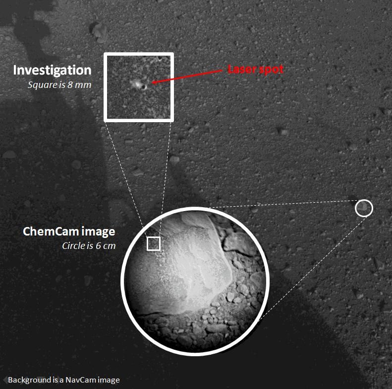
Curiosity carries three instruments that are particularly relevant to decoding the fractures. ChemCam fires a laser at rock targets, vaporizes a small amount of material, and reads the resulting plasma to determine elemental composition — it can identify salt and sulfate minerals in crack-filling material from a distance without physical contact. MAHLI, the rover’s close-up camera, can resolve millimeter-scale textures, allowing scientists to characterize the physical structure of individual fracture edges and fill material in fine detail. SAM, the Sample Analysis at Mars instrument, functions as an onboard chemistry laboratory capable of identifying organic molecules and measuring isotope ratios — information relevant to both the origin of the fractures and, potentially, to the search for biosignatures.
The investigative sequence the team will follow is methodical by necessity. Camera imaging comes first, establishing the geometry of the polygon network — polygon size, edge regularity, crack depth where visible — across as much of the field as the rover can survey. ChemCam then targets the most scientifically promising crack-filling material to determine whether salt or sulfate minerals are present. Drill samples, which feed material directly to SAM, are reserved for the most compelling targets identified in earlier stages. This process unfolds over weeks to months, not days.
There is an important constraint to acknowledge honestly. Curiosity was launched in 2011 and operates with finite power reserves and limited remaining drill capability — the rover is aging, and its science team must make careful decisions about which sections of this large fracture field to investigate most intensively. Not every polygon can be sampled, and the choices the team makes about where to focus will shape what conclusions can eventually be drawn. Complementing the rover’s ground-level work, the Mars Reconnaissance Orbiter’s HiRISE camera can image the full spatial extent of the fracture field from orbit at roughly 25 centimeters per pixel, allowing scientists to map polygon patterns across areas far too large for the rover to traverse on its own. Cross-referencing surface chemistry with orbital geometry is central to interpreting Mars surface patterns at this scale.
Why a Cracked Plain Matters to Planetary Science
The largest honeycomb crack field ever found on Mars is not simply a striking landscape feature — it is potentially the most spatially extensive physical record yet identified of how long and how steadily water shaped the planet before it disappeared. That distinction matters because the single most consequential open question in Mars science is not whether water existed there, but for how long it persisted in forms and quantities that could have supported life.
Understanding the timing and mechanism of Mars’s transition from wet to dry also has implications well beyond the red planet. Mars and Earth formed from similar raw materials in similar orbital zones; the fact that one retained its water and one did not is a fundamental puzzle in planetary science. The detailed geological record of Mars’s drying is a key piece of evidence in solving it. Models built from that record inform how scientists evaluate the habitability of rocky exoplanets around other stars — worlds that cannot yet be visited or sampled but whose prospects for life can be estimated from what Mars and Earth teach us about the conditions that preserve or destroy liquid water over geological time.
What remains genuinely open deserves equal emphasis: whether these specific fractures formed from water cycling, from ice, or from dry thermal stress is not yet resolved. The findings reported so far describe the discovery and its scientific potential — not a confirmed interpretation. The picture will evolve as Curiosity’s analysis continues, and responsible understanding of this discovery requires holding that uncertainty clearly in mind. For now, the enduring image is this: a rover the size of a car, crawling across a plain of ancient geometric cracks on a world roughly 140 million miles from Earth, methodically asking whether the patterns beneath its wheels are the fossilized footprint of a planet that was once, for a very long time, wet.