
A continuous biological structure more than 5,000 miles wide — stretching from the west coast of Africa all the way to the Gulf of Mexico — has been mapped in unprecedented detail using satellite imagery, leaving oceanographers reassessing what they thought they knew about the Atlantic Ocean. The structure is real, it is vast, and until space-based observation made it visible in its entirety, science lacked the tools to describe it fully.
A 5,000-Mile Living Structure, Hiding in Plain Sight
The feature in question is the Great Atlantic Sargassum Belt (GASB): a sprawling, cohesive mass of brown seaweed called Sargassum that floats at the ocean surface across the tropical Atlantic, spanning more than 8,850 kilometers — a distance wider than the gap between New York City and Moscow. Images captured from orbit have exposed the belt’s true scale in a way that no ship-borne survey ever could, confirming that what was once dismissed as a seasonal nuisance is in fact one of the largest biological aggregations on the planet’s surface.
The significance of the GASB extends well beyond spectacle. Scientists studying the belt have documented measurable consequences for Atlantic coastlines, tropical fisheries, and regional climate systems. This is not a myth, a misidentification, or a case of satellite data being over-interpreted. It is a peer-documented phenomenon — one that researchers are still working to fully understand, and about which key questions remain genuinely open.
What Exactly Is Sargassum — and Why Does It Form a Belt?
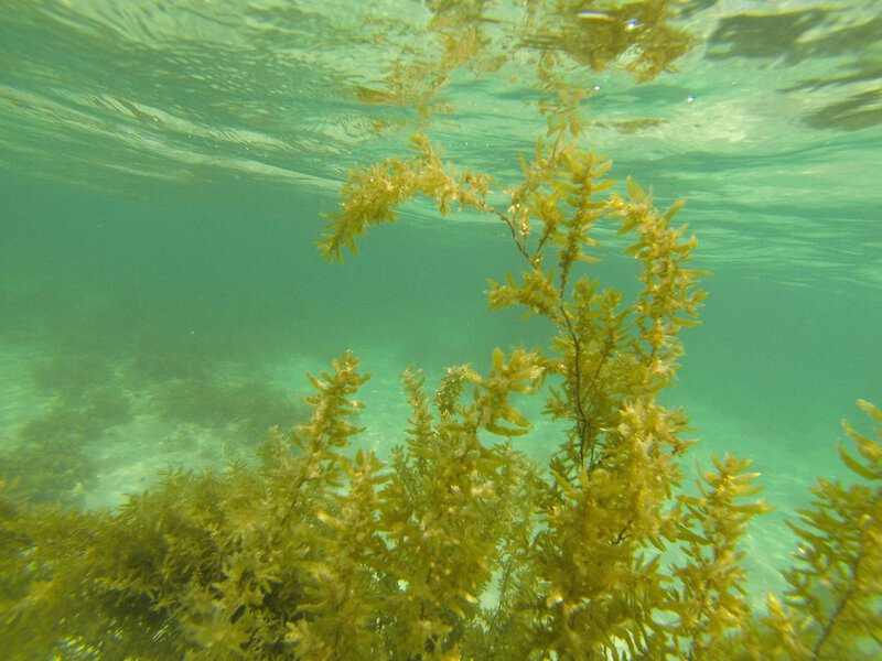
Sargassum is a genus of free-floating brown macroalgae — large seaweed — that behaves unlike virtually any other marine plant. Rather than anchoring to the seafloor, it reproduces and drifts entirely at the ocean surface, forming dense, buoyant mats that can resemble floating islands. Satellite observations confirm that the GASB occupies tropical Atlantic waters in a rough band between approximately 5°N and 25°N latitude, connecting West African coastal waters to the Caribbean Sea and the Gulf of Mexico.
To understand the belt’s emergence, it helps to know where Atlantic Sargassum historically lived. The Sargasso Sea — a distinct body of water located in the North Atlantic near Bermuda, bounded by ocean currents rather than coastlines — was long considered the primary habitat for this seaweed. Scientists now recognize that what was once largely confined to the Sargasso Sea has evolved into the far larger, more dynamic Great Atlantic Sargassum Belt, a transformation with no clear historical precedent in the modern scientific record.
The belt is not a static object. Ocean surface currents, the Atlantic trade winds, and pulses of nutrient-rich water rising from the deep ocean work together to aggregate Sargassum into a persistent, seasonally recurring band. The system is self-reinforcing: as the seaweed accumulates, it alters local light and nutrient conditions in ways that can sustain further growth, making the belt a dynamic biological engine rather than a passive accumulation of drifting plants.
How Satellites Exposed a Structure Invisible to Ships
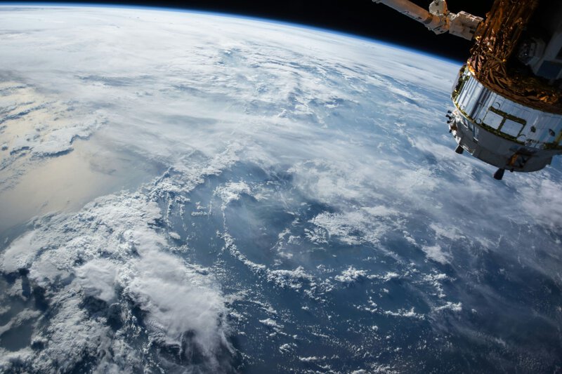
The core observational problem with the GASB is one of scale. No single research vessel, coastal monitoring station, or aircraft survey could perceive a 5,000-mile structure as a unified whole. Only satellite-mounted sensors capable of imaging entire ocean basins simultaneously could reveal the belt’s true dimensions and continuity. NASA’s Earth Observatory has documented the belt’s growth through orbital imagery, demonstrating how space-based platforms transformed an anecdotal observation into a quantified scientific dataset.
The technology enabling this detection is called remote sensing. NASA and European Space Agency (ESA) satellites carry instruments that detect the specific wavelengths of light that Sargassum reflects differently from open seawater. Specialized algorithms then process those spectral signatures across millions of square kilometers, producing maps of the belt’s distribution with a level of detail that was simply impossible before the satellite era. The instrument that first made systematic monitoring feasible was MODIS — the Moderate Resolution Imaging Spectroradiometer — a NASA sensor whose data allowed researchers at the University of South Florida to publish foundational work documenting the belt’s emergence as a recurring, ocean-wide phenomenon. That finding has since been corroborated by multiple institutions.
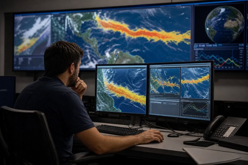
Continuous year-round satellite monitoring now gives scientists something invaluable: a repeatable, quantified record of the belt’s growth, movement, and seasonal peaks. Satellite images have revealed the belt growing denser and pushing steadily closer to populated coastlines, converting what was once guesswork into trackable data with direct implications for coastal planning.
Why the Belt Grew: Nutrients, Warming, and Human Fingerprints
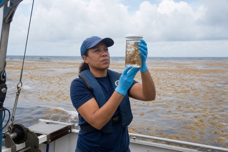
The GASB’s dramatic expansion since roughly 2011 has attracted intense scientific scrutiny, and researchers have identified several probable drivers — though assigning precise responsibility to each remains contested. The leading explanation centers on elevated concentrations of nitrogen and phosphorus in tropical Atlantic waters. These nutrients act as fertilizers for Sargassum, and scientists have linked their increased availability to two principal sources: Amazon River discharge carrying agricultural runoff from South American farmland into the Atlantic, and dust-borne nutrients blown westward across the ocean from the Sahara Desert.
Rising ocean surface temperatures also correlate with conditions favorable to Sargassum growth, and multiple studies have noted the association. However, the scientific community is careful to distinguish correlation from confirmed causation. Whether warming is a primary driver, a contributing amplifier, or a secondary factor remains an active area of research, and responsible reporting requires acknowledging that uncertainty rather than papering over it.
At its recorded peak, the GASB has been estimated to contain more than 20 million metric tons of Sargassum — placing it, by biomass, among the largest plant aggregations on Earth’s surface, according to analyses published in peer-reviewed journals including Science. The relative contributions of agricultural runoff, natural nutrient cycling, and ocean warming to producing that biomass are still being disentangled, and no single study has yet assigned definitive percentage weights to each driver.
When the Belt Hits Shore: Florida, the Caribbean, and Beyond
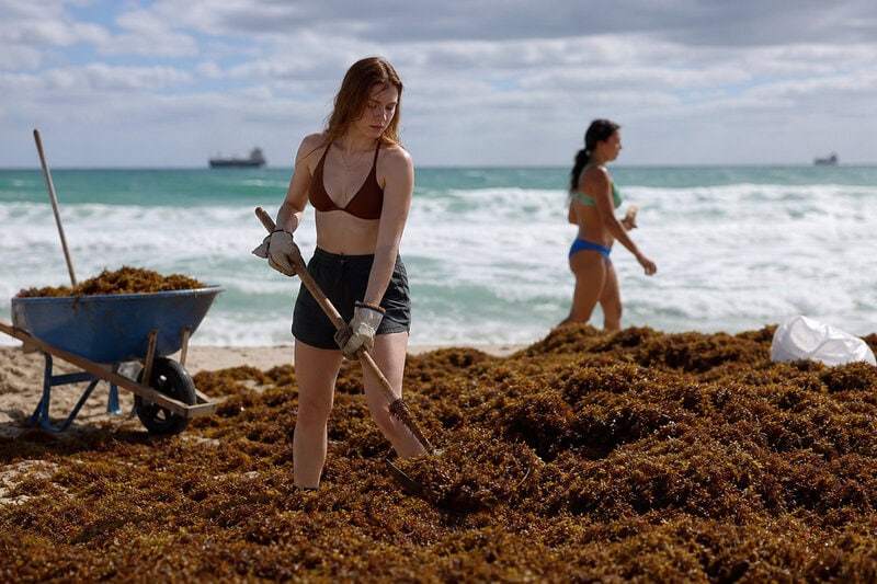
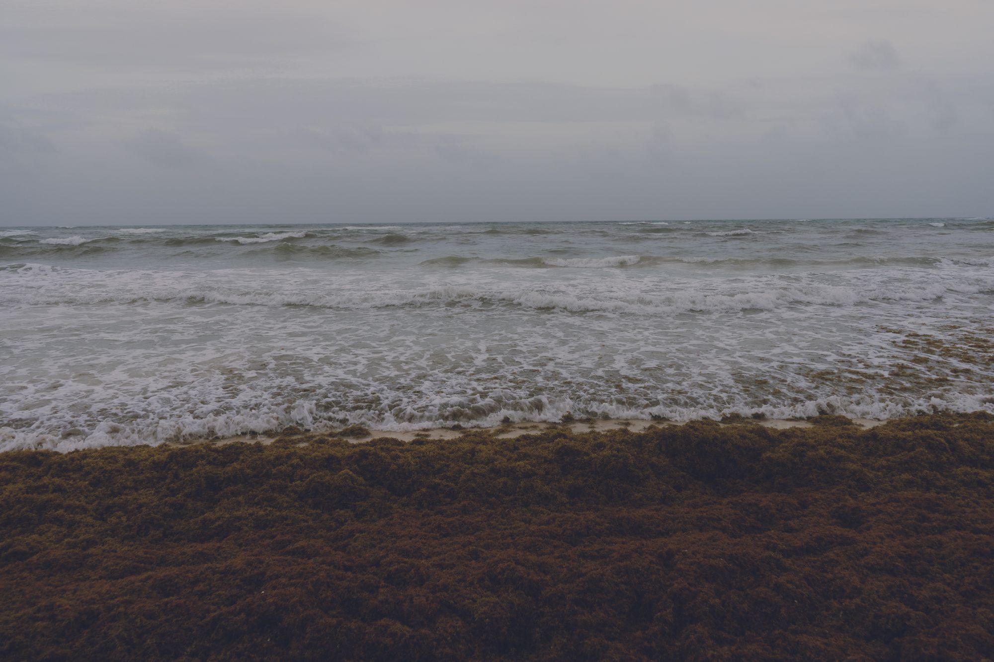
The consequences of the GASB become most immediate when the seaweed reaches land. Sargassum from the belt has been washing up on Florida beaches in volumes large enough to require mechanical removal, and Caribbean communities from Mexico’s Yucatán Peninsula to the Lesser Antilles have faced similar inundations, with shorelines buried under rotting mats meters deep.
The onshore ecological damage follows a predictable mechanism. As beached Sargassum decomposes, it releases hydrogen sulfide — the compound responsible for the characteristic rotten-egg odor — depletes oxygen in nearshore waters, and creates conditions that can harm nesting sea turtles and coastal fish populations. Tourism-dependent economies across Florida, the Yucatán, and the wider Caribbean have reported significant revenue losses during heavy-inundation seasons, illustrating that a remote ocean phenomenon carries very direct human costs.
It is important, however, to distinguish open-ocean Sargassum from beached Sargassum. In the open Atlantic, the belt functions as a critical and productive habitat. Hundreds of species — including juvenile sea turtles, various eel species, and commercially important fish — rely on the structure for shelter and feeding during vulnerable life stages. Scientists monitoring the belt’s movement toward the U.S. coastline consistently emphasize this dual nature: the same structure that damages beaches when it arrives in excess is, at sea, an irreplaceable nursery ecosystem. The ecological story is complex, not simply negative.
What Scientists Still Do Not Know — and Why It Matters
Transparency about uncertainty is essential to understanding the GASB accurately. Researchers have not yet established a reliable long-term predictive model for the belt’s annual size and coastal trajectory. Forecasting exactly when and where Sargassum will impact specific coastlines in a given season remains an unsolved scientific challenge, limiting the ability of coastal managers to prepare effectively.
Contested projections further complicate the picture. Some studies suggest that reducing agricultural nutrient inputs — particularly from the Amazon basin — could eventually stabilize or even shrink the belt. Others project continued expansion under warming scenarios. The scientific community has not reached consensus on which trajectory is more likely, and long-range projections about the GASB should be treated with appropriate skepticism until a stronger evidence base is established.
A monitoring gap also constrains scientific understanding. While NASA and ESA satellites provide detailed surface imagery, the three-dimensional structure of the belt — how deeply it extends below the waterline and how it interacts with subsurface ocean currents — remains poorly characterized. Scientists are calling for dedicated ship-based and submersible surveys to complement satellite data and fill that structural gap. Without them, even the most sophisticated orbital imagery captures only half the picture.
These knowledge gaps matter beyond the laboratory. Without a clearer understanding of the GASB’s drivers and likely trajectory, coastal managers, fisheries regulators, and climate negotiators lack the evidence needed to design interventions that are proportionate and effective. Continued investment in GASB research is, in this sense, a practical priority with direct policy implications — not merely an academic exercise.
The Bigger Picture: A New Feature on Earth’s Ocean Map
The Great Atlantic Sargassum Belt is not merely a nuisance, a curiosity, or a sensational headline. It represents the emergence of a new, persistent, large-scale feature in the Atlantic Ocean system — one that did not exist in its current form a generation ago and that may define the biology of the tropical Atlantic for decades to come. The 5,000-mile carpet of seaweed visible from space is, in miniature, a demonstration of how rapidly Earth’s ocean systems can reorganize under new pressures — and how dependent our understanding of those changes has become on the satellites orbiting above them.
Space-based platforms are now capable of detecting and monitoring planetary-scale changes — ecological, geological, and atmospheric — that would be entirely invisible to ground-level observation. The GASB’s documentation is one of the clearest illustrations of that capability and its scientific value. What ships spent decades failing to perceive as a coherent whole, satellites revealed within years of systematic monitoring.
As of 2025, the Great Atlantic Sargassum Belt stands as one of the most dramatic documented examples of a marine ecosystem reorganizing in real time. Leading oceanographers describe the phenomenon as unprecedented in the modern scientific record while stressing, consistently and correctly, that understanding it fully will require years of additional observation, modeling, and field research. As satellite monitoring improves and ocean surveys expand, the GASB will remain among the most closely watched features on Earth — a 5,000-mile reminder that the planet’s oceans are still fully capable of surprising us.