
Every 15 to 20 minutes, Volcán de Fuego hurls a column of ash and gas hundreds of meters into the Guatemalan sky — yet its immediate neighbor, Acatenango, has not erupted since 1972 and stands in what geologists call near-complete repose. Two stratovolcanoes sharing the same magmatic roots beneath the Sierra Madre can behave as differently as a lit fuse and a stone wall, and scientists are still working out exactly why.
Two Volcanoes, One Striking Contrast
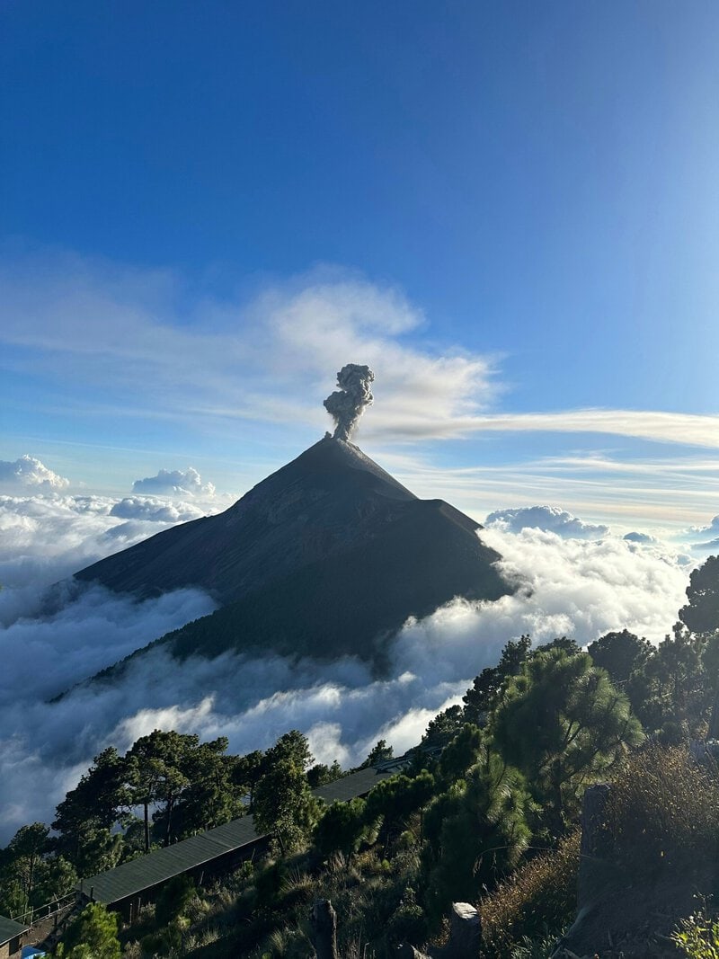
Acatenango rises to 3,976 meters (13,045 feet) above sea level in the Guatemalan Highlands, roughly 25 kilometers southwest of the colonial city of Antigua. That elevation makes it one of the most accessible front-row seats to active volcanism on Earth. Hikers who commit to the approximately 8.4-mile round-trip route — a 1,570-meter ascent requiring 8 to 9 hours of active hiking, typically spread across two days — do not simply gain altitude. They walk through a living geology textbook, one that raises more questions than it answers about why one volcano roars while its twin sleeps.
The contrast is not merely scenic. It is scientifically consequential. Understanding what separates Acatenango’s silence from Fuego’s fury touches on some of the deepest unresolved problems in volcanology: how magma moves through the crust, what triggers eruptions, and whether a dormant volcano situated beside an active one is truly safe to treat as background.
What Kind of Volcano Is Acatenango, and How Did It Form?
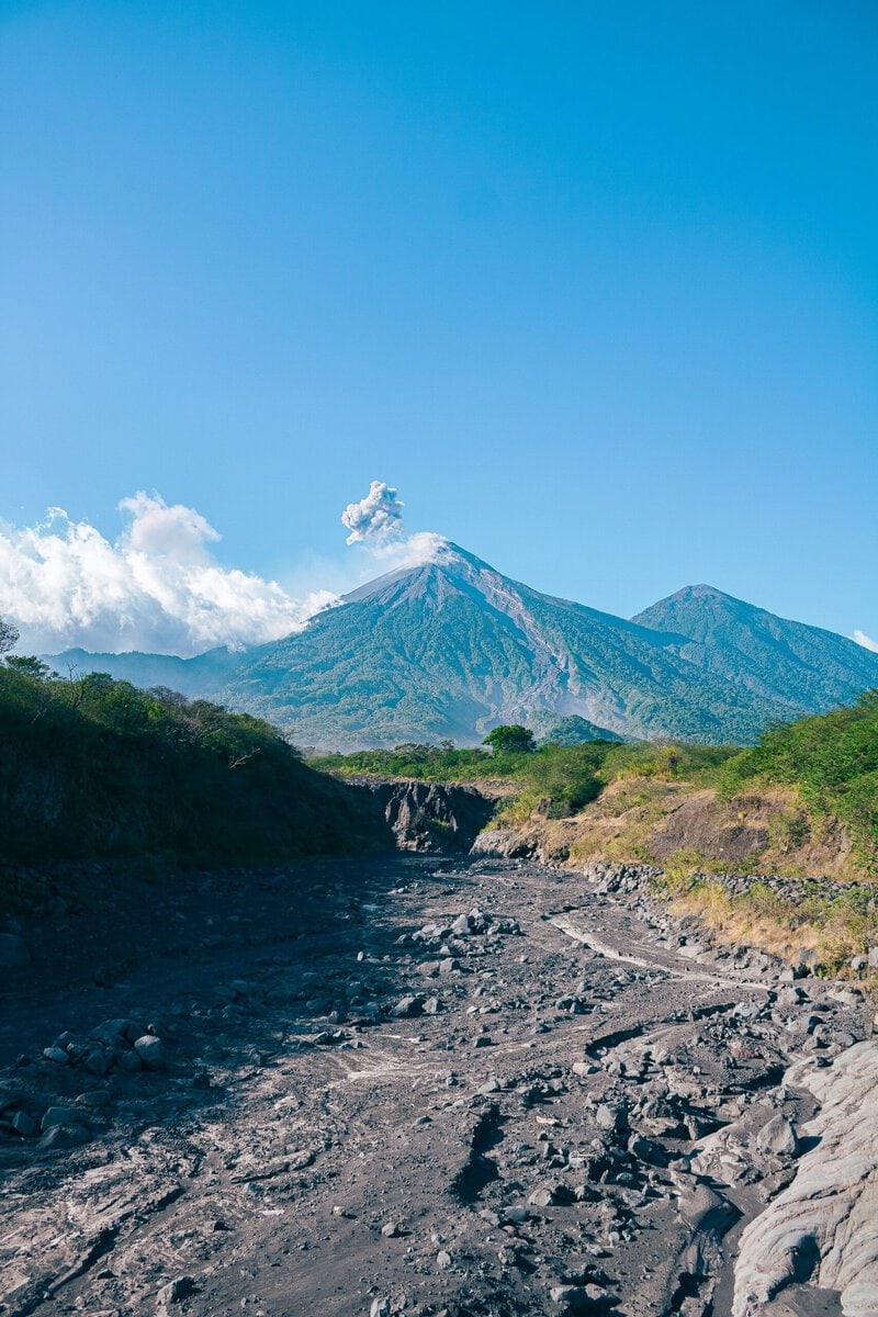
Acatenango is a stratovolcano — also called a composite volcano — built from alternating layers of hardened lava, volcanic ash, and pyroclastic debris. That layered architecture gives it the characteristic steep, symmetrical cone visible from Antigua’s streets and produces its two distinct summits: Yepocapa, the older northern peak, and Pico Mayor, the higher southern summit at 3,976 meters. The difference between a stratovolcano and a gentler shield volcano is not just shape; it reflects fundamentally different magma chemistry, eruption style, and hazard profile.
The tectonic engine driving Acatenango sits far below the surface. The volcano occupies the Guatemalan segment of the Central American Volcanic Arc, where the Cocos tectonic plate subducts — dives — beneath the Caribbean plate at roughly 72 to 80 millimeters per year, according to the U.S. Geological Survey. As the oceanic crust descends into the hot mantle, it releases water and other volatiles. That fluid injection lowers the melting point of the surrounding mantle rock, generating silica-rich magma that rises through the overlying crust and, over tens of thousands of years, builds structures like Acatenango.
Acatenango is one of roughly 37 volcanoes strung along Guatemala’s Sierra Madre range, itself a segment of the approximately 1,500-kilometer-long Central American Volcanic Arc — a chain the Smithsonian Institution’s Global Volcanism Program catalogs as one of the most volcanically dense corridors on the planet. The eruptive history of Acatenango’s older Yepocapa cone remains a subject of ongoing research. Some volcanologists estimate activity beginning as early as 230,000 years ago, though precise radiometric dating of its deeper layers is, as of 2024, still incomplete — a reminder that even well-visited volcanoes can hold significant geological mysteries.
Fuego: Why Is the Neighbor Always Erupting?
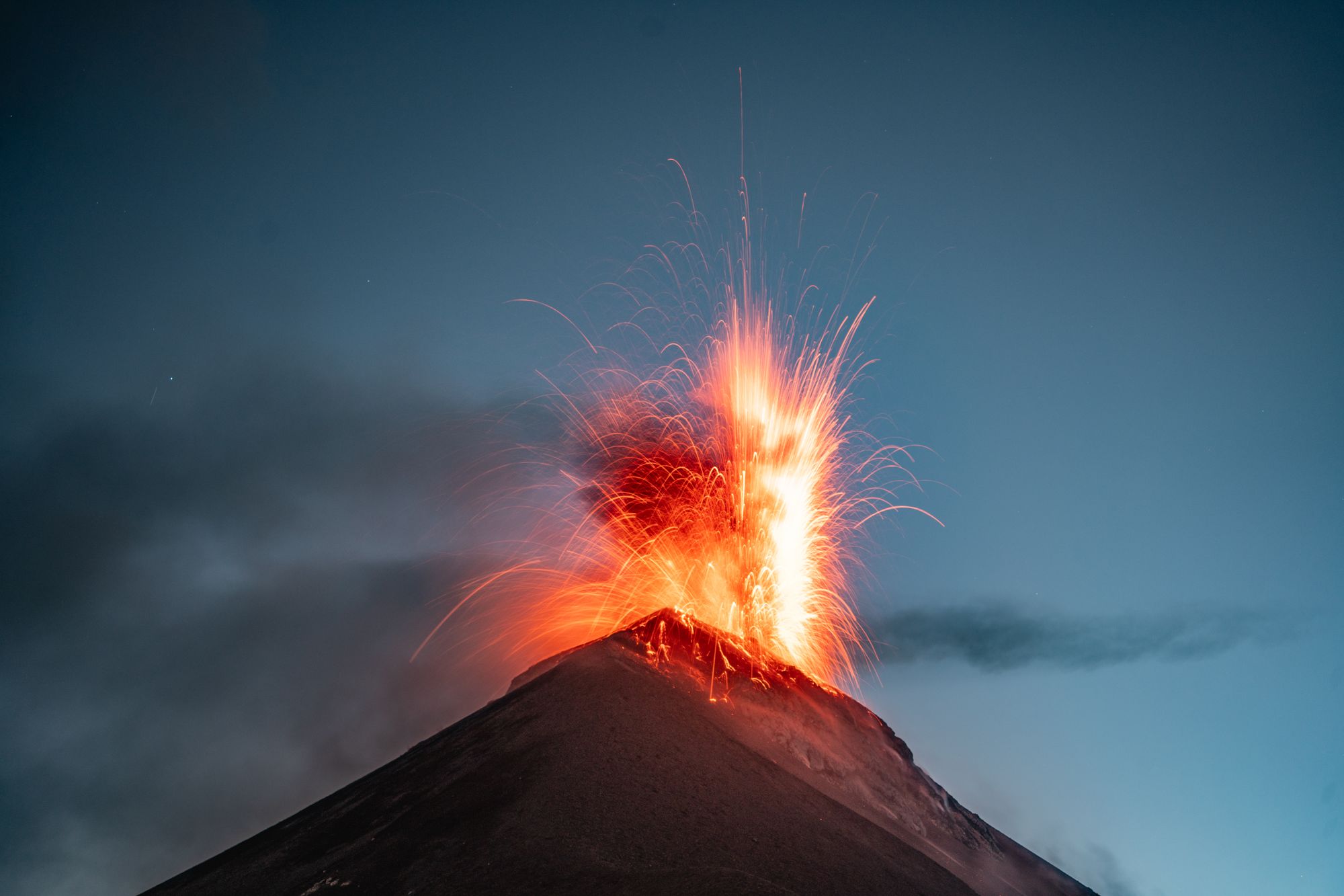
Volcán de Fuego — “Volcano of Fire” in Spanish — is classified by the Smithsonian Institution’s Global Volcanism Program as one of the most continuously active volcanoes in the Western Hemisphere. Recorded eruptive activity spans more than 500 years, with major paroxysms occurring multiple times per year and smaller explosions happening so frequently that local communities have long treated the rumble and glow as background noise.
The mechanism behind Fuego’s near-constant output begins with magma composition. Fuego produces relatively low-viscosity, mafic magma — rich in iron and magnesium — which allows dissolved gases, primarily water vapor, carbon dioxide, and sulfur dioxide, to escape more freely than they would in thicker, more silica-rich material. The result is frequent but often moderate explosive bursts, a style volcanologists classify on a spectrum from Strombolian to sub-Plinian activity, named after the perpetually active Stromboli volcano in Italy. In simpler terms: Fuego vents pressure regularly rather than building toward catastrophic release.
That does not make it harmless. The June 2018 Fuego paroxysm, documented by Guatemala’s national volcanological agency INSIVUMEH and analyzed in subsequent peer-reviewed research, generated pyroclastic density currents — fast-moving avalanches of hot gas and volcanic debris that can travel at highway speeds — killing at least 215 people and burying communities under lahar deposits. A lahar is a volcanic mudflow, typically formed when hot material mixes with water from rivers, rainfall, or melting ice. The 2018 event illustrated with terrible clarity why continuous monitoring of even familiar volcanic activity is not optional.
A significant open question concerns the relationship between Fuego and Acatenango at depth. Researchers at the Universidad de San Carlos de Guatemala and international collaborators are actively investigating whether the two volcanoes share a single interconnected magma reservoir or draw from separate but adjacent magmatic systems. That distinction carries direct implications for eruption forecasting: if the systems are coupled, pressure changes in one could theoretically influence the other.
The Strange Silence of Acatenango
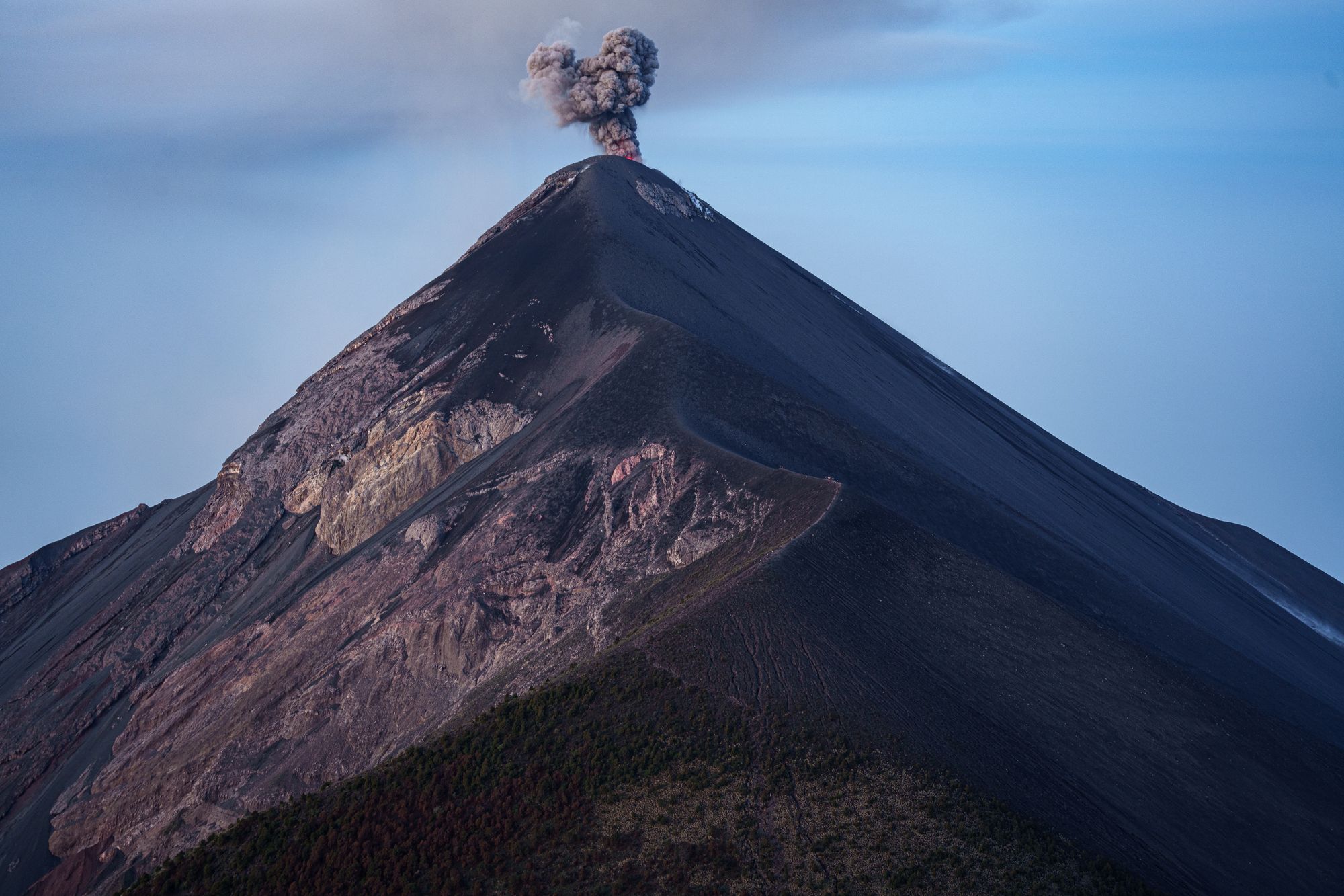
Acatenango’s most recent confirmed eruption occurred in 1972, according to the Smithsonian Institution’s Global Volcanism Program. That makes it dormant — not extinct. The difference is scientifically important: a dormant volcano retains the structural and thermal conditions to erupt again, whereas an extinct volcano is considered to have permanently lost its magmatic supply. No eruption at Acatenango is currently anticipated, but the designation of dormant is explicitly not a guarantee of permanent silence.
What makes Acatenango’s quiet so scientifically unusual is its proximity to Fuego. In a tightly coupled volcanic system, one might expect the frequent magmatic pressure fluctuations generated by Fuego’s near-daily eruptions to influence neighboring structures. The fact that Acatenango shows no observable response — at least at the surface — suggests either effective physical separation of their magma bodies at depth, or that Acatenango’s conduit system has become partially sealed, restricting upward magma movement. The latter hypothesis has been noted in volcanological literature but has not been confirmed in peer-reviewed studies with sufficient data to be considered established consensus.
Volcanologists use the term “repose interval” to describe the time between eruptions of a given volcanic center. For stratovolcanoes globally, repose intervals of decades to centuries are common and do not by themselves signal a volcano’s end. What is uncommon — and instructive — is a 50-year-dormant peak sitting immediately beside one erupting multiple times daily. Whether Acatenango’s silence reflects long-term magmatic decline or a temporary repose before future activity is, as of 2024, an open and actively debated question.
The Hike as a Geology Field Course
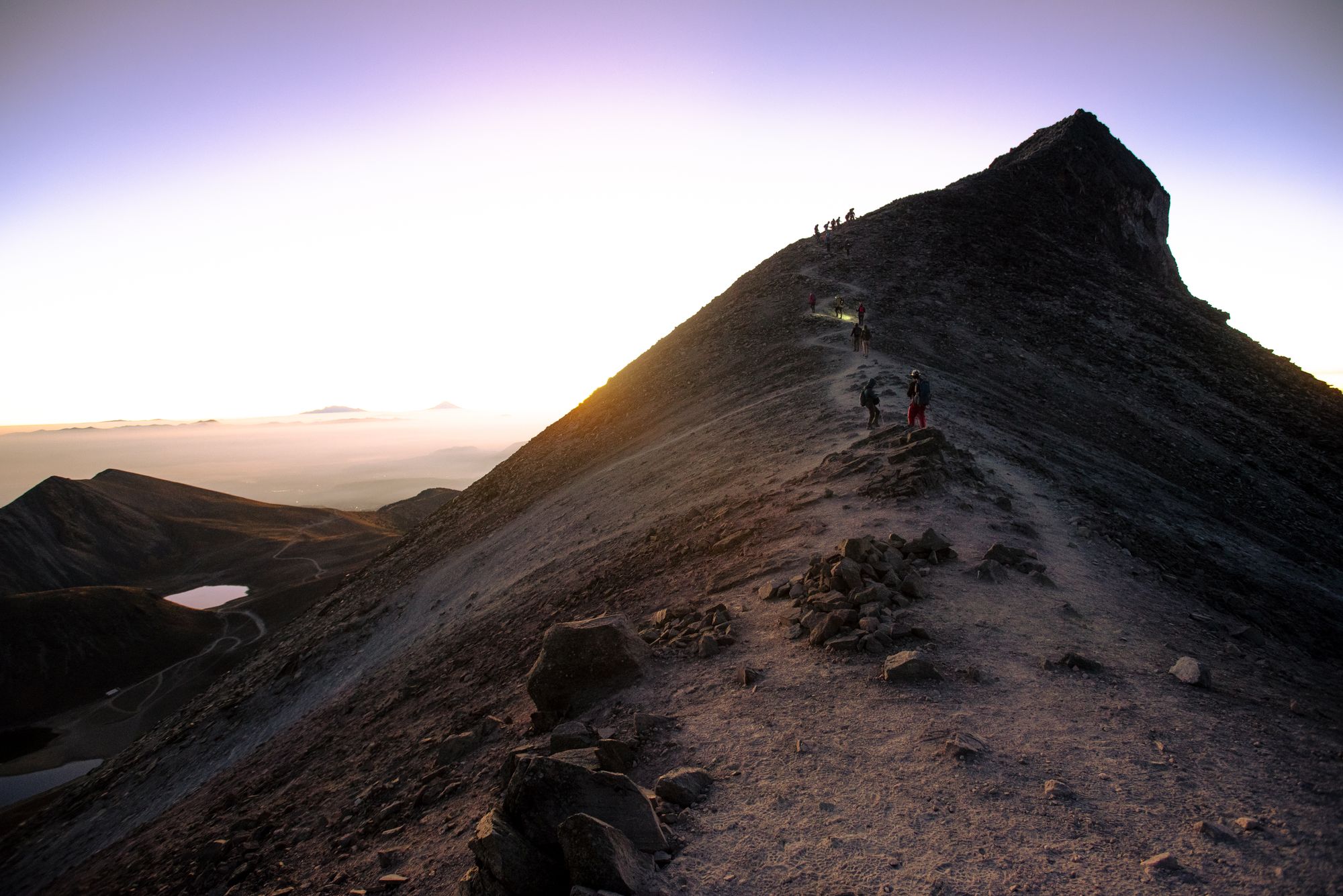
For those who want to engage with this science directly, the Acatenango hike demands serious preparation. Hikers begin at roughly 2,800 meters elevation and ascend 1,570 meters to the 3,976-meter summit — a vertical gain comparable to stacking the Empire State Building nearly four times. The full route covers approximately 8.4 miles and requires 8 to 9 hours of active hiking. Most visitors spread this across two days, camping on the upper slopes to catch sunrise and a night of Fuego observation. A full planning guide to the Acatenango volcano hike covers gear, logistics, and timing in detail — essential reading before departure given the altitude and exposed terrain.
Each elevation band on the ascent tells a distinct geological story. The lower slopes are blanketed in dense cloud forest growing in volcanic soils enriched by centuries of ashfall. The Food and Agriculture Organization of the United Nations has documented volcanic soils derived from repeated ashfall as among the most mineral-rich agricultural substrates on Earth — a fact visible in the lush productivity of Guatemala’s highland farmland. Above roughly 3,400 meters, the forest gives way to sparse páramo, the high-altitude grassland ecosystem characteristic of tropical mountain summits, before transitioning to bare volcanic scree on the upper cone.
That upper scree is itself a scientific record. Hikers traverse fields of loose pumice and dark andesite lava flows — andesite being the intermediate-composition volcanic rock characteristic of subduction-zone stratovolcanoes, named for the Andes where it was first described. In exposed trail cuts, alternating layers of ash and lava read like stratigraphic pages in a diary of Acatenango’s eruptive past. Each layer represents an event; its thickness and composition encodes information about eruption intensity, prevailing wind patterns, and magma evolution over time.
At the summit, atmospheric pressure drops to roughly 62% of sea-level pressure, meaning each breath delivers significantly less oxygen than at the trailhead. This is not merely a discomfort — it is a direct physiological consequence of altitude, and it explains why the hike’s two-day structure is medically sound advice rather than a comfort preference. Rapid ascent to nearly 4,000 meters without acclimatization carries real risks, including acute mountain sickness. Guided approaches to climbing Acatenango build in appropriate rest and pacing for this reason, and are strongly recommended for hikers without high-altitude experience.
Watching Fuego from Acatenango: What Real-Time Volcanism Looks Like
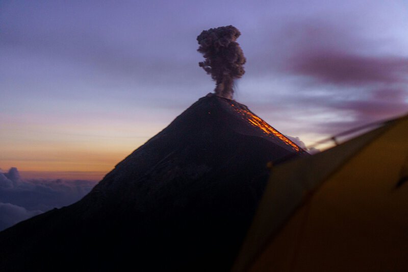
From Acatenango’s high camp, observers watch Fuego’s eruption column rise and collapse in near-real time, with each explosion’s sound arriving several seconds after the visual — a direct consequence of sound traveling at roughly 343 meters per second at sea level, and slower still at altitude. That delay is a measurable reminder that what appears simultaneous in a volcano video is actually a sequence of physical events propagating through different media at different speeds.
The incandescent orange glow visible from camp at night is frequently misidentified as flowing lava. What observers are actually watching is ejected spatter and ballistic bombs — fragments of partially molten magma flung from the vent — whose color directly encodes temperature. Bright orange coloration indicates surface temperatures in the range of approximately 900 to 1,000°C, according to standard pyrometric methods used by volcanologists to estimate lava temperatures remotely. The bombs cool and darken as they travel through the air, a color shift visible to the naked eye over the few seconds of each fragment’s flight.
INSIVUMEH operates a network of seismometers, tiltmeters, and gas-sensing instruments on and around Fuego, with data shared in real time with the Smithsonian Institution and USGS as part of the Global Volcano Monitoring Network. This instrumentation makes the Fuego-Acatenango complex one of the better-monitored volcanic pairs in Central America. Even so, the 2018 Fuego paroxysm demonstrated that escalation can outpace warning systems, and INSIVUMEH and the Guatemalan government continue to refine evacuation protocols in direct response. Responsible tour operators on Acatenango monitor INSIVUMEH alerts as a standard safety practice and adjust schedules accordingly.
Why This Volcanic Pair Matters Beyond Guatemala
The Acatenango-Fuego complex offers volcanologists something rare: a dormant and an active stratovolcano in close geographic proximity, both rooted in the same subduction system, allowing researchers to compare magma composition, degassing behavior, and structural evolution within a tightly controlled geographic frame. That kind of natural experiment is difficult to replicate in a laboratory and impossible to manufacture in the field.
The climate implications extend the relevance further. Large stratovolcano eruptions can inject sulfur dioxide into the stratosphere, where it forms aerosols capable of measurably cooling global surface temperatures for one to three years — a phenomenon documented after the 1991 eruption of Mount Pinatubo in the Philippines by NASA’s Goddard Institute for Space Studies. Fuego’s frequent smaller eruptions contribute to regional aerosol loading in ways that remain an active area of atmospheric research, with implications for regional precipitation patterns and agricultural planning across Central America.
As of 2024, the USGS and international research partners identify improved understanding of coupled volcanic systems — where one volcano’s behavior might influence a neighbor’s — as a priority research area. Populated regions worldwide sit near such pairs, and forecasting models developed from data collected at well-instrumented sites like Fuego and Acatenango have direct applicability elsewhere. Acatenango’s geological profile is increasingly referenced in comparative volcanology precisely because the contrast it presents is so sharp and so well-located for study.
Acatenango is not merely a hiking destination with a dramatic view. It is a 3,976-meter vantage point into one of Earth’s most instructive and least fully understood volcanic relationships — where the stillness of one peak and the fury of another ask the same fundamental question science has not yet completely answered: what decides when a volcano wakes up?