
A strip of land roughly the size of 127 football fields stands between a cluster of San Mateo County neighborhoods and the kind of wind-driven fire behavior that has leveled entire California communities in recent years. Nearly $2 million is now committed to managing those 167 acres, with a grant covering approximately half the cost. The investment, by the Midpeninsula Regional Open Space District — known as Midpen — pairs wildfire fuel reduction with wildlife habitat conservation, embodying a dual-objective model that California fire and conservation policy increasingly treats as the standard for responsible open space stewardship.
The Wildland-Urban Interface: Why Ordinary Edges Kill
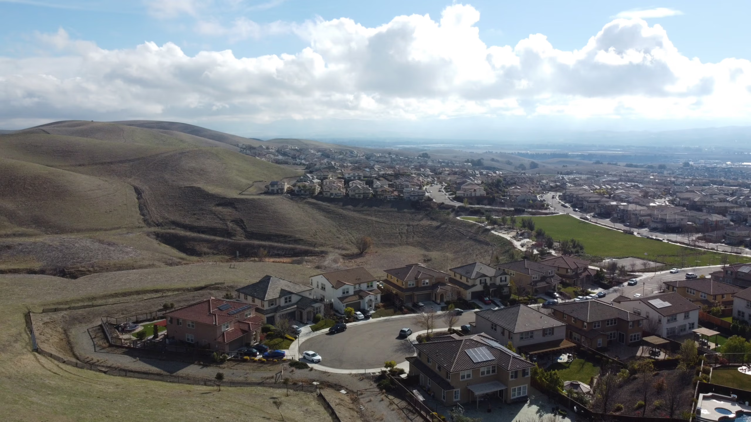
The land in question sits in what fire scientists call the wildland-urban interface, or WUI — the band where human development meets undeveloped wildland vegetation. It is not a dramatic term for a dramatic landscape. It describes the ordinary edges where backyards give way to chaparral and cul-de-sacs run out where oak woodland begins. That ordinariness is precisely what makes it dangerous. According to the USDA Forest Service, roughly one-third of all U.S. housing units sit within the WUI, yet this zone accounts for the majority of structure losses in California wildfires.
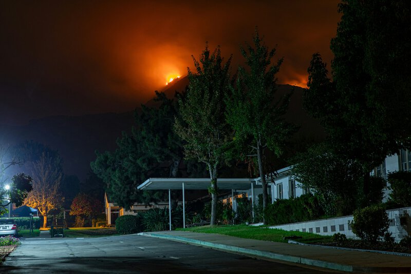
The 2018 Camp Fire, which destroyed more than 18,000 structures in Paradise, and the 2021 Dixie Fire, which burned across four counties, both demonstrated how WUI conditions drive catastrophic losses. The physics are straightforward: continuous fuel loads allow flame fronts to advance steadily, while spotting — the process by which burning embers are lofted and carried ahead of the fire — can ignite structures well beyond the visible fire edge. A neighborhood does not need to be adjacent to a flame front to burn; it needs only to be within ember range of one.
San Mateo County’s coastal hills create textbook WUI conditions. The fog-dependent vegetation of the peninsula’s chaparral and coastal scrub retains moisture through summer but cures rapidly during drought and offshore wind events. When wind pushes offshore and humidity drops, hillsides that appeared green weeks earlier become dense, dry fuel. The 167 acres Midpen manages sit directly in this zone, making their active stewardship a practical community safety measure rather than a symbolic conservation gesture.
How Managed Open Space Interrupts Fire Behavior
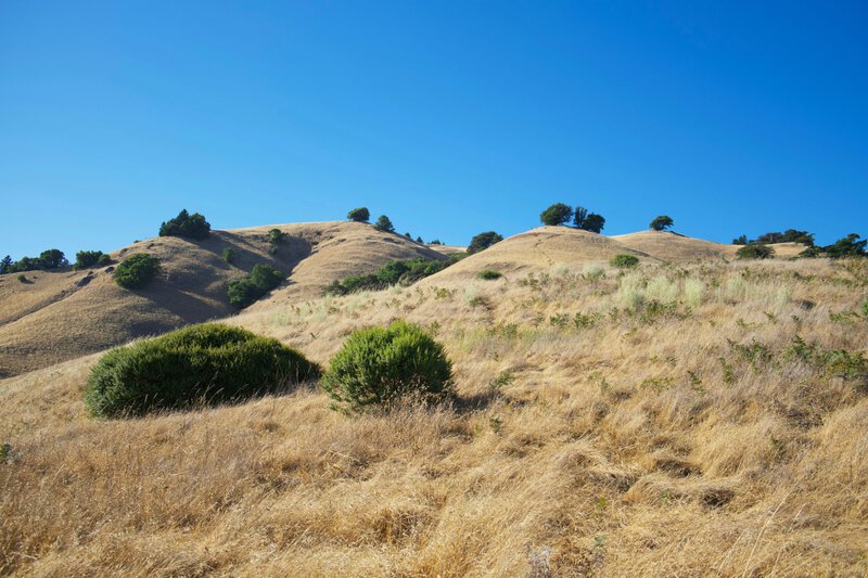
The mechanism by which strategically managed open space slows fire spread is well-established, though frequently misunderstood. The key concept is the fuel break — a strip or zone where vegetation is reduced, modified, or replaced with less flammable species to slow fire spread and create anchor points for firefighter suppression. This differs from a firebreak, which removes all vegetation entirely. A fuel break does not stop fire; it changes fire behavior enough to make suppression feasible and to reduce the rate at which embers are generated and carried forward.
Fire intensity is a function of three variables: fuel quantity, fuel continuity, and fuel moisture content. Strategic thinning and native plant restoration in a well-designed fuel break address all three simultaneously. Research published in the International Journal of Wildland Fire has documented that treated areas consistently show lower flame lengths and reduced rates of spread compared to untreated adjacent vegetation under comparable weather conditions. Even modest reductions in fire intensity — from a 20-foot flame to an 8-foot flame, for example — can shift a fire from one that overwhelms aerial suppression resources to one that ground crews can safely approach.
Central to this project, and to fuel break ecology broadly, is the management of ladder fuels: the shrubs, brush piles, and small trees that allow a ground-level fire to climb into a forest canopy. Once fire reaches the canopy, it generates its own wind, spreads exponentially faster, and becomes nearly impossible to suppress under anything but calm conditions. Removing ladder fuels severs that vertical pathway and is among the most cost-effective single interventions available in WUI fire management.
It is worth being precise about what the science does and does not establish. The link between fuel reduction and improved fire behavior is supported by decades of peer-reviewed research and is not meaningfully contested among fire ecologists. What remains an active area of study, per the Joint Fire Science Program, is the precise quantification of how much any single parcel reduces measurable community risk under real-world conditions. The mechanisms are sound; the dose-response relationship at the neighborhood scale is still being refined.
Habitat Conservation as a Built-In Co-Benefit
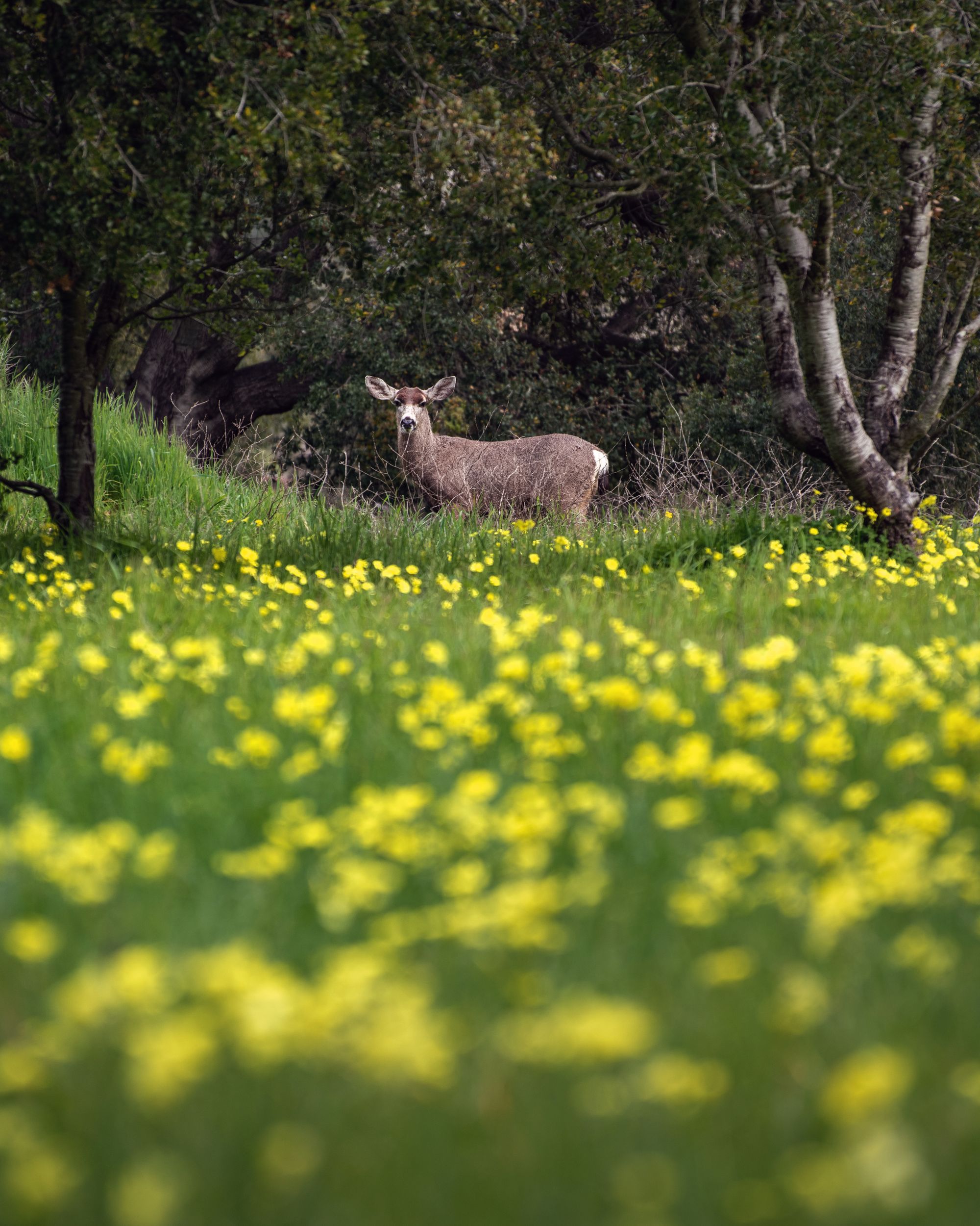
The Midpen project does not frame wildfire prevention as its sole objective. Animal habitats are an explicit part of the investment — a dual-objective approach that aligns with California’s 30×30 conservation goal, which commits the state to protecting 30 percent of its lands and coastal waters by 2030.
The habitat dimension centers on wildlife corridors: connected strips of habitat that allow animals to move between larger patches of open space, reducing genetic isolation and enabling range shifts in response to climate change. The California Department of Fish and Wildlife identifies corridor connectivity as among the highest conservation priorities in the state, particularly as development fragments coastal landscapes. In the Santa Cruz Mountains ecosystem that San Mateo County’s hills are part of, maintaining movement corridors for wide-ranging species is essential to long-term population viability.
Historically, fuel reduction and habitat conservation have been cast as competing goals. Dense vegetation favored by some wildlife — particularly the coastal scrub and chaparral thickets that characterize the peninsula — is also the vegetation that creates dangerous fuel loads. But research from UC Berkeley’s Center for Fire Research and Outreach suggests that mosaic habitats — a patchwork of open, thinned, and vegetated areas — can serve both fire safety and biodiversity objectives simultaneously. The varied vegetation heights and densities that a well-designed fuel break creates may actually support more species than a uniformly dense stand. That said, specific species inventories confirmed for this Midpen project have not been publicly released, and the full habitat benefits will depend on implementation details not yet fully disclosed.
The $2 Million Question: Funding Landscape-Scale Fire Resilience
The funding structure of the Midpen project reflects a reality that any fire manager or conservation planner will recognize immediately: landscape-scale fire resilience is expensive, and no single agency can carry the cost alone. With total investment approaching $2 million and a grant covering roughly half, the project exemplifies the blended public funding model that has become standard for WUI management in California. Land acquisition, skilled labor for vegetation management, monitoring, and long-term maintenance all carry costs that accumulate over decades.
California has signaled a clear policy direction on this front. CAL FIRE’s 2021 Wildfire and Forest Resilience Action Plan committed $1.5 billion over two years to fuel treatments statewide — an explicit shift from reactive suppression toward proactive landscape management. The Midpen project is one expression of that broader investment philosophy applied at the county scale.
The economic argument for prevention has been quantified, with caveats. A 2022 analysis by the Nature Conservancy estimated that every dollar invested in forest and habitat restoration in fire-prone regions yields approximately $3 to $10 in avoided suppression, health, and property costs. These are modeled estimates that carry regional variability, making direct application to any specific project imprecise. But the directional finding — that prevention is substantially cheaper than response — is consistent across multiple independent analyses and provides a defensible rationale for public investment at this scale.
Midpen’s institutional structure matters here. As a regional open space district, Midpen manages land in perpetuity. The ecological investments made in these 167 acres do not expire when a grant period closes; they compound over decades of stewardship. That long time horizon is a structural advantage over one-time fuel treatments on private land, where management continuity depends on individual landowner decisions and financial capacity.
What the Science Cannot Promise: Honest Limits of Open Space as Fire Defense
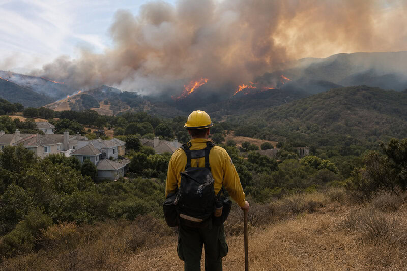
Any credible account of wildfire prevention open space must include what it cannot do. Fire ecologists at the USDA Forest Service’s Pacific Southwest Research Station have consistently emphasized that no single open space parcel, regardless of management quality, can stop a wind-driven megafire under extreme conditions. When relative humidity drops below 10 percent, wind speeds exceed 40 miles per hour, and fuel moisture is critically low, fire behavior enters a regime that exceeds the design parameters of any fuel break currently deployed. The 2018 Camp Fire spread under exactly those conditions.
Scale is a related constraint. At 167 acres, the Midpen project is meaningful at the neighborhood level — it can alter fire behavior in its immediate vicinity and provide suppression opportunities that would not otherwise exist. But it represents a fraction of the landscape-scale connectivity required to reduce regional fire risk across the peninsula. It functions as one node in a larger system that must include adjacent private lands, regional parks, and municipal open space to perform as the science intends.
Maintenance is a third, underappreciated constraint. Fuel breaks and restored native habitat are not one-time installations. They require ongoing management — typically through prescribed burns or mechanical treatment — on cycles ranging from three to seven years. A 2020 report by the Public Policy Institute of California on state fire governance identified underfunded maintenance as a documented failure mode: parcels treated at significant expense that revert to high fuel loads within a decade because follow-through funding was never secured. How Midpen will fund long-term maintenance of this project over its full management horizon is a question worth tracking as the work progresses.
Climate change introduces genuine uncertainty as well. As California’s fire seasons intensify under documented warming trends, even well-maintained fuel breaks will face progressively more extreme conditions. Whether current fuel break designs remain effective as baseline fire weather shifts is an area of active research, and projections carry substantial uncertainty. The science supports continued investment in fuel management; it does not guarantee static outcomes as the climate baseline moves.
A Replicable Model — With Site-Specific Caveats
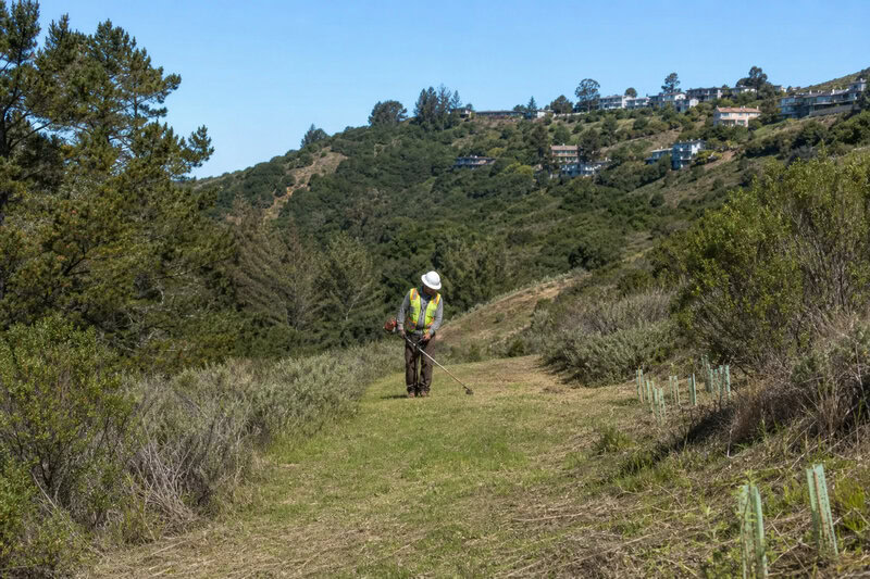
The Midpen project reflects a convergence of wildfire science, biodiversity policy, and community fire safety that represents the current best-practice framework for WUI management in coastal California. By combining fuel break ecology with wildlife corridor design in a single investment, it avoids the historical trap of treating fire risk and habitat conservation as mutually exclusive priorities. That integration is not incidental — it is the design, and it matters for long-term project viability because it broadens the base of stakeholder support and funding eligibility.
The model is potentially transferable. The WUI conditions that define San Mateo County’s coastal hills — fog-belt chaparral abutting suburban development on steep, complex terrain — are shared by dozens of communities across the Bay Area and Central Coast. The ecological logic that applies here applies in Marin County, in the East Bay hills, and in the Santa Cruz Mountains communities that burned in 2020. Site-specific adaptation would be required in each case, but the framework does not need to be invented from scratch.
The calibrated conclusion the evidence supports is this: managed open space is a meaningful, cost-effective layer of wildfire defense, particularly when integrated into broader regional fuel management networks. It is risk reduction, not risk elimination — a distinction that matters for honest public communication and for realistic fire preparedness planning at every level of government.
As California’s 2030 conservation and fire resilience targets converge, projects like Midpen’s 167-acre investment in San Mateo County offer a documented, ecology-grounded approach to making communities safer while protecting the native landscapes that define the region — not as a silver bullet, but as a serious, science-backed contribution to a problem that demands every available tool.