
A flood that once threatened a community every fifty years now arrives, on average, every three years. That is not a projection from a climate model — it is the measured consequence of clear-cut logging, according to a new study from the University of British Columbia that found clear-cutting can make catastrophic flood events up to 18 times more frequent, with effects that linger for more than 40 years after the last tree falls.
What the UBC Study Actually Found
Researchers at the University of British Columbia analyzed streamflow records across British Columbia watersheds, comparing flood frequency and magnitude in logged catchments against those with intact forest cover. The headline result is striking: clear-cut logging — the removal of virtually all trees from a given area in a single harvest, as opposed to selective or partial-cut methods that leave portions of the canopy standing — can compress a 50-year flood return interval down to roughly three years. That compression reframes industrial logging not merely as an ecological concern but as a measurable hydrological hazard.
Critically, the study found that large, rare flood events — the kind that reshape river channels, destroy roads and bridges, and cost lives — are the most dramatically amplified by clear-cutting. Smaller, more routine high-water events show comparatively modest changes. The risk amplification is concentrated precisely where it is most consequential.
Perhaps the most practically important nuance the research surfaces is that logging does not raise flood risk uniformly everywhere. Watershed geography, soil type, slope, and rainfall regime all determine whether a given forest is highly vulnerable or relatively resilient to the hydrological effects of harvest. That heterogeneity complicates blanket policy responses, but it also points toward something more useful: targeted, science-based protection of the watersheds where clear-cutting poses the greatest danger. As The Conversation explains in its coverage of the findings, the study illuminates a striking link between clear-cut logging and flood risk in British Columbia — one that policymakers have not yet fully absorbed.
British Columbia’s watersheds are not abstract geography. They supply drinking water to communities across the province, support Pacific salmon runs that underpin both ecology and Indigenous economies, and drain into populated valleys where floods carry real human costs. The stakes extend well beyond the timber industry’s balance sheet.
The Forest as a Flood-Control System
To understand why a chainsaw can function like a dam removal in reverse, it helps to examine the forest’s layered hydrological role. A mature forest intercepts rainfall on its canopy before it even touches the ground. What does reach the soil enters through a deep network of roots and passes through a thick layer of accumulated leaf litter, fungal mats, and decayed organic matter — a porous sponge that absorbs water and releases it slowly over time. The forest then returns a substantial portion of annual precipitation directly to the atmosphere through evapotranspiration, the combined process by which trees lose water through leaf surfaces and root uptake. In dense forests, evapotranspiration consumes enough precipitation that streams receive a meaningfully smaller and more gradual water supply than they would across bare ground.
When clear-cutting removes this layered system, the consequences are hydraulic and immediate. Rainfall that once took days or weeks to travel from hillside to river can arrive in hours. Logging machinery compacts the soil, destroying the pore structure that once absorbed surface runoff. Without canopy interception, the full force of a storm’s rainfall reaches the ground at once. Without evapotranspiration, annual soil moisture levels remain elevated, meaning soils are closer to saturation — and therefore closer to the point where they simply shed water rather than absorb it — when the next storm arrives. The result is the sharp, high-peaked flows that engineers and emergency managers define as dangerous floods.
Why the Biggest Floods Are Hit the Hardest
The relationship between logging and flood amplification is not linear — it is nonlinear in a way that concentrates risk at the extreme end of the spectrum. During an ordinary rainstorm, an intact forest absorbs, delays, and disperses enough water to keep peak flows within manageable bounds. During an extreme event — an atmospheric river or a prolonged multi-day storm — even healthy forests eventually saturate. Once soils are full, their buffering capacity largely disappears and water rushes directly to streams. Logged watersheds reach that saturation threshold far sooner, and with far less rainfall, than intact ones. The full pulse of a major storm therefore moves through a logged catchment largely unimpeded, producing flood peaks that a forested watershed would never generate from the same storm.
A useful analogy: removing a forest from a steep watershed before a major storm is roughly analogous to removing the shock absorbers from a vehicle before driving over a boulder field. The vehicle still moves, but every impact is transmitted directly and with full force. The more severe the terrain — or the storm — the more consequential the absent buffering becomes.
This physics carries a serious implication for infrastructure design and risk assessment. Flood-return-interval calculations used by engineers to size culverts and bridges, by insurers to set premiums, and by planners to zone floodplains are typically derived from historical streamflow records. Where those records predate large-scale logging in a watershed, they may systematically underestimate the flood risk that communities face today. A bridge designed to handle a 1-in-50-year flood may, in a heavily logged watershed, now be sized for what has effectively become a 1-in-3-year event.
The 40-Year Shadow: Why Recovery Takes Decades
The UBC study’s finding that the hydrological effects of clear-cutting can persist for more than 40 years is one of its most sobering contributions. A watershed logged today may still carry meaningfully elevated flood risk when children born this year reach middle age.
The biological explanation is straightforward. Young replanted forests take roughly 20 to 40 years to re-establish the deep root networks, canopy density, and soil structure needed to restore meaningful hydrological function. Some old-growth characteristics — particularly the coarse root channels that act as underground drainage conduits and the thick organic horizons that give forest soils their sponge-like quality — may require a century or more to fully rebuild. Replanting a clearcut with seedlings is not equivalent to restoring a forest’s flood-buffering capacity on any timescale relevant to current infrastructure or living communities.
The policy implication is direct. Commercial logging rotations in British Columbia and much of the Pacific Northwest typically run between 40 and 80 years. Where rotations fall at the shorter end of that range, some watersheds may be re-harvested before they have meaningfully recovered their pre-logging hydrological function. The result could be a compounding cycle: each successive harvest begins from an already-degraded baseline, potentially ratcheting flood risk upward across multiple logging generations. Analysis of the study’s implications for watershed management suggests this compounding dynamic has received insufficient attention in current regulatory frameworks.
It is worth being precise about what is established scientific consensus and what the UBC research newly contributes. The broad principle that deforestation increases peak streamflow is well-established across decades of forest hydrology literature — this is not a contested finding. What the UBC study advances is the precise quantification of risk amplification for rare, extreme events, the identification of which watershed characteristics govern vulnerability, and the duration over which elevated risk persists. Those specifics matter enormously for policy, even where the general direction of the effect was already understood.
Not All Forests React the Same Way
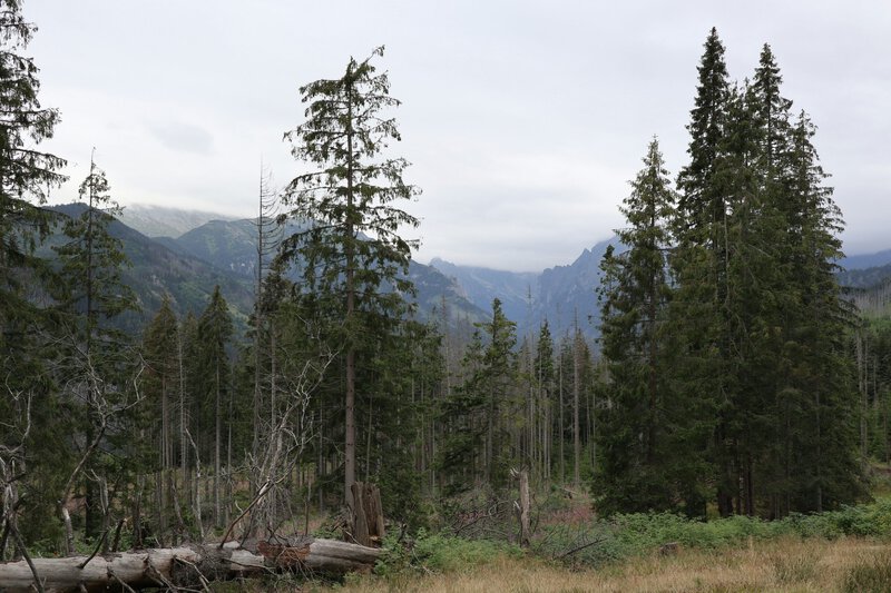
The finding that logging dramatically increases flooding in some watersheds while having little measurable effect in others is scientifically significant precisely because it resists simple generalization. It moves the conversation from a binary debate about whether logging causes flooding toward a more actionable question: which specific forests, if logged, pose unacceptable flood risk to downstream communities?
Factors that appear to amplify vulnerability include steep terrain, thin soils with limited water-storage capacity, high-rainfall climates, and proximity to rivers already running near flood stage during major storms. These conditions are widespread in coastal British Columbia but vary considerably across North America and globally. Yale Environment 360’s coverage of the research highlights this site-specificity as one of the study’s most practically useful dimensions for land managers and regulators.
That heterogeneity has a genuine upside. If science can map which watersheds carry the highest flood-amplification potential, regulators gain the ability to prioritize protection where the stakes are greatest rather than applying uniform rules that may be simultaneously over-restrictive in genuinely low-risk areas and dangerously permissive in high-risk ones. Risk-stratified watershed management — protecting the most vulnerable catchments while allowing carefully managed harvest elsewhere — becomes a scientifically defensible option in a way it was not before this kind of quantitative mapping existed.
One important caveat: the research is grounded in British Columbia watersheds. The underlying hydrological mechanisms are broadly applicable — water behaves the same way in Oregon, Scotland, or Borneo — but the specific magnitude of flood-risk increase may differ in drier climates, flatter landscapes, or forests with different species composition and soil types. Extending this research to other regions remains an active scientific need.
What the Findings Mean for Policy, Communities, and the Future
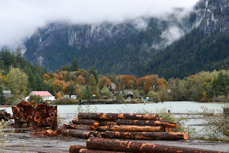
The UBC study arrives at a moment when climate change is already intensifying precipitation extremes across the Pacific Northwest and other forested regions globally. Atmospheric rivers are becoming more intense. Storm totals are rising. The flood-amplifying effect of clear-cutting is therefore likely to interact with a wetter, stormier baseline — a compounding risk that neither logging regulation nor municipal flood planning has yet fully incorporated. The 18-times figure, derived from current conditions, may itself understate future risk if precipitation extremes continue to intensify as projected.
For policymakers, the research strengthens the scientific case for several specific interventions: mandatory riparian buffer zones that shield the streams most sensitive to peak-flow changes; watershed-level cumulative-impact assessments before logging approvals, rather than parcel-by-parcel reviews that miss system-level effects; and the routine integration of forest-cover and logging-history data into the flood-risk modeling used by civil engineers, municipal planners, and building-code bodies. Discussion among scientists and informed observers following the study’s publication reflects a growing recognition that flood infrastructure and forest policy cannot continue to be designed in separate silos.
For communities and homeowners in forested river valleys, the research underscores the value of knowing the logging history of the watershed upstream. That information is often a matter of public record — held by provincial or state forestry agencies — but it is rarely consulted when families assess flood insurance needs or when municipalities update their emergency-response plans. The upstream logging status of a watershed is, according to this research, as relevant to a property’s flood exposure as its elevation above the mapped floodplain.
Forests have always been part of the flood-control infrastructure that human settlements depend on — silently, invisibly, and at no cost. The University of British Columbia study makes quantitatively clear that dismantling that infrastructure carries a measurable price, one counted not in board-feet of timber but in the frequency of disasters that communities once considered rare and must now treat as routine.