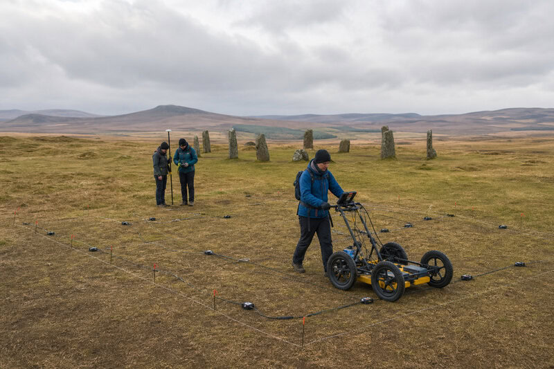
Archaeologists already knew that Machrie Moor on the Isle of Arran held six prehistoric stone circles — one of Scotland’s most celebrated concentrations of Neolithic and Bronze Age monuments. A geophysical survey carried out by Historic Environment Scotland (HES) has now detected a seventh, buried beneath the peat where no circle had ever been recorded, and it was found without lifting a single turf.
A Seventh Circle Hidden in Plain Sight
The discovery was led by HES archaeologist Dr Nick Hannon, whose team dragged geophysical sensors across the moorland surface and identified a circular anomaly consistent with a stone or timber monument. The feature had left no visible trace above ground — no upright stones, no earthwork, no crop mark — yet the instruments read its presence clearly in the substrate beneath the moor.
Heritage Daily reported the find as a buried ancient circle at Machrie Moor, and it reframes a site already considered one of Scotland’s most significant prehistoric ceremonial landscapes as a place whose full complexity is still being mapped. The six previously identified stone circles — formally catalogued as circles 1, 2, 3, 4, 5, and 11 — were used by Neolithic and Bronze Age farming communities for ritual and ceremonial purposes, a function inferred from excavated deposits including cremated human remains and deliberately placed artefacts recovered during earlier investigations.
The site also sits adjacent to the Arran cursus, a ceremonial enclosure roughly 1.1 kilometres long, whose scale underlines the landscape’s sustained importance as a gathering place across millennia. Earlier excavations of the known circles revealed that several had earlier phases of construction, indicating the site was repeatedly modified over long periods rather than built in a single moment. The hidden seventh feature makes that pattern of accumulated, overlapping activity still more complex.
What Geophysical Survey Actually Does
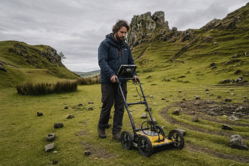
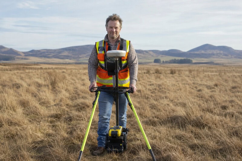
Ground-penetrating radar (GPR) works by emitting pulses of electromagnetic energy into the ground and recording the time it takes for signals to bounce back from subsurface features. Denser or wetter materials — such as stone or compacted soil — reflect electromagnetic energy differently from the surrounding matrix, creating a readable contrast that trained interpreters translate into a map of buried structures. The technique is entirely non-invasive: archaeologists gather structural data without excavating, preserving the site’s integrity throughout the process.
GPR is one component of a broader geophysical survey toolkit. HES archaeologists used it here alongside other remote-sensing methods to build a picture of the buried landscape beneath Machrie Moor. Because GPR identifies anomalies rather than confirmed objects, the team’s characterisation of the find as a possible stone or timber circle reflects appropriate scientific caution. Physical excavation would be required to confirm the monument’s material, internal structure, and precise date. Until that work is done, the feature remains a strong and carefully interpreted signal — visible enough to demand attention, complex enough to resist easy answers.
Why Peat Is Both the Problem and the Preservative
Machrie Moor’s waterlogged peat is the reason the buried circle survived at all. The anaerobic, acidic conditions that characterise deep peat slow organic decay dramatically, meaning timber uprights or postholes could retain their structure for thousands of years beneath the surface. Peat accumulation on Arran means the monument may have been buried progressively over centuries, rendering it invisible long before modern archaeologists arrived.
Yet the same peat that preserved the monument also concealed it. Surface survey methods — including aerial photography and lidar, which maps surface topography using laser pulses — could not detect a feature with no visible ground expression. This is a wider truth in Scottish prehistoric archaeology: the most complete picture of any site often lies below the visible record, accessible only through subsurface techniques like GPR. Machrie Moor is a clear demonstration of what those techniques can recover from landscapes previously considered well understood.
What the Buried Circle Might Be — and What Remains Unknown
HES archaeologists have characterised the buried feature as consistent with a stone or timber circle, but its precise form, dimensions, and construction material cannot be confirmed without excavation. The National reported that archaeologists describe the find as an ancient underground circle that may date to the Neolithic or Bronze Age — given its apparent association with the surrounding monument complex. Definitive dating will depend on radiocarbon analysis of organic material found in direct stratigraphic context during any future excavation.
Timber circles are known to precede or accompany stone circles at other Scottish prehistoric sites, raising the possibility that the buried feature represents an earlier construction phase later superseded by one of the standing monuments nearby. That interpretation remains speculative. Dr Hannon and the HES team have not publicly speculated on the circle’s specific function beyond the broader ceremonial context already established for the Machrie Moor landscape — a restraint that is scientifically appropriate given what the current evidence can and cannot support.
The Broader Significance for Scottish Prehistoric Archaeology
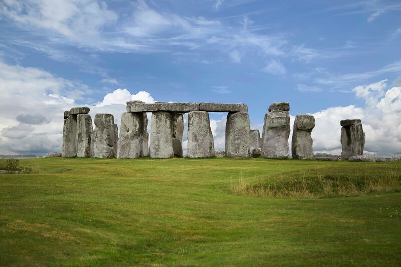
The Machrie Moor discovery is consistent with a pattern emerging from geophysical survey work at prehistoric monuments across Britain and Ireland. Landscapes once thought fully mapped have repeatedly yielded hidden features — the surroundings of Stonehenge being the most prominent example, where a major survey programme revealed buried shafts and other previously unknown monuments. The Herald Scotland noted that the new circle adds to growing evidence that Scotland’s prehistoric monument density is systematically underestimated.
For Scottish archaeology specifically, the find reinforces the case for expanding non-invasive survey programmes at known ceremonial sites. The cost of GPR survey is modest relative to the information it can recover, and the Machrie Moor result demonstrates that even intensively studied sites can conceal major monuments. Because the discovery was made by HES — the national body responsible for protecting Scotland’s historic environment — it carries direct implications for how the Machrie Moor scheduled monument is managed going forward. Any decision to investigate further must weigh the research value of excavation against the irreversible nature of digging into a preserved site, a balance that the scheduled monument consent process in Scotland is designed to negotiate.
What Happens Next
HES has not announced a confirmed timeline for follow-up excavation, and any invasive investigation of a scheduled monument in Scotland requires formal consent — a process designed to ensure that digging is justified by a clear research question and carried out to professional standards. Before any ground is broken, additional geophysical work, including targeted GPR transects and possibly magnetometry (which maps variations in soil magnetism caused by burning or disturbance), could refine the buried circle’s dimensions and internal structure, sharpening the questions that an eventual excavation would need to answer.
Radiocarbon dating of organic material retrieved during future excavation will be essential for placing the monument within Machrie Moor’s known sequence of construction and use. TFN described the new circle at Machrie Moor as a landmark moment for the site’s archaeological record — and whether the buried feature proves to be a timber precursor to one of the standing monuments, a contemporaneous structure that served a distinct ceremonial role, or something that fits neither category, the answers will matter beyond Arran. They will matter for understanding how prehistoric communities organised, shared, and modified ceremonial space across centuries.
Until excavation and analysis are complete, the seventh circle of Machrie Moor remains what the geophysical data made it: a strong, carefully interpreted signal from the deep past. Its existence is no longer in doubt. What it meant to the people who built it is the question that archaeology must now work patiently toward answering.