Home Environmental The Garlock Fault Line Is Finally Slipping (And Other Catastrophic Earthquakes in California)
Environmental By Trista -

If there is one thing that California is known for besides being the home of Hollywood, it’s earthquakes. Other states experience extreme weather phenomena like hurricanes and tornadoes, but Californians are most often subject to earthquakes. Most earthquakes in the Golden State are small and do not cause a lot of damage. As climate change continues to occur, the rate of serious earthquakes hitting California could absolutely increase.

Recently, a fault in the Mojave Desert called Garlock Fault began to slip after 500 years of no movement. If this fault continues to shift, California could experience numerous large, powerful earthquakes. In fact, in July of this year, Southern California was hit with its most massive quake in 20 years. This earthquake in Ridgecrest caused millions of dollars in damages and injured many people. To learn more about the growing risk of earthquakes in California as well as the most significant quakes in the history of the state, keep reading!

Earthquakes in California

The Garlock Fault Line Is Finally Slipping (And Other Catastrophic Earthquakes in California)
California is known for having many earthquakes. Photo Credit: Pixabay

California may not have a very long written history, but records of earthquakes date back pretty far. Researchers have found notes on earthquakes that affected the construction of various Spanish missions throughout the state in the late 18th century. When the missions were secularized in 1834, documentation on earthquakes vanished.
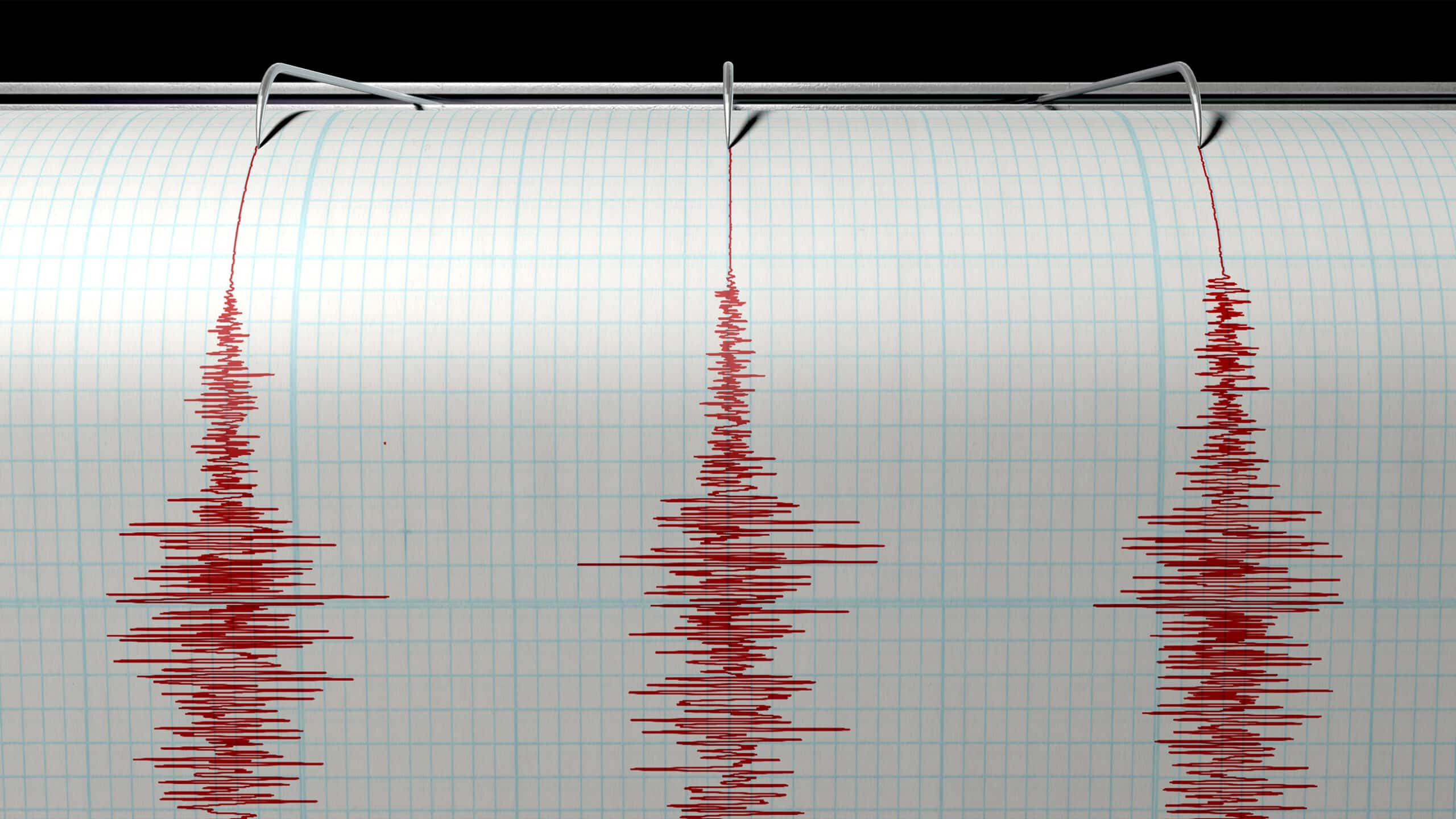
The Garlock Fault Line Is Finally Slipping (And Other Catastrophic Earthquakes in California)
A seismograph machine needle drawing a red line on graph paper depicting seismic and earthquake activity. Photo Credit: Inked Pixels/Shutterstock

It wasn’t until the California Gold Rush boom of the 1840s that more earthquake records were begun. Many ship captains and other explorers also made notes of earthquakes they experienced while on their voyages. From 1850 to about 2004, there was an average of one pretty damaging seismic event each year.

Early Earthquakes

The Garlock Fault Line Is Finally Slipping (And Other Catastrophic Earthquakes in California)
Earthquakes have been documented in California since the state began taking records. Photo Credit: Pixabay

Spanish explorers and Catholic missionaries from the Portola expedition documented the earliest known earthquake in 1769. They felt it during their travels north from San Diego to Los Angeles along the Santa Ana River. Most of the damaging earthquakes that had been documented up until then occurred on the East Coast and in the American Midwest.

The Garlock Fault Line Is Finally Slipping (And Other Catastrophic Earthquakes in California)
Building damaged in Hayward California by Hayward earthquake 1868. Photo Credit: Wikipedia

Around the turn of the 19th century, settlers discovered that the hazards of earthquakes were much more serious on the West Coast. Several earthquakes, like the 1812 San Juan Capistrano, 1857 Fort Tejon, and 1872 Lone Pine quakes, destroyed areas that were not very populated. It wasn’t until the 1868 Hayward earthquake that people realized how dangerous earthquakes were. We’ll cover more on that quake a little later.

Charles Richter

The Garlock Fault Line Is Finally Slipping (And Other Catastrophic Earthquakes in California)
Seismologist Charles Richter developed the Richter scale. Photo Credit: Pixabay

Charles Richter was a physicist and seismologist who famously created the Richter magnitude scale. Until the moment magnitude scale was developed in 1979, the Richter scale was the primary method for sizing earthquakes. Richter first used the Richter scale in 1935.

The Garlock Fault Line Is Finally Slipping (And Other Catastrophic Earthquakes in California)
Charles Richter. Photo Credit: Wikipedia

According to Richter, it wasn’t until the devastating earthquake in 1906 in San Francisco that the United States government finally acknowledged the gravity of earthquakes. Before that, there was no agency established in the country to focus on research on earthquake activity. In 1910, seismologists developed California’s first earthquake monitoring program at the University of California, Berkeley.

Caltech Lab 

The Garlock Fault Line Is Finally Slipping (And Other Catastrophic Earthquakes in California)
The Caltech lab houses an earthquake observation network. Photo Credit: Pixabay

In addition to the work that was done at the University of California, Berkeley to monitor earthquake activity, other schools joined in. The California Institute of Technology, also known as Caltech, developed several vital tools for seismology. Located in Pasadena, California, this school is well known for its strengths in engineering and natural science.

The Garlock Fault Line Is Finally Slipping (And Other Catastrophic Earthquakes in California)
Beckman Institute for research in the chemical and biological sciences on California Institute of Technology (Caltech) Campus. Photo Credit: afrimu/Shutterstock

Researchers at Caltech constructed an earthquake observation center. They custom-built their own short-period seismometers, an updated version of the Mercalli intensity scale, and the Richter magnitude scale. This is in part thanks to Charles Richter, an alumnus of the California Institute of Technology.

Policy Changes

The Garlock Fault Line Is Finally Slipping (And Other Catastrophic Earthquakes in California)
Earthquakes have led to changes in building policies and codes. Photo Credit: Pixabay

When an earthquake occurred in Long Beach, California, in 1933, it damaged and destroyed many buildings and public schools in the Long Beach and Los Angeles areas. Another earthquake that struck several decades later in the San Fernando Valley caused much structural damage to hospitals. All of this destruction in densely populated areas caused a lot of concern.

The Garlock Fault Line Is Finally Slipping (And Other Catastrophic Earthquakes in California)
Hayes Valley Construction. Photo Credit: Flickr

Because of these incidents, Californians involved in policymaking worked hard to change state laws. They aimed to make building codes require residential and commercial structures to be strong enough to withstand earthquakes. Buildings like schools, fire stations, and hospitals are held to a higher standard. Additionally, the construction of living spaces is banned near active faults.

Tectonic Setting

The Garlock Fault Line Is Finally Slipping (And Other Catastrophic Earthquakes in California)
California’s tectonic setting is unique. Photo Credit: Pixabay

In the last 66 million years, North America’s West Coast has been dominated by a subduction zone. That means that the edge of a tectonic plate of the Earth’s crust moves downward and sideways into the mantle of a plate beneath it. On the West Coast, the Farallon tectonic plate subducts beneath the North American tectonic plate.

The Garlock Fault Line Is Finally Slipping (And Other Catastrophic Earthquakes in California)
Earthquake damaged road in Hawaii Volcanoes National Park from eruption. Photo Credit: Button Push/Shutterstock

Part of the margin that’s left from this process in California is the San Andreas Fault. This fault is a strike-slip, which means that its surface is vertical, and the footwall moves right or left laterally with little to no vertical movement. Other areas of the plate margin include the Pacific-North American plate boundary in the Basin and Range Province of eastern California and Western Nevada. This range also extends south into the California Continental Borderland area.

Los Angeles Basin

The Garlock Fault Line Is Finally Slipping (And Other Catastrophic Earthquakes in California)
The Los Angeles Basin has an unusual tectonic setting. Photo Credit: Pixabay

The Los Angeles Basin is located in a region called the Peninsular Ranges, which are in Southern California. This basin connects to a unique collection of mountain chains known as the California Transverse Ranges, which trend east to west. It is a coastal lowland region that has a floor with long, low ridges and small hill groupings by the edge of the Pacific plate.

The Garlock Fault Line Is Finally Slipping (And Other Catastrophic Earthquakes in California)
Los Angeles Basin from the Landsat satellite using NASA’s SRTM satellite. Photo Credit: Wikimedia Commons

Tectonically, the Los Angeles Basin is still very active. For that reason, the area experiences earthquakes. Because there are numerous faults and fault splays in the region, there is not one single area that is hit with seismic activity. Most of the earthquakes that hit this area are mild, hitting less than a 2.25 magnitude.

Mendocino Fracture Zone

The Garlock Fault Line Is Finally Slipping (And Other Catastrophic Earthquakes in California)
The energy around the Mendocino Fracture Zone has impacted tsunamis. Photo Credit: Pixabay

The Mendocino Fracture Zone is quite a significant boundary that stretches more than 2,500 miles. It begins off the coast of Cape Mendocino and runs far up northern California. This zone runs west from the famed San Andreas Fault along with the Cascadia subduction zone toward the south end of the Gorda Ridge.

The Garlock Fault Line Is Finally Slipping (And Other Catastrophic Earthquakes in California)
Mendocino fracture zone map. Photo Credit: Wikipedia

Although a fracture zone is typically not a transform fault, the term is loosely used to refer to the area of active faults east of the Gorda Ridge, which is located off the northern coast of California. Those that study tsunamis have noted that the energy surrounding the Mendocino Fracture Zone has led to higher wave heights, especially in the Crescent City region.

Salton Trough

The Garlock Fault Line Is Finally Slipping (And Other Catastrophic Earthquakes in California)
The Salton Trough is located in Southern California. Photo Credit: Pixabay

The Salton Trough is a large tectonic pull-apart basin in southern California. It reaches several counties, including Imperial County, Riverside County, and San Diego County. This trough was formed because of the Earth’s crust stretching out and sinking.

The Garlock Fault Line Is Finally Slipping (And Other Catastrophic Earthquakes in California)
Two people on the shore of the Salton Sea Lake in California. Photo Credit: Public Domain Pictures

The San Andreas Fault and the East Pacific Rise are primarily responsible for the formation of the Salton Trough. At the bottom of the Salton Trough lies the Salton Sink and it’s topographically the lowest point in the area. This trough connects to the San Andreas Fault via the southeast part of the basin. Tectonic activity in the area leads to the Salton Trough frequently experiencing migrating earthquake swarms.

San Francisco Bay Area

The Garlock Fault Line Is Finally Slipping (And Other Catastrophic Earthquakes in California)
The notable San Andreas Fault is in the Bay Area. Photo Credit: Pixabay

The San Andreas Fault is the most well-known system of faults in the San Francisco Bay Area. It travels offshore and extends into the East Bay Area. Most of the faults lie east of the primary San Andreas Fault location. Experts believe that by 2030, there is a 70 percent chance that a 6.7 magnitude or greater earthquake will occur in this area of California.

The Garlock Fault Line Is Finally Slipping (And Other Catastrophic Earthquakes in California)
Cityscape view of San Francisco and the Bay Bridge with Colorful Sunset from island, California, USA. Photo Credit: anek.soowannaphoom/Shutterstock

The Hayward Fault Zone is especially at risk because it has gone two decades past its return period. The average return period for an earthquake is 130 years. 2018 marked 150 years since the devastating 1868 Hayward Earthquake.

San Andreas Fault

The Garlock Fault Line Is Finally Slipping (And Other Catastrophic Earthquakes in California)
The San Andreas Fault is known as a continental transform fault. Photo Credit: Pixabay

We’ve mentioned it before, but the San An dreas Fault is one of the main areas in California that’s hit by earthquakes. It’s known as a continental transform fault and extends more than 750 miles through the state of California. The fault is divided into three segments. Each segment has different features as well as different degrees of earthquake risks.

The Garlock Fault Line Is Finally Slipping (And Other Catastrophic Earthquakes in California)
The San Andreas fault line reason for so many earthquakes is good visibly in the dried-out plains desert. Photo Credit: oliverdelahaye/Shutterstock

Many of the most notable earthquakes in history occurred in the San Andreas Fault region. They include the 1857 Fort Tejon earthquake, the infamous 1906 San Francisco earthquake and the 1989 Loma Prieta earthquake. Experts believe that in the next 30 years, the San Andreas Fault has a 7 percent chance of having an earthquake that measures more than a magnitude of 8.0.

Fault Zones

The Garlock Fault Line Is Finally Slipping (And Other Catastrophic Earthquakes in California)
San Andreas fault zones lie in northern, central, and southern California. Photo Credit: Pixabay

As we mentioned before, the San Andreas Fault is divided into three segments. The northern portion of the fault begins in Hollister, California, and moves through the Santa Cruz Mountains, which is where the 1989 Loma Prieta earthquake hit. It then taps out offshore near Daly City.

The Garlock Fault Line Is Finally Slipping (And Other Catastrophic Earthquakes in California)
The top deck of the Nimitz Freeway collapsed down onto the lower deck by the 1989 Loma Prieta earthquake. Photo Credit: Wikipedia

The San Andreas Fault’s central segment moves in a northwestern direction from Parkfield, California, to Hollister. This area does experience earthquakes, but most of the time, the fault will continuously slip without any shocks. The fault’s southern portion, better known as the Mojave segment, starts around Bombay Beach. It moves along the San Bernardino Mountains’ southern base and continues along the San Gabriel Mountains’ northern base.

Garlock Fault

The Garlock Fault Line Is Finally Slipping (And Other Catastrophic Earthquakes in California)
The Garlock Fault has been still for five centuries. Photo Credit: Pixabay

Researchers have their eye on the Garlock Fault because of some recent seismic activity. The Garlock Fault is a left-lateral, strike-slip fault that runs along the northernmost margins of southern California’s Mojave Desert. Most of this fault’s length stretches alongside the Tehachapi Mountains.

The Garlock Fault Line Is Finally Slipping (And Other Catastrophic Earthquakes in California)
A USGS Earthquake Science Center Mobile Laser Scanning truck scans the surface rupture near the zone of maximum surface displacement of the magnitude 7.1 earthquake that struck the Ridgecrest area. Credit: USGS/NASA

Having a left-lateral slip makes the Garlock Fault different from almost all of the other faults. This notion is because the area that lies on the opposite side of the vault moves to the left of the view facing it. In turn, the region that is north of the Garlock Fault moves west while the southern terrain moves east.

Geography

The Garlock Fault Line Is Finally Slipping (And Other Catastrophic Earthquakes in California)
This fault runs from a junction connected to the San Andreas Fault. Photo Credit: Pixabay

This fault got its name from a mining town called Garlock, which is now considered to be a ghost town. The Garlock Fault is the second-longest fault in the Golden State after the San Andreas Fault. It stretches over 160 miles. This fault is known for being one of Southern California’s most prominent geological features.

The Garlock Fault Line Is Finally Slipping (And Other Catastrophic Earthquakes in California)
An abandoned building in Garlock, CA. Photo Credit: Jonathan Percy/Shutterstock

The Garlock Fault is the marker for the northern boundary of the Mojave Block, the southern ends of the Sierra Nevada, and the westernmost Basin and Range province valleys. This fault moves from a San Andreas Fault junction near California’s Antelope Valley toward the Death Valley Fault Zone to its east. The areas surrounding the Garlock Fault are relatively uninhabited.

Activity

The Garlock Fault Line Is Finally Slipping (And Other Catastrophic Earthquakes in California)
The movement has been detected this year from the Garlock Fault. Photo Credit: Pixabay

Typically, the Garlock Fault moves between 2 and 11 millimeters each year and tends to slip roughly 7 millimeters. Because of that, researchers do not consider the Garlock Fault to be particularly active as it rarely generates seismic activity that humans can detect. They believe the last ruptures of note in the Garlock Fault occurred in the years 1050 AD and 1500 AD.

The Garlock Fault Line Is Finally Slipping (And Other Catastrophic Earthquakes in California)
Surface rupture associated with a 6.4 MW earthquake on July 4, 2019, near Ridgecrest, California. Photo Credit: Wikipedia

Seismologists are concerned because, for the first time in 500 years, the Garlock Fault has moved. After the massive earthquake in Ridgecrest in the summer of 2019, a movement was triggered along the Garlock Fault. Since that time, this fault has slipped nearly 1 inch at its surface. This figure indicates that the Garlock Fault could potentially erupt with an 8.0 magnitude earthquake in the future.

Biggest Earthquakes in California History

The Garlock Fault Line Is Finally Slipping (And Other Catastrophic Earthquakes in California)
The most powerful earthquake in California’s history occurred at Fort Tejon. Photo Credit: Pixabay

California, located along the infamous Pacific Ring of Fire, has a long history of devastating earthquakes due to its position atop major fault lines, including the San Andreas Fault. Over the centuries, the state has experienced numerous seismic events, some of which have reshaped its landscape and urban development. From the catastrophic 1906 San Francisco earthquake to the more recent 1994 Northridge quake, these powerful tremors serve as reminders of California’s ongoing vulnerability to seismic activity.

Fort Tejon Earthquake

The Garlock Fault Line Is Finally Slipping (And Other Catastrophic Earthquakes in California)
Fort Tejon After Earthquake in 1857. Photo Credit: Wikimedia Commons

This earthquake occurred on January 9, 1857, and has remained the most massive earthquake in the history of California. It was centered in Parkfield, California, roughly 45 miles northeast of San Luis Obispo. Experts estimate the earthquake’s magnitude ranged from 7.9 to 8.3.

The Fort Tejon Earthquake took place along California’s San Andreas Fault. It was so powerful that land on the Carrizo Plain was displaced by 9 meters, which equates to about 30 feet. This earthquake caused heavy, strong shaking for one to three minutes. Records show that a lot of property was damaged due to the quake, and two people lost their lives.

San Francisco Earthquake

The Garlock Fault Line Is Finally Slipping (And Other Catastrophic Earthquakes in California)
Over 700 people died during the San Francisco earthquake. Photo Credit: Pixabay

To date, the San Francisco Earthquake has been the deadliest quake in California’s history. It happened on April 18, 1906, and caused 700 deaths. Experts believe that potentially hundreds more people could have perished due to the 7.9 magnitude earthquake.

The Garlock Fault Line Is Finally Slipping (And Other Catastrophic Earthquakes in California)
Ruins in vicinity of Post and Grant Avenue after San Francisco Earthquake of 1906. Photo Credit: Wikipedia

This earthquake was centered roughly 296 miles off the San Andreas Fault. It shook powerfully for between 45 and 60 seconds. It was so strong that people in southern Oregon, Nevada, and even south of Los Angeles experienced rumbling. In the short time that the earthquake shook, not only were hundreds of lives lost, but more than $400 million in damages occurred.

Lone Pine Earthquake

The Garlock Fault Line Is Finally Slipping (And Other Catastrophic Earthquakes in California)
The Lone Pine quake was so massive that it shook nearly the entire state. Photo Credit: Lane V. Erickson/Shutterstock

The United States Geological Survey names the Lone Pine Earthquake as one of three that caused shaking across the entire state of California. It struck Lone Pine, California, which is located in Owens Valley and had a magnitude of 7.8. Twenty-seven people were killed because of this quake.

The Garlock Fault Line Is Finally Slipping (And Other Catastrophic Earthquakes in California)
Lone Pine fault scarp of 1872 Owens Valley earthquake. Photo Credit: Wikipedia

Reports show that the Lone Pine Earthquake was strong enough to stop clocks as well as wake people up as far away as San Diego. This powerful earthquake caused a surface rupture that spanned 90 to 100 kilometers, or 62 miles. In addition to 27 people dying, 57 were injured. Also, Lone Pine experienced $250,000 in property damage.

Kern County Earthquake

The Garlock Fault Line Is Finally Slipping (And Other Catastrophic Earthquakes in California)
This earthquake is also known as one of the United States’ most significant quakes. Photo Credit: Pixabay

The Kern County Earthquake had a magnitude of 7.3 and struck on July 21, 1952. It hit near Bakersfield and Grapevine, California, located in Kern County. This quake caused 12 fatalities and at the time, was the largest earthquake to hit California since the San Francisco Earthquake of 1906.

The Garlock Fault Line Is Finally Slipping (And Other Catastrophic Earthquakes in California)
A collapsed school was damaged by the 1952 Kern County earthquake. Photo Credit: Wikipedia

In Bealville, California, reinforced concrete railroad tunnels cracked open, and the rails bent into S shapes. Salt beds located in Owens Lake roughly 100 miles away shifted. People as far away as Reno, Nevada, San Francisco, and San Diego felt shaking from the quake. It caused more than $60 million in damages, which in today’s dollars equals over $575 million.

1922 Offshore Northern California Earthquake

The Garlock Fault Line Is Finally Slipping (And Other Catastrophic Earthquakes in California)
Luckily the fatality count for this earthquake was zero. Photo Credit: Pixabay

Thankfully the Offshore Northern California Earthquake of 1922 happened away from civilization, so the effects were limited. It occurred 37 miles west of Eureka offshore on January 31, 1922. It helped that Eureka, California was far less populated than it is today.

The Garlock Fault Line Is Finally Slipping (And Other Catastrophic Earthquakes in California)
California Coastline Beach near Eureka, California. Photo Credit: LindaPerez/Shutterstock

For this area of California, the Offshore Northern California Earthquake is the strongest in recorded history. It had a magnitude of 7.6 and led to many landslides, as well as a small tsunami. Many homes had their chimneys fall off and break because of the shocks. Several ships at sea felt changes in the ocean’s waves due to the 1922 Offshore Northern California Earthquake.

Landers Earthquake

The Garlock Fault Line Is Finally Slipping (And Other Catastrophic Earthquakes in California)
The Landers Earthquake was the biggest quake in the area for decades. Photo Credit: Pixabay

On June 28, 1992, the Landers earthquake hit Southern California. This 7.3 magnitude quake was the largest to hit the area in 40 years. It caused five distinct faults to rupture in an area of more than 53 miles.

The Garlock Fault Line Is Finally Slipping (And Other Catastrophic Earthquakes in California)
Single rupture surface in the fault zone of 1992 Landers Earthquake. Photo Credit: Portland State University

Because of the Landers earthquake, faults slipped up to 18 feet. This shock was based in the Mojave Desert, roughly 120 miles outside of Los Angeles. Although the property damage was minimal compared to the size of the earthquake, it injured more than 400 people and caused three people to lose their lives. The destruction cost more than $92 million, which is over $168 million in today’s dollars.

Santa Barbara Earthquake

The Garlock Fault Line Is Finally Slipping (And Other Catastrophic Earthquakes in California)
The Santa Barbara Earthquake was based in the Pacific Ocean. Photo Credit: Pixabay

On December 21, 1812, a large 7.5 magnitude earthquake hit the ocean off the coast of Ventura and Santa Barbara, California. This quake came just two short weeks after a tremendous shock in San Juan Capistrano, California, which we’ll talk about later. There are not many records about this quake itself, but there is a lot of evidence of the damage it caused.

The Garlock Fault Line Is Finally Slipping (And Other Catastrophic Earthquakes in California)
Ruins of Mission La Purisima Concepcion. Photo Credit: Wikipedia

The Santa Barbara earthquake of 1812 completely destroyed the Mission in Santa Barbara. This quake also demolishes the Mission La Purisima Concepcion in the area that is now known as Lompoc, California. A Spanish ship that was sailing 38 miles offshore got damaged in part because of a tsunami caused by the earthquake.

Lompoc Earthquake

The Garlock Fault Line Is Finally Slipping (And Other Catastrophic Earthquakes in California)
Because of a low population density, the Lompoc Earthquake did not cause any deaths. Photo Credit: Pixabay

A 7.1 magnitude earthquake hit Lompoc, California, on November 4, 1927. This quake is on record as being one of the most powerful earthquakes to hit Southern California in the 20th century. Because this area of California had a small population density at the time, no one was seriously injured or killed in the Lompoc earthquake.

The Garlock Fault Line Is Finally Slipping (And Other Catastrophic Earthquakes in California)
Jalama Beach in Lompoc, California. Photo Credit: Scenic Corner/Shutterstock

It also helped that the epicenter of the Lompoc earthquake was located 10 miles offshore. In the nearby town of Surf, California, there were reports of people feeling the shocks. This earthquake also caused a 2-meter tsunami in the area, leading to the deaths of many fish.

Humboldt Earthquake

The Garlock Fault Line Is Finally Slipping (And Other Catastrophic Earthquakes in California)
Luckily the area that this earthquake hit was relatively uninhabited, so no one was hurt. Photo Credit: Pixabay

On January 22, 1923, the northwestern coast of California was hit by a strong 7.2 magnitude earthquake. At the time, Humboldt County was populated by very few people, just as it is today. When the large Humboldt earthquake hit the area, there were no injuries or fatalities.

The Garlock Fault Line Is Finally Slipping (And Other Catastrophic Earthquakes in California)
Aerial view of jetties, constructed of dolosse, at Humboldt Bay harbor entrance. Photo Credit: Wikipedia

This earthquake did cause some property damage. There were reports of homes in several towns in the area being hit and experiencing damage. The Humboldt earthquake also triggered a tsunami offshore. Additionally, people as far away as Reno, Nevada said they felt strong shaking. Now that’s a pretty strong earthquake!

El Centro Earthquake

The Garlock Fault Line Is Finally Slipping (And Other Catastrophic Earthquakes in California)
The El Centro Earthquake is the strongest quake to hit California’s Imperial Valley. Photo Credit: Pixabay

The El Centro earthquake hit California’s Imperial Valley on May 19, 1940. This quake had a 7.1 magnitude and is known for being the strongest earthquake in the Imperial Valley’s history. More than 20 people were injured, and nine people lost their lives because of this massive earthquake.

The Garlock Fault Line Is Finally Slipping (And Other Catastrophic Earthquakes in California)
Aerial View of Downtown El Centro, California in the Imperial Valley. Photo Credit: Jacob Boomsma/Shutterstock

Even though the epicenter of the shock was located more than 4 hours away, people in Los Angeles reported that buildings were swaying. The effects of the El Centro earthquake were even felt in Tucson, Arizona! It significantly damaged irrigation systems far and wide, especially across the border with Mexico. In today’s dollars, more than $600 million worth of damages were caused by the El Centro earthquake.

Eureka Earthquake

The Garlock Fault Line Is Finally Slipping (And Other Catastrophic Earthquakes in California)
The Eureka Earthquake was another powerful quake that occurred offshore. Photo Credit: Pixabay

Off the coast of Northern California on November 8, 1980, a powerful earthquake hit. The Eureka earthquake had a magnitude of 7.3 and was strong enough to kill five people and injured six others. On the other hand, the property damage was minimal.

The Garlock Fault Line Is Finally Slipping (And Other Catastrophic Earthquakes in California)
Eureka Harbor. Photo Credit: Pixabay

This quake is also referred to as the Gorda Basin earthquake because of where it was centered. The shaking was intense and lasted between 15 and 30 seconds. People could feel this earthquake from San Francisco, California, all the way up to Salem, Oregon. In 1980, the destruction caused $2.8 million worth of damages. In today’s dollars, that equals more than $8.2 million.

Hector Mine Earthquake

The Garlock Fault Line Is Finally Slipping (And Other Catastrophic Earthquakes in California)
The Hector Mine Earthquake hit a Marine Corps base. Photo Credit: Pixabay

On October 16, 1999, a powerful 7.1 magnitude earthquake hit Twentynine Palms, California. This quake shook a remote area of the Mojave Desert where the Marine Corps Air Ground Combat Center is located. It was named after the Hector Mine quarry, which is about 14 miles northwest of the epicenter of the earthquake.

The Garlock Fault Line Is Finally Slipping (And Other Catastrophic Earthquakes in California)
Surface Rupture of the 1999 M7.1 Hector Mine Earthquake. Photo Credit: USGS

The shock of the earthquake was felt throughout Southern California and also felt by people as far away as Nevada. Because the Hector Mine earthquake struck in a very remote area, only four people were injured. Experts believe that the Landers earthquake we mentioned earlier could have triggered the Hector Mine earthquake.

2005 Offshore Northern California Earthquake

The Garlock Fault Line Is Finally Slipping (And Other Catastrophic Earthquakes in California)
The 2005 Offshore Northern California Earthquake hit off the coast of Crescent City, California. Photo Credit: Pixabay

It seems like many of the strongest earthquakes to hit the state of California happen offshore. The 2005 Offshore Northern California earthquake is no exception. This quake struck roughly 90 miles west of Crescent City, California, which is about 20 miles south of the Oregon border.

The Garlock Fault Line Is Finally Slipping (And Other Catastrophic Earthquakes in California)
Rocky coastline of Northern California. Photo Credit: Aimee Lee Studios/Shutterstock

The 7.2 magnitude 2005 Offshore Northern California earthquake was far enough out to see that there were no injuries or fatalities reported. Additionally, it was far enough away that there was virtually no property damage. Some people on the southern Oregon coastline down to northern California felt light shaking.

Ridgecrest Earthquake

The Garlock Fault Line Is Finally Slipping (And Other Catastrophic Earthquakes in California)
The most recent major earthquake to hit California is the Ridgecrest Earthquake. Photo Credit: Pixabay

On July 5, 2019, a massive 7.1 magnitude earthquake hit Ridgecrest, California, which is located in Kern County. This quake came just one day after a 6.4 magnitude earthquake hit the area the day before. Even though the shock was strong, there was very little damage to buildings in the town.

The Garlock Fault Line Is Finally Slipping (And Other Catastrophic Earthquakes in California)
Highway CA-178, road fractured. A 6.4 magnitude earthquake struck the Ridgecrest area, the next day a 7.1 hit the same area. Photo Credit: Nick Sklias/Shutterstock

Some people reported that their mobile homes were moved off their foundations. Also, several fires and gas leaks occurred as well as power outages. The economic loss caused by damages from the Ridgecrest earthquake totaled $10 million, and experts believe there is a 30 percent chance that damages could eventually exceed $100 million. This quake was the largest to hit Southern California in nearly 20 years. 

1934 Imperial Valley Earthquake

The Garlock Fault Line Is Finally Slipping (And Other Catastrophic Earthquakes in California)
The Imperial Valley has experienced quite a few earthquakes. Photo Credit: Pixabay

Before the El Centro earthquake in 1940, the Imperial Valley was hit by a 7.1 magnitude quake on December 31, 1934. What a way to ring in the new year! The Imperial Valley earthquake at the time was one of the very few California earthquakes to hit a magnitude of more than 7.

The Garlock Fault Line Is Finally Slipping (And Other Catastrophic Earthquakes in California)
Cerro Prieto Fault. Photo Credit: Wikipedia

This earthquake ruptured the Cerro Prieto Fault, a transform fault located in the northernmost part of Baja California. The fault experienced several meters of surface slip. Since the Imperial Valley earthquake happened in a sparsely populated area, no injuries or fatalities were reported. Just a few buildings were shaken up.

Petrolia Earthquake

The Garlock Fault Line Is Finally Slipping (And Other Catastrophic Earthquakes in California)
In 1992, Humboldt County was once again hit by an earthquake. Photo Credit: Pixabay

The Petrolia earthquake hit Humboldt County on April 25, 1992. The towns of Petrolia and Ferndale, California, were hit the hardest by this massive 7.1 earthquake. Nearly 100 people were injured, and hundreds of homes were damaged.

The Garlock Fault Line Is Finally Slipping (And Other Catastrophic Earthquakes in California)
Humoboldt County NV. Photo Credit: Pixabay

Luckily, no one was killed during the Petrolia earthquake. This is fortunate because although the area is not densely populated, it’s a popular tourist attraction, so there are a lot of people in the area. The town’s first post office, 100-year-old general store, and a gas station burned down to the ground. In 1992, the damages from the Petrolia earthquake cost about $7.5 million. In today’s terms, that equals nearly $14 million.

San Andreas Earthquake

The Garlock Fault Line Is Finally Slipping (And Other Catastrophic Earthquakes in California)
The San Andreas Earthquake is one of the earliest known quakes to hit California. Photo Credit: Pixabay

One of the earliest earthquakes on record in California is the San Andreas earthquake. Not many records are available of this earthquake, but experts believe it was centered on the San Andreas Fault. It was quite powerful and had a magnitude of 7.

The Garlock Fault Line Is Finally Slipping (And Other Catastrophic Earthquakes in California)
San Andreas Earthquake. Photo Credit: Pixabay

It’s estimated that the San Andreas earthquake was felt from San Juan Bautista to San Francisco, California, which is approximately 91.8 miles. This quake ended up rupturing an area of the San Andreas Fault that stretched between 48 and 62 miles. It hit the area in June 1838 and caused no injuries or fatalities.

Mendocino Fault Earthquake

The Garlock Fault Line Is Finally Slipping (And Other Catastrophic Earthquakes in California)
The Mendocino Fault Earthquake is another one that was centered in the Pacific Ocean. Photo Credit: Pixabay

On September 1, 1994, a massive earthquake hit the Pacific Ocean, roughly 85 miles west of Cape Mendocino. Cape Mendocino is a very wooded area that has a tiny population. The Mendocino Fault earthquake was the most massive quake to hit the continental United States in 1994.

The Garlock Fault Line Is Finally Slipping (And Other Catastrophic Earthquakes in California)
California‘s rugged Mendocino Coast. Photo Credit: Ethan Daniels/Shutterstock

Although it was a seven magnitude earthquake, the Mendocino Fault earthquake caused very little damage because it happened offshore. Luckily, no one was hurt or killed during this earthquake. It was, however, powerful enough to be felt across more than 50,000 square miles. People from southwestern Oregon, all the way to the San Francisco Bay Area, felt the rumbling. It also caused a 5.5-inch tsunami

San Juan Capistrano Earthquake

The Garlock Fault Line Is Finally Slipping (And Other Catastrophic Earthquakes in California)
The San Juan Capistrano Earthquake caused a lot of trouble. Photo Credit: Pixabay

The San Juan Capistrano earthquake hit southern California on December 8, 1812. Experts also refer to it as the Wrightwood earthquake. It is not known where exactly the earthquake occurred or how large it actually was. Records indicate that the San Juan Capistrano earthquake had a magnitude of 6.9.

The Garlock Fault Line Is Finally Slipping (And Other Catastrophic Earthquakes in California)
Photograph of Mission San Juan Capistrano, showing ruined altar of stone church, California, ca.1900. Photo Credit: Wikimedia Commons

It is estimated that the San Juan Capistrano earthquake originated in the San Andreas Fault around its Mojave segment. This quake caused a lot of damage and heartbreak. 40 Native Americans who were attending a mass service at the Mission in San Juan Capistrano lost their lives when the earthquake caused the roof and mortar walls of the church to collapse. 

1979 Imperial Valley Earthquake

The Garlock Fault Line Is Finally Slipping (And Other Catastrophic Earthquakes in California)
The 1979 Imperial Valley Earthquake caused millions of dollars of destruction. Photo Credit: Pixabay

On October 15, 1979, a large 6.6 magnitude earthquake hit the Imperial Valley. At the time, the 1979 Imperial Valley earthquake was California’s largest earthquake in the last quarter-century. Tons of property damage occurred, and nearly 100 people were injured. Luckily, no one was killed because of the 1979 Imperial Valley earthquake.

The Garlock Fault Line Is Finally Slipping (And Other Catastrophic Earthquakes in California)
1979 Imperial Valley earthquake damaged the Imperial County Services Building. Photo Credit: Wikimedia Commons

The area that was hit by this earthquake is a majorly agricultural region and sits on the border from California to Mexico. This quake was actually helpful for researchers as the Imperial County Services Building located in El Centro, California, had been outfitted with several earthquake sensors. In today’s dollars, more than $102 million worth of property damage was caused by the 1979 Imperial Valley earthquake.

Loma Prieta Earthquake

The Garlock Fault Line Is Finally Slipping (And Other Catastrophic Earthquakes in California)
The Loma Prieta Earthquake is one of California’s most infamous quakes. Photo Credit: Pixabay

On October 17, 1989, a massive earthquake hit near Loma Prieta Peak in the Santa Cruz Mountains. It caused billions of dollars worth of damage to the Oakland and San Francisco, California areas. It’s commonly known as the World Series earthquake because it happened during the beginning of a World Series baseball game at Candlestick Park.

The Garlock Fault Line Is Finally Slipping (And Other Catastrophic Earthquakes in California)
A building in the Marina District at Beach and Divisadero settled onto its buckled garage supports. Photo Credit: Wikipedia

In just 15 seconds, the Loma Prieta earthquake destroyed the Nimitz Freeway in Oakland. Roughly 3,757 people were hurt, and more than 60 people died. Because the earthquake happened during the World Series game, most people in the area were home watching it, so the casualty count was much lower than it could have been. In today’s dollars, the Loma Prieta earthquake cost over $11 billion.

Hayward Earthquake

The Garlock Fault Line Is Finally Slipping (And Other Catastrophic Earthquakes in California)
The Hayward Earthquake is one of the most damaging in California history. Photo Credit: Pixabay

On October 21, 1868, a 6.8 magnitude earthquake hit San Francisco, California. The United States Geological Survey considers the Hayward earthquake as being one of the most destructive to ever occur in California. It caused a large amount of property damage as well as 30 deaths.

The Garlock Fault Line Is Finally Slipping (And Other Catastrophic Earthquakes in California)
Hayward Quake damaged San Francisco in 1906. Photo Credit: Wikipedia/UC Berkeley

The damage from the Hayward earthquake costs $350,000. Today, those numbers would exceed $6.3 million. Experts believe that if an earthquake of the same magnitude hit the area today, the local economy would be devastated, hundreds of people would die. Thousands would be left homeless because of the destruction. The United States Geological Survey believes the Hayward fault is a ticking time bomb and could set off a 6.8 to 7 magnitude quake anytime. 

San Jacinto Earthquake

The Garlock Fault Line Is Finally Slipping (And Other Catastrophic Earthquakes in California)
Thanks to the day of the week, the San Jacinto Earthquake hit, lives were saved. Photo Credit: Pixabay

In Hemet and San Jacinto, California, a 6.8 magnitude earthquake hit on April 21, 1918. The damage to property was significant, but only one person was killed. This luck is in part due to the fact that the earthquake occurred on a Sunday.

The Garlock Fault Line Is Finally Slipping (And Other Catastrophic Earthquakes in California)
1918 Great Hemet Earthquake, California. Photo Credit: Flickr

The streets of these towns were basically empty when the San Jacinto earthquake boomed. The central business districts in Hemet and San Jacinto which were usually busy and bustling were empty because it was a day of rest. That’s good because several large masonry structures collapsed entirely due to the shocks from the San Jacinto earthquake. In 1918, the earthquake caused about $200,000 in damages, which is roughly $3.6 million in today’s dollars.

Santa Barbara Earthquake

The Garlock Fault Line Is Finally Slipping (And Other Catastrophic Earthquakes in California)
The Santa Barbara Earthquake provided insight into how earthquakes can cause damage. Photo Credit: Pixabay

A huge earthquake hit the southern California seaside city of Santa Barbara on June 29, 1925. This 6.8 magnitude quake caused much damage just from its forceful shaking. Since not much was known about the power of earthquakes back then, researchers used what they learned from the Santa Barbara earthquake to evaluate how destructive they can be.

The Garlock Fault Line Is Finally Slipping (And Other Catastrophic Earthquakes in California)
1925 Santa Barbara earthquake. Photo Credit: Wikipedia

Close to 36 blocks in Santa Barbara’s downtown business district were destroyed because of the shaking. The famous Mission in Santa Barbara suffered a lot of harmful damage, and a total of 13 people lost their lives. The damage would have been more considerable if the Santa Barbara earthquake hit during regular business hours, but instead, it happened just before 7:00 AM. In today’s dollars, the destruction caused by the Santa Barbara earthquake would cost over $117 million.

Northridge Earthquake

The Garlock Fault Line Is Finally Slipping (And Other Catastrophic Earthquakes in California)
The Northridge Earthquake caused thousands of people to be displaced from their homes. Photo Credit: Pixabay

The Northridge earthquake hit Northridge, California, on January 17, 1994. This 6.7 magnitude earthquake struck around 4:30 AM. Since it happened, the Northridge earthquake has been known as one of the deadliest earthquakes ever to hit California. Had this earthquake happened at another time of day, it’s possible that fewer people would have been injured.

The Garlock Fault Line Is Finally Slipping (And Other Catastrophic Earthquakes in California)
1994 Northridge earthquake. Photo Credit: Wikipedia

Between 80,000 and 125,000 either lost their homes or were temporarily displaced because of this earthquake. It caused 60 fatalities and more than 7,000 people to get hurt. At the time, the total cost of damage from the Northridge earthquake was $40 billion. Today, an earthquake of this size would cost over $70 billion.

Advertisement