
Drivers cruising westward through New Mexico on the historic Route 66 corridor near Grants encounter something that stops casual scrolling through the radio dial: more than 114,000 acres of jet-black, fractured rock spreading across the high desert like a wound that never quite healed. Geologists estimate the youngest lava flows at El Malpais National Monument are approximately 3,000 years old — meaning this volcanic terrain was still cooling while the Bronze Age was drawing to its close and Indigenous communities across the American Southwest were already building lasting civilizations nearby.
What “El Malpais” actually means — and why the name still fits
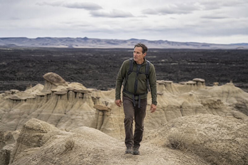
The name is Spanish for “the badlands” or “the bad country,” a label Spanish colonizers applied to volcanic terrain they found impassable, agriculturally worthless, and hostile to human ambition. More than four centuries later, the description holds. The National Park Service manages El Malpais National Monument across Cibola County in western New Mexico, making it one of the largest accessible lava-field complexes in the continental United States.
The NPS designates the monument as a site of outstanding geological, biological, and cultural significance. Indigenous peoples — including the Pueblo of Acoma — have lived alongside and within this landscape for thousands of years, long before any federal agency arrived to name it a monument. Their presence is not incidental to the story of El Malpais; it is foundational to understanding what this place actually is.
Paradoxically, the terrain’s apparent hostility is precisely what made it scientifically valuable. Because hardened lava resists plowing, mining, and the ordinary erasure of human development, the geological record here has remained unusually intact. Researchers can read the landscape almost like a stratigraphic textbook left open in the desert sun.
The geology: five flows, eight vents, one extraordinary record
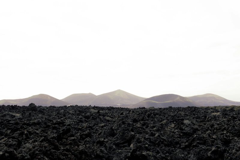
Five major lava flows and at least eight volcanic vents shaped the landscape visitors see today, according to the National Park Service’s geological assessments of El Malpais. A volcanic vent is an opening in Earth’s crust through which magma — molten rock generated by heat and pressure deep beneath the surface — forces its way upward. Once that molten rock breaches the surface, it becomes lava. As lava cools and solidifies, it forms basalt, a dense, iron-rich volcanic rock that gives El Malpais its characteristic dark coloration and the considerable, almost punishing weight it presents underfoot.
Two distinct lava types dominate the monument, and they create dramatically different conditions for hikers. Pahoehoe (pronounced “pah-HOY-hoy”) cools into smooth, ropy, almost sculptural surfaces that can feel nearly walkable. A’a’ (pronounced “ah-ah”) is the opposite: a jagged, clinkery rubble of sharp fragments capable of shredding boot leather and turning an ankle without warning. Both types appear at El Malpais, sometimes within meters of each other — a function of subtle differences in lava viscosity and cooling rate during each eruptive episode.
The flows at El Malpais span tens of thousands of years. The oldest preserve records of volcanic activity that shaped the regional landscape long before human habitation of the Southwest. The youngest — and most scientifically arresting — is the McCartys Flow, dated to approximately 3,000 years ago, placing it squarely within the period of human occupation of the American Southwest.
The McCartys Flow: young, vast, and still largely untouched
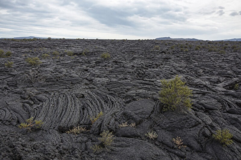
The McCartys Flow is one of the youngest and best-preserved lava flows in the continental United States, stretching roughly 40 miles from its source vents toward the Rio San Jose valley. Its scientific significance stems directly from that youth. Three thousand years is, in geological terms, essentially instantaneous — a rounding error in the 4.5-billion-year ledger of Earth’s history. Because so little time has passed, the flow has experienced minimal erosion. Its original surface textures remain sharp. Its lava tubes — tunnels formed when the outer crust of a flowing lava stream solidifies while molten rock continues moving beneath — are largely intact. Collapse pits, where tube ceilings have fallen in, punctuate the surface at irregular intervals, offering vertical windows into the flow’s interior architecture.
The human dimension of the McCartys Flow is not incidental. Oral traditions of the Acoma Pueblo, as documented by the NPS, reference the eruption itself, suggesting that Indigenous communities witnessed and remembered this volcanic event. That is a remarkable overlap of geological and human timescales — a moment when the planet’s internal mechanics were visible and memorable to the people living nearby.
One scientific nuance deserves explicit acknowledgment: while 3,000 years is the widely cited estimate for the McCartys Flow, dating volcanic deposits involves inherent uncertainties. Researchers use radiocarbon dating of charred organic material trapped beneath flows and cosmogenic surface-exposure dating — a technique measuring the accumulation of rare isotopes in surface rocks exposed to cosmic radiation. Both methods carry error margins. The “3,000 years ago” figure is a well-supported estimate, not a certified timestamp.
Why El Malpais looks like Mars — and what that comparison actually teaches
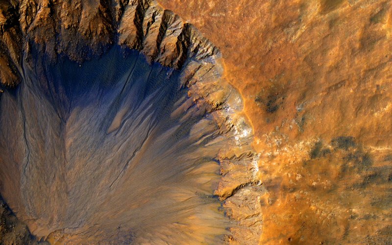
The comparison between El Malpais and the Martian surface is not merely poetic license. Planetary geologists have studied terrestrial basaltic lava fields — including those in New Mexico — as geological analogues for volcanic terrain on Mars, using these sites to calibrate remote-sensing instruments and evaluate rover mobility across rough basaltic surfaces. The dark basaltic rock, the near-absence of vegetation on the youngest flows, and the collapsed lava tube systems of El Malpais closely mirror features observed in Mars’s volcanic regions, including the vast Tharsis Plateau.
The analogue value extends into biology. Researchers have documented specialized organisms — including rare lichens, fungi, and invertebrates — colonizing the harshest lava surfaces at El Malpais, persisting in microhabitats within rock crevices and tube interiors where moisture and organic matter accumulate. These communities serve as a working model for how life might persist in analogously harsh environments elsewhere. Whether any life-supporting microhabitats exist or once existed within Martian lava tubes remains an open, actively researched, and genuinely unresolved question — one that sites like El Malpais help scientists frame more precisely.
Route 66 as an accidental gateway to deep time
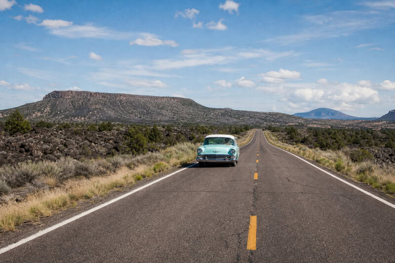
El Malpais National Monument borders the historic alignment of Route 66 — the so-called Mother Road — near the town of Grants, New Mexico. Interstate 40, which follows the Route 66 corridor through this stretch of the state, passes within sight of the lava fields. The NPS visitor center sits just off I-40 at exit 85. Travelers can transition from highway speed to standing on ancient lava in under ten minutes. Few geological detours in the American West offer that ratio of accessibility to spectacle.
The cultural irony is worth naming plainly. Route 66 was engineered to move people efficiently through landscapes like this one — to compress distance, reduce friction, and keep commerce flowing between Chicago and Los Angeles. El Malpais rewards exactly the opposite impulse: slow, careful, on-foot movement across terrain that changes character every few hundred meters and punishes inattention. The lava field does not accommodate highway logic.
The NPS maintains several marked trails across the monument, including access to a lava tube system that visitors can enter with appropriate equipment. Rangers consistently advise sturdy, ankle-supporting boots — the a’a’ surface in particular is aggressive — along with ample water. The dark basaltic rock absorbs and radiates heat efficiently, making the lava field substantially warmer at ground level than ambient air temperature suggests. These are practical warnings, not decorative ones. Visitors planning to enter lava tubes should bring reliable lighting and check current NPS guidance on trail and tube conditions before arrival.
Practical information for visitors
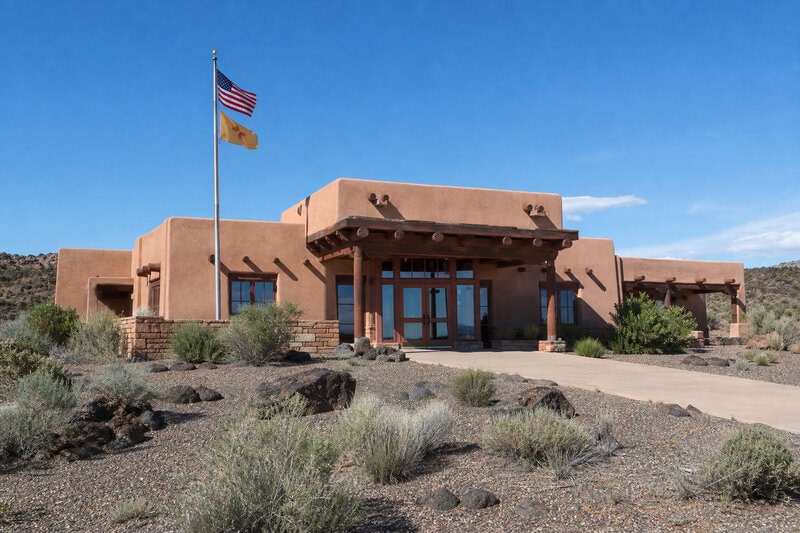
The El Malpais National Monument visitor center is located at 1900 E. Santa Fe Avenue in Grants, New Mexico, and is operated by the National Park Service. The monument is open year-round, though summer heat on the dark lava surface can be extreme and spring or fall visits are generally more comfortable. Admission to the monument is free. The NPS website provides current trail conditions, lava tube access information, and ranger program schedules.
What travelers — and scientists — should take away
El Malpais National Monument preserves a volcanic record spanning tens of thousands of years, with its youngest lava flows dating to approximately 3,000 years ago, making it one of the most geologically recent and scientifically legible lava-field complexes accessible to the American public. That geological youth is the monument’s defining characteristic — not merely a talking point, but the reason the science remains so readable and the terrain so visually arresting.
The landscape is simultaneously ancient geology and a living cultural site. The Acoma Pueblo and neighboring Indigenous nations maintain a relationship with these flows that predates the monument designation by millennia and cannot be reduced to scenic backdrop. Any account of El Malpais that omits that human continuity misreads the place.
In a broader scientific context, understanding young, well-preserved terrestrial lava fields is foundational work at a moment when planetary scientists are actively mapping volcanic systems on the Moon and Mars. The volcanic landscape at El Malpais is not a regional curiosity — it is a reference point for researchers interpreting surfaces hundreds of millions of miles away.
The monument asks nothing complicated of travelers passing through on the old Mother Road. Stop. Step off the pavement. Set a boot onto the black rock. Reckon, for a moment, with the fact that the ground underfoot was still molten when the ancestors of today’s Pueblo peoples were watching it cool — and that their oral traditions have carried the memory of that eruption forward across three thousand years. That reckoning earns the detour.