
An orbital navigation error of just a few centimeters — smaller than the width of a thumb — can compound silently over hours and days until a spacecraft finds itself kilometers from where mission controllers believe it to be. For most of spaceflight’s history, that margin was acceptable. For the precision demands of the next generation of proximity operations, lunar logistics, and Earth-observation science, it is not. That gap between what our coordinate systems promise and what physics actually delivers is the quietly consequential problem that the GRITSS CubeSat mission, developed through a partnership between NASA and Dutch small-satellite manufacturer ISISPACE, is specifically designed to probe.
What Is an Orbital Reference Frame — and Why Does It Matter?

Every spacecraft depends on invisible scaffolding: an orbital reference frame, the agreed-upon coordinate system against which all positions and velocities are measured. Think of it as a universal address grid for space, anchored mathematically to Earth’s center of mass and oriented relative to extremely distant, effectively stationary celestial objects. Every trajectory command, every rendezvous maneuver, every reentry targeting sequence assumes this grid is accurate.
The most widely used global standard is the International Celestial Reference Frame (ICRF), maintained by the International Astronomical Union. The ICRF is extraordinarily precise by ordinary measures, but it must be continuously reconciled with the dynamic reality of Earth itself — its irregular rotation, the wobble of its poles, and slow elastic deformation caused by tidal forces. This reconciliation falls largely to the International Earth Rotation and Reference Systems Service (IERS), which publishes corrections that navigation teams incorporate into their trajectory models.
The practical consequence is direct. Every trajectory correction uploaded to a spacecraft is written in the language of the reference frame. If the frame carries a subtle accumulated error, the correction inherits that error. The spacecraft moves exactly as commanded — and arrives in the wrong place. For routine low Earth orbit operations, current frames are more than adequate. But the emerging requirements of next-generation proximity operations, lunar Gateway logistics, and megaconstellation coordination are beginning to push against the limits of what today’s reference frame precision can reliably support. That boundary is where GRITSS enters the picture.
The Compounding Sources of Frame Uncertainty
Reference frame errors do not arise from one dramatic source. They accumulate from several mundane ones, each individually small and collectively significant.
Earth’s gravitational field is neither smooth nor static. The planet’s mass is continuously redistributed by glacial melt, groundwater extraction, and slow convective movement in the mantle. These shifts gradually displace Earth’s center of mass — the anchor point of the reference frame — requiring ongoing model updates. A frame perfectly calibrated five years ago is not perfectly calibrated today.
A second source of uncertainty is subtler: the difficulty of separating satellite movement from frame model error. Atmospheric drag and solar radiation pressure act on orbiting objects in ways that are predictable in principle but imperfect in practice. When a satellite’s observed position deviates slightly from its predicted position, analysts must determine whether the satellite moved unexpectedly or whether the model of space itself was slightly wrong. That ambiguity contaminates the calibration data used to refine the frame.
Ground-based tracking infrastructure introduces further complications. Networks such as the International GNSS Service and arrays of Very Long Baseline Interferometry (VLBI) radio antennas — where two widely separated dishes observe the same distant radio source simultaneously to extract precise geometry — provide the observational bedrock of reference frame measurement. Gaps in global station coverage and subtle inconsistencies in individual antenna calibrations introduce regional biases that are difficult to fully characterize.
Taken together, these factors mean that even the best current reference frames carry position uncertainties at the few-millimeter to centimeter level near Earth. In everyday terms, that is invisible. For satellites measuring ice sheet elevation or sea surface height to the sub-centimeter accuracy that meaningful climate trend data requires, it is a real and present limitation.
Enter GRITSS: A CubeSat with an Outsized Mandate

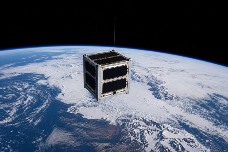
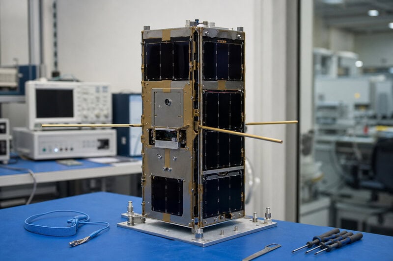
The GRITSS mission is a small-satellite technology demonstration developed through a collaboration between NASA and ISISPACE, a Netherlands-based company with an established track record in producing capable CubeSat bus platforms. The mission’s core concept is elegant in its logic: deploy a small, rigorously characterized satellite carrying highly stable timing references and precision GNSS receivers, then use that satellite as a calibration witness — a well-modeled object whose actual observed position can be compared against what the reference frame predicts, revealing the residual discrepancy between the two.
Because the satellite’s physical properties — its mass distribution, surface reflectivity, and aerodynamic profile — are carefully documented before launch, analysts can model the non-gravitational forces acting on it with higher confidence than is possible for many operational spacecraft. That confidence is what makes the comparison meaningful. If the observed position diverges from the predicted position after all known forces are accounted for, the most probable explanation is a frame error rather than an unmodeled perturbation.
The CubeSat form factor is not incidental to this strategy — it is part of it. A CubeSat’s small mass and volume translate directly into lower launch costs and faster deployment timelines, allowing the mission to occupy orbital inclinations and altitudes that complement existing tracking infrastructure rather than duplicate coverage that larger, more expensive assets already provide. ISISPACE’s experience producing standardized, flight-proven bus platforms makes it possible to bring a precision-focused geodetic payload to orbit on a budget that would have been unimaginable for this class of science a decade ago.
Readers should note that specific performance claims for GRITSS represent projected targets rather than peer-reviewed results. The satellite is an active or recently deployed technology demonstration, and its on-orbit findings have not yet been independently validated by the broader scientific community.
How the Science Works: Precision Measurement from a Small Box
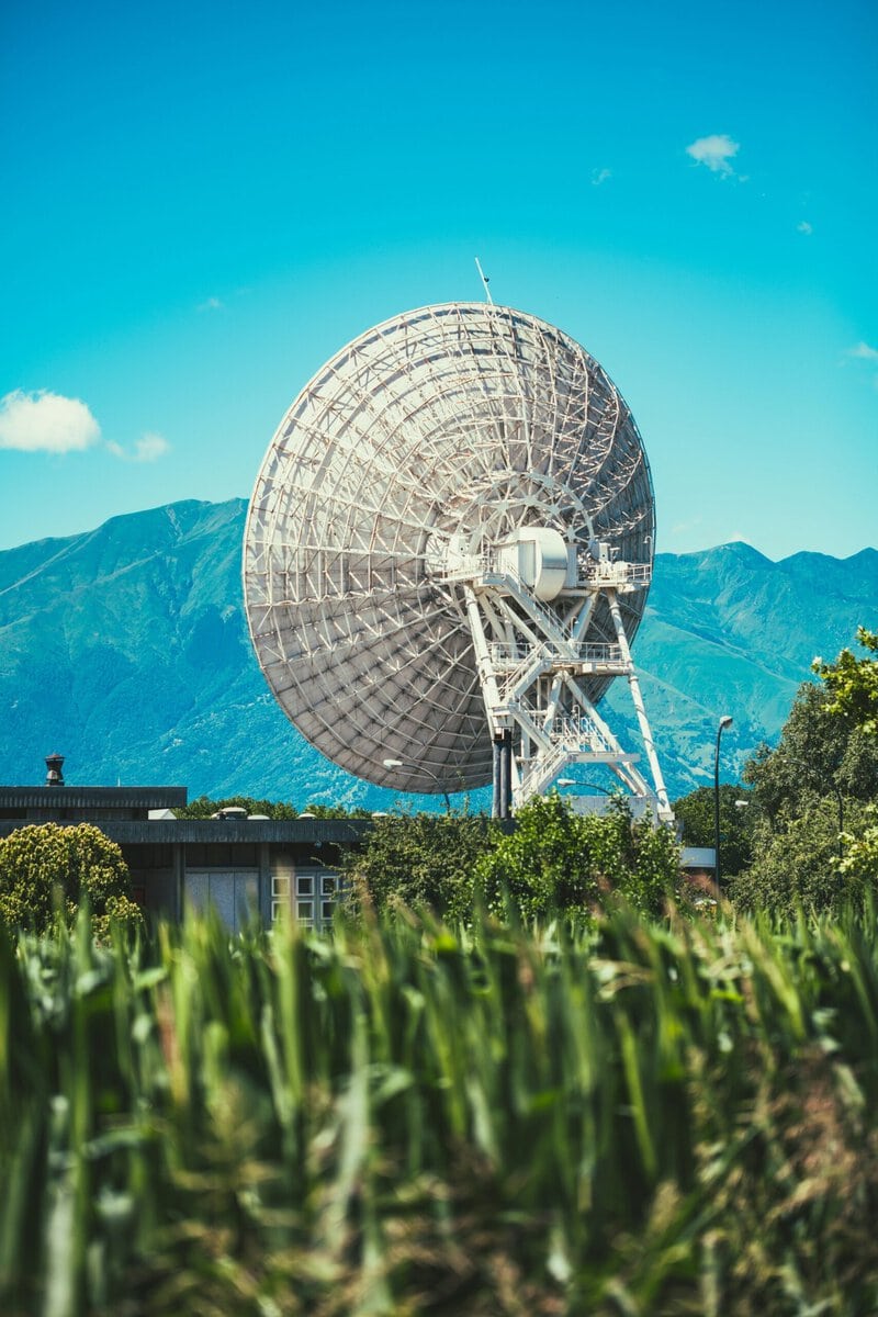
The measurement strategy GRITSS employs draws on well-established geodetic science applied in a new configuration. Onboard GNSS receivers log the satellite’s position continuously as it orbits. Simultaneously, ground stations track the satellite independently using radar ranging and, where available, Satellite Laser Ranging (SLR) — a technique that bounces a precisely timed laser pulse off a retroreflector on the satellite’s surface to measure distance with millimeter-level accuracy. Comparing the two independent position records allows analysts to identify systematic offsets consistent with frame error rather than with any actual movement of the satellite.
If future variants of this mission concept incorporate inter-satellite link capability — allowing timing signals to be exchanged between GRITSS and other precisely tracked objects — the technique becomes more powerful still. Discrepancies across multiple overlapping measurements can be triangulated to isolate where in the frame’s geometry an error originates, in much the same way that land surveyors use overlapping baseline measurements to locate a hidden benchmark error on the ground.
Central to all of this is precise timekeeping. In orbital mechanics, position and time are inseparable: a timing error of one microsecond translates to roughly 300 meters of ambiguity in light-travel distance. Ultra-stable onboard oscillators are therefore as mission-critical as any sensor. Maintaining that stability through the thermal cycling and radiation environment of low Earth orbit — where temperatures swing by more than 100 degrees Celsius between sunlit and shadowed portions of each orbit — is a genuine engineering challenge and one of the key technical goals the mission is designed to evaluate.
The underlying geodetic method is scientifically mature. Applying it at this precision level from a CubeSat platform, however, has not yet been definitively demonstrated, and independent validation by the broader geodesy community will be required before any GRITSS results could be used to revise the operational reference frame standards that navigation teams worldwide rely upon.
Why This Matters Well Beyond One Small Satellite
The implications of improved orbital reference frame precision extend far beyond spacecraft navigation in the narrow operational sense.
Earth observation science is perhaps the most immediate beneficiary. Satellites measuring ice sheet elevation, sea surface height, and crustal deformation following earthquakes all require centimeter-level position knowledge to generate scientifically defensible long-term trend data. The reference frame is not an abstract bureaucratic standard — it is the ruler against which every measurement of planetary change is made. A more accurate ruler produces more trustworthy science, with direct consequences for how confidently researchers can characterize the pace of sea level rise or the progression of glacier loss over decades.
Commercial and governmental megaconstellations face a different but equally concrete version of the same problem. Coordinating thousands of satellites in shared orbital shells requires a common positional language precise enough that collision-avoidance algorithms are not overwhelmed by false alarms generated by frame ambiguity rather than genuine proximity risk. A sharper reference frame is, in this context, a safety and efficiency resource for the entire industry.
NASA’s Artemis program and the planned lunar Gateway station represent a third domain of relevance. In lunar orbital regimes, Earth-based GNSS signals are weak, intermittent, or absent entirely. Navigation in that environment depends increasingly on high-fidelity reference frames calibrated by in-situ missions — exactly the kind of foundation that GRITSS-class experiments are designed to begin building. The agency’s broader navigation research portfolio, which connects near-Earth reference frame work to eventual lunar precision navigation, is documented at NASA’s main website.
The mission also reflects a broader trend that space agencies and researchers have begun to acknowledge: small satellites are proving viable as precision science instruments, not merely as technology demonstrators or communications relays. The assumption that geodetic-quality measurements inherently require large, expensive, purpose-built platforms is being tested and, in some cases, revised.
Open Questions and What to Watch For
The immediate milestone for GRITSS is on-orbit commissioning followed by the first systematic comparison of onboard GNSS logs against independent ground-truth tracking data. That analysis will take months to complete and must survive peer review before its conclusions carry weight with the bodies — primarily the IERS — that maintain and update operational reference frame standards.
A central open question is hardware longevity. Whether CubeSat-class components can maintain the thermal and mechanical stability required for sub-centimeter geodetic performance over a multi-year mission lifetime remains to be demonstrated. Radiation-induced drift in oscillators and thermal deformation of antenna mounting structures are known challenges for precision instruments in low Earth orbit, and GRITSS will generate real data on how well current small-satellite engineering practices handle them.
The broader space geodesy community has also not yet reached consensus on whether distributed networks of small calibration satellites can fully replace, or only supplement, the large ground-based VLBI antenna arrays and SLR stations that currently anchor the reference frame. Those existing networks represent decades of careful characterization — an infrastructure whose replacement would require extraordinary evidence. The more likely near-term outcome is complementarity rather than substitution, with small satellites filling coverage gaps that ground infrastructure cannot economically address.
Those following this area of research should look for peer-reviewed publications from the mission team and independent analyses from institutions with deep geodetic expertise — including the Jet Propulsion Laboratory’s Navigation and Ancillary Information Facility, European Space Agency geodesy groups, and the researchers who contribute to IERS products. Those assessments will provide the authoritative measure of whether GRITSS delivered on the quiet but consequential ambition of helping humanity know, just a little more precisely, exactly where it is in space. Mission updates are shared periodically through NASA’s official communications channels.